Directions to Resort (Boston) with public transportation
The following transit lines have routes that pass near Resort
 Bus: 354, 43, 450, 504, SL5.
- Train: FRAMINGHAM/WORCESTER, HAVERHILL, NEEDHAM.
- Subway: BLUE LINE, GREEN LINE D, GREEN LINE E, ORANGE LINE, RED LINE.
How to get to Resort by bus?
Click on the bus route to see step by step directions with maps, line arrival times and updated time schedules.
From The Mall At Chestnut Hill, Newton
75 minFrom FOUR POINTS BY SHERATON Boston Newton, Newton
38 minFrom Arlington, MA, Arlington
78 minFrom Mspca, Boston
56 minFrom Market Basket, Revere
44 minFrom Melrose, MA, Melrose
66 minFrom Hyatt Place Medford, Medford
27 minFrom Roslindale, Boston
57 minFrom Brigham and Women's Faulkner Hospital, Boston
72 minFrom Qea, Quincy
109 min
How to get to Resort by train?
Click on the train route to see step by step directions with maps, line arrival times and updated time schedules.
How to get to Resort by subway?
Click on the subway route to see step by step directions with maps, line arrival times and updated time schedules.
Subway stations near Resort in Boston
Bus stops near Resort in Boston
- State St @ Washington Mall - State St Sta, 3 min walk,VIEW
- Congress St @ State St, 3 min walk,VIEW
- Downtown Crossing - Franklin St @ Washington St, 6 min walk,VIEW
- Cambridge St @ Government Ctr Sta, 6 min walk,VIEW
- Temple Pl @ Washington St, 7 min walk,VIEW
- Tremont St Opp Temple Pl, 8 min walk,VIEW
- Park Street - Tremont St @ Winter St, 11 min walk,VIEW
- Park Street - Tremont St Opp Hamilton Pl, 12 min walk,VIEW
Bus lines to Resort in Boston
- 116, Maverick - Wonderland,VIEW
- 354, Boston (Express) via Woburn - Burlington (Express) via Woburn,VIEW
- BLUE LINE SHUTTLE, Airport - Government Center (Express),VIEW
- BLUE LINE SHUTTLE, Airport - Government Center via Maverick,VIEW
- BLUE LINE SHUTTLE, Orient Heights - Government Center (Local),VIEW
- BLUE LINE SHUTTLE, Orient Heights - Government Center (Express),VIEW
- BLUE LINE SHUTTLE, Airport - Government Center (Local),VIEW
- BLUE LINE SHUTTLE, Wonderland - Government Center,VIEW
- RED LINE SHUTTLE, Harvard - JFK/UMass via State Street,VIEW
- 4, Design Center - North Station via South Station,VIEW
- 15, Ruggles - Fields Corner,VIEW
- 39, Back Bay - Forest Hills,VIEW
- 57, Kenmore - Watertown Yard,VIEW
- 92, Downtown - Sullivan,VIEW
- 93, Downtown - Sullivan,VIEW
- RED LINE SHUTTLE, Harvard - JFK/UMass via Congress Street,VIEW
- RED LINE SHUTTLE, Harvard - Broadway,VIEW
- RED LINE SHUTTLE, Kendall/MIT - JFK/UMass,VIEW
- RED LINE SHUTTLE, JFK/UMass - Kendall/MIT (Shuttle),VIEW
- RED LINE SHUTTLE, Ashmont - Park Street via Post Office,VIEW
What are the closest stations to Resort?
The closest stations to Resort are:
- State Street is 144 yards away, 2 min walk.
- State St @ Washington Mall - State St Sta is 208 yards away, 3 min walk.
- Congress St @ State St is 212 yards away, 3 min walk.
- Government Center is 402 yards away, 5 min walk.
- Downtown Crossing - Franklin St @ Washington St is 419 yards away, 6 min walk.
- Cambridge St @ Government Ctr Sta is 443 yards away, 6 min walk.
- Downtown Crossing is 472 yards away, 6 min walk.
- Temple Pl @ Washington St is 573 yards away, 7 min walk.
- Tremont St Opp Temple Pl is 633 yards away, 8 min walk.
- Park Street - Tremont St @ Winter St is 903 yards away, 11 min walk.
- Park Street - Tremont St Opp Hamilton Pl is 982 yards away, 12 min walk.
Which bus lines stop near Resort?
These bus lines stop near Resort: 354, 43, 450, 504, SL5.
Which train lines stop near Resort?
These train lines stop near Resort: FRAMINGHAM/WORCESTER, HAVERHILL, NEEDHAM.
Which subway lines stop near Resort?
These subway lines stop near Resort: BLUE LINE, GREEN LINE D, GREEN LINE E, ORANGE LINE, RED LINE.
What’s the nearest subway station to Resort in Boston?
The nearest subway station to Resort in Boston is State Street. It’s a 2 min walk away.
What’s the nearest bus station to Resort in Boston?
The nearest bus stations to Resort in Boston are State St @ Washington Mall - State St Sta and Congress St @ State St. The closest one is a 3 min walk away.
What time is the first subway to Resort in Boston?
The GREEN LINE E is the first subway that goes to Resort in Boston. It stops nearby at 5:05 AM.
What time is the last subway to Resort in Boston?
The GREEN LINE E is the last subway that goes to Resort in Boston. It stops nearby at 2:20 AM.
What time is the first bus to Resort in Boston?
The 57 is the first bus that goes to Resort in Boston. It stops nearby at 5:02 AM.
What time is the last bus to Resort in Boston?
The 116 is the last bus that goes to Resort in Boston. It stops nearby at 1:58 AM.
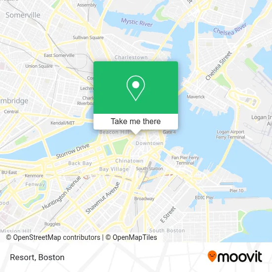
See Resort, Boston, on the map
Public Transit to Resort in Boston
Wondering how to get to Resort in Boston? Moovit helps you find the best way to get to Resort with step-by-step directions from the nearest public transit station.
Moovit provides free maps and live directions to help you navigate through your city. View schedules, routes, timetables, and find out how long does it take to get to Resort in real time.
Looking for the nearest stop or station to Resort? Check out this list of stops closest to your destination: State Street; State St @ Washington Mall - State St Sta; Congress St @ State St; Government Center; Downtown Crossing - Franklin St @ Washington St; Cambridge St @ Government Ctr Sta; Downtown Crossing; Temple Pl @ Washington St; Tremont St Opp Temple Pl; Park Street - Tremont St @ Winter St; Park Street - Tremont St Opp Hamilton Pl.
Bus: 354, 43, 450, 504, SL5, 116, BLUE LINE SHUTTLE, BLUE LINE SHUTTLE, BLUE LINE SHUTTLE, 4, 15, 39, 57, 92, RED LINE SHUTTLE, RED LINE SHUTTLE, RED LINE SHUTTLE.Train: FRAMINGHAM/WORCESTER, HAVERHILL, NEEDHAM.Subway: BLUE LINE, GREEN LINE D, GREEN LINE E, ORANGE LINE, RED LINE, GREEN LINE B, GREEN LINE C.
Want to see if there’s another route that gets you there at an earlier time? Moovit helps you find alternative routes or times. Get directions from and directions to Resort easily from the Moovit App or Website.
We make riding to Resort easy, which is why over 1.7 million users, including users in Boston, trust Moovit as the best app for public transit. You don’t need to download an individual bus app or train app, Moovit is your all-in-one transit app that helps you find the best bus time or train time available.
For information on prices of bus, subway and train, costs and ride fares to Resort, please check the Moovit app.
Use the app to navigate to popular places including to the airport, hospital, stadium, grocery store, mall, coffee shop, school, college, and university.
Resort Address: 10 Post Office Sq street in Boston
- 60 School Street,
- Tremont Temple,
- Tremont Temple Baptist Church,
- Omni Parker House,
- Boston Omni Parker House Hotel,
- Park Street MBTA Station - Green & Red Line,
- Court Square Smoke Shop,
- Hotel Aka Boston Common,
- 45 Province Boston Condos,
- 90 Tremont Street,
- Kimpton Nine Zero an IHG Hotel Boston,
- Beehive,
- Kings Chapel,
- Banh Mi Ok (Banh Mi or),
- Boston Latin School Site,
- Ruth's Chris Steak House,
- Suffolk University's 73 Tremont,
- The Freedom Trail,
- Beantown Pub,
- Insomnia Cookies
Places Near Resort (Boston)
- Castle Island, Boston,
- House Of Blues, Boston,
- Leader Bank Pavilion (Leader Bank Pavillion), Boston,
- Mgm Music Hall, Boston,
- Seaport District, Boston,
- Boston Common, Boston,
- Museum Of Science, Boston,
- Prudential Center, Boston,
- North End, Boston,
- Quincy Market, Boston,
- Isabella Stewart Gardner Museum, Boston,
- Faneuil Hall, Boston,
- Boston Medical Center, Boston,
- Wilbur Theatre, Boston,
- Boston Convention & Exhibition Center, Boston,
- Massachusetts General Hospital, Boston,
- Cheers, Boston,
- Wang Theater, Boston,
- Boston Children's Hospital, Boston,
- Td Garden, Boston
How to get to popular places in Boston with public transit
Get around Boston by public transit!
Traveling around Boston has never been so easy. See step by step directions as you travel to any attraction, street or major public transit station. View bus and train schedules, arrival times, service alerts and detailed routes on a map, so you know exactly how to get to anywhere in Boston.
When traveling to any destination around Boston use Moovit's Live Directions with Get Off Notifications to know exactly where and how far to walk, how long to wait for your line, and how many stops are left. Moovit will alert you when it's time to get off — no need to constantly re-check whether yours is the next stop.
Wondering how to use public transit in Boston or how to pay for public transit in Boston? Moovit public transit app can help you navigate your way with public transit easily, and at minimum cost. It includes public transit fees, ticket prices, and costs. Looking for a map of Boston public transit lines? Moovit public transit app shows all public transit maps in Boston with all Bus, Train, Subway and Ferry routes and stops on an interactive map.
Boston has 4 transit type(s), including: Bus, Train, Subway and Ferry, operated by several transit agencies, including MBTA, Southeastern Regional Transit Authority, MetroWest Regional Transit Authority, Rhode Island Public Transit Authority, WRTA, Lowell Regional Transit Authority, Merrimack Valley Transit, Montachusett Regional Transit Authority, Cape Cod Regional Transit Authority, Brockton Area Transit Authority, Martha's Vineyard Transit Authority, the WAVE - Nantucket Regional Transit Authority, GATRA, Cape Ann Transportation Authority and Massport