Directions to Reunion Christian Church (Somerville) with public transportation
The following transit lines have routes that pass near Reunion Christian Church
 Bus: 77, 87, 89, 90, 96.
- Train: FITCHBURG.
- Subway: RED LINE, GREEN LINE B, GREEN LINE C, GREEN LINE E.
How to get to Reunion Christian Church by bus?
Click on the bus route to see step by step directions with maps, line arrival times and updated time schedules.
From Legal Sea Foods, Boston
55 minFrom Comfort Inn & Suites Logan International Airport, Revere
76 minFrom Nordstrom Rack, Boston
54 minFrom Uscis Biometrics Office, Revere
75 minFrom Prudential Center, Boston
47 minFrom Hampton Inn Boston Seaport District (Hampton Inn-Hampton Inn Boston), Boston
56 minFrom 7F Everett Street, Revere
74 minFrom The Strand Theater, Boston
85 minFrom Bell In Hand Tavern, Boston
46 minFrom The Banshee Bar, Boston
77 min
How to get to Reunion Christian Church by train?
Click on the train route to see step by step directions with maps, line arrival times and updated time schedules.
How to get to Reunion Christian Church by subway?
Click on the subway route to see step by step directions with maps, line arrival times and updated time schedules.
From Legal Sea Foods, Boston
37 minFrom Comfort Inn & Suites Logan International Airport, Revere
61 minFrom Nordstrom Rack, Boston
33 minFrom Uscis Biometrics Office, Revere
60 minFrom Prudential Center, Boston
39 minFrom Hampton Inn Boston Seaport District (Hampton Inn-Hampton Inn Boston), Boston
47 minFrom 7F Everett Street, Revere
59 minFrom The Strand Theater, Boston
53 minFrom Bell In Hand Tavern, Boston
32 minFrom The Banshee Bar, Boston
38 min
Bus stops near Reunion Christian Church in Somerville
Subway stations near Reunion Christian Church in Somerville
Train station near Reunion Christian Church in Somerville
- Porter, 12 min walk,VIEW
Bus lines to Reunion Christian Church in Somerville
- 87, Arlington Center,VIEW
- 88, Lechmere,VIEW
- 89, Sullivan,VIEW
- 90, Assembly,VIEW
- 94, Davis,VIEW
- 96, Medford Square,VIEW
- RED LINE SHUTTLE, Alewife - Park Street,VIEW
- RED LINE SHUTTLE, Alewife - Kendall/MIT,VIEW
- RED LINE SHUTTLE, Alewife - Harvard via Brattle Street,VIEW
- RED LINE SHUTTLE, Alewife - Harvard via Holyoke Street,VIEW
- RED LINE SHUTTLE, Alewife - Davis,VIEW
- 77, Harvard,VIEW
What are the closest stations to Reunion Christian Church?
The closest stations to Reunion Christian Church are:
- Elm St @ Chester St is 73 yards away, 1 min walk.
- Davis Sq. is 245 yards away, 4 min walk.
- Davis is 268 yards away, 4 min walk.
- Massachusetts Ave Opp Rindge Ave is 494 yards away, 6 min walk.
- Porter is 979 yards away, 12 min walk.
- Ball Square Station is 1420 yards away, 17 min walk.
Which bus lines stop near Reunion Christian Church?
These bus lines stop near Reunion Christian Church: 77, 87, 89, 90, 96.
Which train line stops near Reunion Christian Church?
FITCHBURG (#409 | Wachusett)
Which subway line stops near Reunion Christian Church?
RED LINE (Alewife)
What’s the nearest subway station to Reunion Christian Church in Somerville?
The nearest subway station to Reunion Christian Church in Somerville is Davis Sq.. It’s a 4 min walk away.
What’s the nearest train station to Reunion Christian Church in Somerville?
The nearest train station to Reunion Christian Church in Somerville is Porter. It’s a 12 min walk away.
What’s the nearest bus station to Reunion Christian Church in Somerville?
The nearest bus station to Reunion Christian Church in Somerville is Elm St @ Chester St. It’s a 1 min walk away.
What time is the first subway to Reunion Christian Church in Somerville?
The GREEN LINE E is the first subway that goes to Reunion Christian Church in Somerville. It stops nearby at 4:53 AM.
What time is the last subway to Reunion Christian Church in Somerville?
The GREEN LINE E is the last subway that goes to Reunion Christian Church in Somerville. It stops nearby at 2:41 AM.
What time is the first train to Reunion Christian Church in Somerville?
The FITCHBURG is the first train that goes to Reunion Christian Church in Somerville. It stops nearby at 5:47 AM.
What time is the last train to Reunion Christian Church in Somerville?
The FITCHBURG is the last train that goes to Reunion Christian Church in Somerville. It stops nearby at 12:17 AM.
What time is the first bus to Reunion Christian Church in Somerville?
The 77 is the first bus that goes to Reunion Christian Church in Somerville. It stops nearby at 5:02 AM.
What time is the last bus to Reunion Christian Church in Somerville?
The 89 is the last bus that goes to Reunion Christian Church in Somerville. It stops nearby at 1:39 AM.
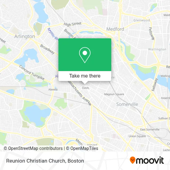
See Reunion Christian Church, Somerville, on the map
Public Transit to Reunion Christian Church in Somerville
Wondering how to get to Reunion Christian Church in Somerville? Moovit helps you find the best way to get to Reunion Christian Church with step-by-step directions from the nearest public transit station.
Moovit provides free maps and live directions to help you navigate through your city. View schedules, routes, timetables, and find out how long does it take to get to Reunion Christian Church in real time.
Looking for the nearest stop or station to Reunion Christian Church? Check out this list of stops closest to your destination: Elm St @ Chester St; Davis Sq.; Davis; Massachusetts Ave Opp Rindge Ave; Porter; Ball Square Station.
Bus: 77, 87, 89, 90, 96, 88, 94, RED LINE SHUTTLE, RED LINE SHUTTLE, RED LINE SHUTTLE, RED LINE SHUTTLE, RED LINE SHUTTLE.Train: FITCHBURG.Subway: RED LINE, GREEN LINE B, GREEN LINE C, GREEN LINE E.
Want to see if there’s another route that gets you there at an earlier time? Moovit helps you find alternative routes or times. Get directions from and directions to Reunion Christian Church easily from the Moovit App or Website.
We make riding to Reunion Christian Church easy, which is why over 1.7 million users, including users in Somerville, trust Moovit as the best app for public transit. You don’t need to download an individual bus app or train app, Moovit is your all-in-one transit app that helps you find the best bus time or train time available.
For information on prices of subway, bus and train, costs and ride fares to Reunion Christian Church, please check the Moovit app.
Use the app to navigate to popular places including to the airport, hospital, stadium, grocery store, mall, coffee shop, school, college, and university.
Reunion Christian Church Address: 55 Davis Sq street in Somerville
- Crystal Ballroom,
- Sommerville Theatre,
- Camberville,
- Davis Station MBTA,
- Psychic Sessions,
- Mike's Food and Spirits,
- MBTA Davis Square Station,
- Saigon Tiger,
- Mirakl,
- Jason Sarbanis-Real Estate Agent,
- DMC,
- Chestnut Hill,
- Boston Rental Exchange, Inc.,
- Trisha Sullivan, CLMT,
- Navy Federal Credit Union,
- 4 College Ave Parking,
- Middlesex Federal Savings Bank,
- Davis Sq,
- Podimetrics,
- Prager Judith Body-Mind Inst
Places Near Reunion Christian Church (Somerville)
- Massachusetts General Hospital, Boston,
- Isabella Stewart Gardner Museum, Boston,
- Seaport District, Boston,
- Museum Of Science, Boston,
- Castle Island, Boston,
- Faneuil Hall, Boston,
- House Of Blues, Boston,
- Boston Convention & Exhibition Center, Boston,
- Boston Common, Boston,
- Boston Medical Center, Boston,
- Boston Children's Hospital, Boston,
- Cheers, Boston,
- Wang Theater, Boston,
- North End, Boston,
- Quincy Market, Boston,
- Prudential Center, Boston,
- Mgm Music Hall, Boston,
- Td Garden, Boston,
- Leader Bank Pavilion (Leader Bank Pavillion), Boston,
- Wilbur Theatre, Boston
How to get to popular places in Boston with public transit
Get around Somerville by public transit!
Traveling around Somerville has never been so easy. See step by step directions as you travel to any attraction, street or major public transit station. View bus and train schedules, arrival times, service alerts and detailed routes on a map, so you know exactly how to get to anywhere in Somerville.
When traveling to any destination around Somerville use Moovit's Live Directions with Get Off Notifications to know exactly where and how far to walk, how long to wait for your line, and how many stops are left. Moovit will alert you when it's time to get off — no need to constantly re-check whether yours is the next stop.
Wondering how to use public transit in Somerville or how to pay for public transit in Somerville? Moovit public transit app can help you navigate your way with public transit easily, and at minimum cost. It includes public transit fees, ticket prices, and costs. Looking for a map of Somerville public transit lines? Moovit public transit app shows all public transit maps in Somerville with all Bus, Train, Subway and Ferry routes and stops on an interactive map.
Boston has 4 transit type(s), including: Bus, Train, Subway and Ferry, operated by several transit agencies, including MBTA, Southeastern Regional Transit Authority, MetroWest Regional Transit Authority, Rhode Island Public Transit Authority, WRTA, Lowell Regional Transit Authority, Merrimack Valley Transit, Montachusett Regional Transit Authority, Cape Cod Regional Transit Authority, Brockton Area Transit Authority, Martha's Vineyard Transit Authority, the WAVE - Nantucket Regional Transit Authority, GATRA, Cape Ann Transportation Authority and Massport