How to get to Revere Temple by bus?
Click on the bus route to see step by step directions with maps, line arrival times and updated time schedules.
From Costco
34 minFrom Mapparium
86 minFrom Encore
96 minFrom The Mapparium
85 minFrom The Midtown Hotel
90 minFrom Massachusetts General Hospital/Harvard Medical School
32 minFrom Bebop
85 minFrom Assembly Square Mall Shopping Center
45 minFrom Boston Burger Company - Boston
85 minFrom Bunker Hill Monument
39 min
How to get to Revere Temple by subway?
Click on the subway route to see step by step directions with maps, line arrival times and updated time schedules.
From Costco
53 minFrom Mapparium
43 minFrom Encore
45 minFrom The Mapparium
46 minFrom The Midtown Hotel
47 minFrom Massachusetts General Hospital/Harvard Medical School
39 minFrom Bebop
45 minFrom Assembly Square Mall Shopping Center
48 minFrom Boston Burger Company - Boston
44 minFrom Bunker Hill Monument
47 min
Bus stops near Revere Temple
Subway station near Revere Temple
- Beachmont, 33 min walk,VIEW
Bus lines to Revere Temple
- 110, Wellington,VIEW
- 116, Haymarket Via Maverick,VIEW
- 411, Jack Satter House,VIEW
- BLUE LINE SHUTTLE, Wonderland - Suffolk Downs,VIEW
- BLUE LINE SHUTTLE, Wonderland - Orient Heights,VIEW
- BLUE LINE SHUTTLE, Airport - Wonderland,VIEW
- BLUE LINE SHUTTLE, Maverick - Wonderland,VIEW
- BLUE LINE SHUTTLE, Wonderland - Government Center,VIEW
- BLUE LINE SHUTTLE, Wonderland - Airport (Shuttle),VIEW
- 426, Central Square Via Cliftondale,VIEW
- 450, Salem Depot,VIEW
What are the closest stations to Revere Temple?
The closest stations to Revere Temple are:
- Beach St @ N Shore Rd is 170 yards away, 3 min walk.
- Revere Beach - Beach St Opp Kimball Ave is 212 yards away, 3 min walk.
- Beach St @ Shirley Ave - Bell Circle is 636 yards away, 8 min walk.
- Beachmont is 2836 yards away, 33 min walk.
Which bus lines stop near Revere Temple?
These bus lines stop near Revere Temple: 110, 450.
Which subway line stops near Revere Temple?
BLUE LINE (Wonderland)
What’s the nearest bus station to Revere Temple?
The nearest bus stations to Revere Temple are Beach St @ N Shore Rd and Revere Beach - Beach St Opp Kimball Ave. The closest one is a 3 min walk away.
What time is the first subway to Revere Temple?
The BLUE LINE is the first subway that goes to Revere Temple. It stops nearby at 5:08 AM.
What time is the last subway to Revere Temple?
The BLUE LINE is the last subway that goes to Revere Temple. It stops nearby at 2:10 AM.
What time is the first bus to Revere Temple?
The 116 is the first bus that goes to Revere Temple. It stops nearby at 4:26 AM.
What time is the last bus to Revere Temple?
The 110 is the last bus that goes to Revere Temple. It stops nearby at 2:21 AM.
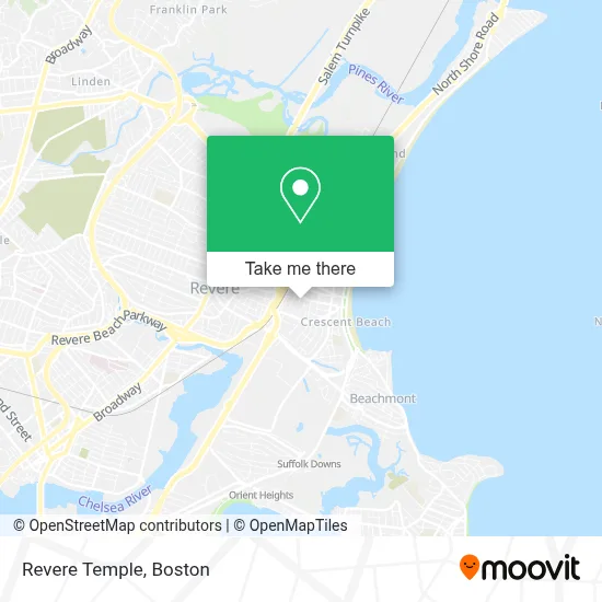
See Revere Temple on the map
Public Transportation to Revere Temple
Wondering how to get to Revere Temple? Moovit helps you find the best way to get to Revere Temple with step-by-step directions from the nearest public transit station.
Moovit provides free maps and live directions to help you navigate through your city. View schedules, routes, timetables, and find out how long does it take to get to Revere Temple in real time.
Looking for the nearest stop or station to Revere Temple? Check out this list of stops closest to your destination: Beach St @ N Shore Rd; Revere Beach - Beach St Opp Kimball Ave; Beach St @ Shirley Ave - Bell Circle; Beachmont.
Bus: 110, 450, 116, 411, BLUE LINE SHUTTLE, BLUE LINE SHUTTLE, BLUE LINE SHUTTLE, BLUE LINE SHUTTLE, BLUE LINE SHUTTLE, 426.Subway: BLUE LINE.
Want to see if there’s another route that gets you there at an earlier time? Moovit helps you find alternative routes or times. Get directions from and directions to Revere Temple easily from the Moovit App or Website.
We make riding to Revere Temple easy, which is why over 1.7 million users, including users in Revere, trust Moovit as the best app for public transit. You don’t need to download an individual bus app or train app, Moovit is your all-in-one transit app that helps you find the best bus time or train time available.
For information on prices of bus and subway, costs and ride fares to Revere Temple, please check the Moovit app.
Use the app to navigate to popular places including to the airport, hospital, stadium, grocery store, mall, coffee shop, school, college, and university.
Revere Temple Address: 75 Thornton St street in Revere
- The Carl Hyman Towers,
- Autobody Specialists Inc,
- Revere RMV,
- Nino’S,
- Coinbridge,
- 7F Everett Street,
- Beyrut Espresso,
- American Legion,
- Bell Circle Rotary,
- Bank Of America,
- Revere Registry Of Motor Vehicles,
- Sayar Food Market,
- Uscis Biometrics Office,
- Registry of Motor Vehicles,
- Marshalls,
- Collision Headquarters,
- Comfort Inn & Suites Logan International Airport,
- MBTA Revere Beach Station,
- Kelly's Roast Beef,
- Rumney Marsh Burying Ground
Places Near Revere Temple
- Boston Convention & Exhibition Center, Boston,
- Leader Bank Pavilion (Leader Bank Pavillion), Boston,
- Prudential Center, Boston,
- House Of Blues, Boston,
- Mgm Music Hall, Boston,
- Boston Children's Hospital, Boston,
- Boston Medical Center, Boston,
- Wang Theater, Boston,
- Faneuil Hall, Boston,
- Massachusetts General Hospital, Boston,
- Td Garden, Boston,
- Boston Common, Boston,
- Cheers, Boston,
- Museum Of Science, Boston,
- Quincy Market, Boston,
- North End, Boston,
- Isabella Stewart Gardner Museum, Boston,
- Wilbur Theatre, Boston,
- Castle Island, Boston,
- Seaport District, Boston
How to get to popular places in Boston with public transit
Get around Revere by public transit!
Traveling around Revere has never been so easy. See step by step directions as you travel to any attraction, street or major public transit station. View bus and train schedules, arrival times, service alerts and detailed routes on a map, so you know exactly how to get to anywhere in Revere.
When traveling to any destination around Revere use Moovit's Live Directions with Get Off Notifications to know exactly where and how far to walk, how long to wait for your line, and how many stops are left. Moovit will alert you when it's time to get off — no need to constantly re-check whether yours is the next stop.
Wondering how to use public transit in Revere or how to pay for public transit in Revere? Moovit public transit app can help you navigate your way with public transit easily, and at minimum cost. It includes public transit fees, ticket prices, and costs. Looking for a map of Revere public transit lines? Moovit public transit app shows all public transit maps in Revere with all Bus, Train, Subway and Ferry routes and stops on an interactive map.
Boston has 4 transit type(s), including: Bus, Train, Subway and Ferry, operated by several transit agencies, including MBTA, Southeastern Regional Transit Authority, MetroWest Regional Transit Authority, Rhode Island Public Transit Authority, WRTA, Lowell Regional Transit Authority, Merrimack Valley Transit, Montachusett Regional Transit Authority, Cape Cod Regional Transit Authority, Brockton Area Transit Authority, Martha's Vineyard Transit Authority, the WAVE - Nantucket Regional Transit Authority, GATRA, Cape Ann Transportation Authority and Massport