How to get to Reverie 73 - Lowell by bus?
Click on the bus route to see step by step directions with maps, line arrival times and updated time schedules.
How to get to Reverie 73 - Lowell by train?
Click on the train route to see step by step directions with maps, line arrival times and updated time schedules.
Bus stops near Reverie 73 - Lowell
What are the closest stations to Reverie 73 - Lowell?
The closest stations to Reverie 73 - Lowell are:
- Bridge St & 13th St is 119 yards away, 2 min walk.
- Humphrey St & 18th St is 537 yards away, 7 min walk.
- Hildreth St & Essex St is 1346 yards away, 17 min walk.
Which bus line stops near Reverie 73 - Lowell?
10 (Ayotte's Market)
Which train line stops near Reverie 73 - Lowell?
LOWELL (#331 | Lowell)
What’s the nearest bus station to Reverie 73 - Lowell?
The nearest bus station to Reverie 73 - Lowell is Bridge St & 13th St. It’s a 2 min walk away.
What time is the first bus to Reverie 73 - Lowell?
The 1 is the first bus that goes to Reverie 73 - Lowell. It stops nearby at 5:55 AM.
What time is the last bus to Reverie 73 - Lowell?
The 8 is the last bus that goes to Reverie 73 - Lowell. It stops nearby at 7:30 PM.
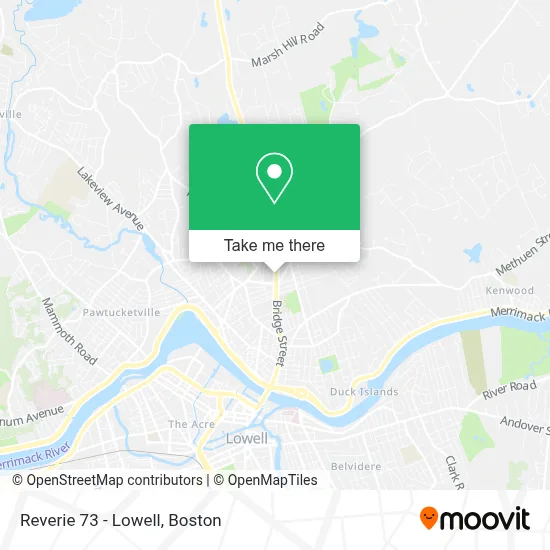
See Reverie 73 - Lowell on the map
Public Transportation to Reverie 73 - Lowell
Wondering how to get to Reverie 73 - Lowell? Moovit helps you find the best way to get to Reverie 73 - Lowell with step-by-step directions from the nearest public transit station.
Moovit provides free maps and live directions to help you navigate through your city. View schedules, routes, timetables, and find out how long does it take to get to Reverie 73 - Lowell in real time.
Looking for the nearest stop or station to Reverie 73 - Lowell? Check out this list of stops closest to your destination: Bridge St & 13th St; Humphrey St & 18th St; Hildreth St & Essex St.
Bus: 10, 1, 8.Train: LOWELL.
Want to see if there’s another route that gets you there at an earlier time? Moovit helps you find alternative routes or times. Get directions from and directions to Reverie 73 - Lowell easily from the Moovit App or Website.
We make riding to Reverie 73 - Lowell easy, which is why over 1.7 million users, including users in Lowell, trust Moovit as the best app for public transit. You don’t need to download an individual bus app or train app, Moovit is your all-in-one transit app that helps you find the best bus time or train time available.
For information on prices of bus and train, costs and ride fares to Reverie 73 - Lowell, please check the Moovit app.
Use the app to navigate to popular places including to the airport, hospital, stadium, grocery store, mall, coffee shop, school, college, and university.
Reverie 73 - Lowell Address: 1148 Bridge St street in Lowell
- Bravos Roast Beef & Pizza,,
- Smiley Dental Lowell,
- Garage Door Repair,
- Western Union,
- Haffner's Gas Station And Car Wash,
- Village Medical at Walgreens - Lowell,
- Lowell Locksmith Deadbolts Installed,
- Property Management,
- Yandi's Tree Service,
- Z.R. Rourke Real Estate & Rourke Construction and Rentals,
- Northeast Rehab,
- Transponder Car Keys Locksmith,
- Bunk Barn,
- Freedom Communications Lowell,
- A-Tech,
- Green Clean Laundromat,
- 980 Wcap,
- Mansi Chokshi,
- Demoulas Market Basket #2 Lowell,
- Sunrise Shopping Center
Places Near Reverie 73 - Lowell
- Seaport District, Boston,
- Museum Of Science, Boston,
- Faneuil Hall, Boston,
- Boston Common, Boston,
- Boston Convention & Exhibition Center, Boston,
- Boston Children's Hospital, Boston,
- Leader Bank Pavilion (Leader Bank Pavillion), Boston,
- Td Garden, Boston,
- Wilbur Theatre, Boston,
- House Of Blues, Boston,
- Isabella Stewart Gardner Museum, Boston,
- Wang Theater, Boston,
- Massachusetts General Hospital, Boston,
- Castle Island, Boston,
- Cheers, Boston,
- Boston Medical Center, Boston,
- Prudential Center, Boston,
- Quincy Market, Boston,
- North End, Boston,
- Mgm Music Hall, Boston
How to get to popular places in Boston with public transit
Get around Lowell by public transit!
Traveling around Lowell has never been so easy. See step by step directions as you travel to any attraction, street or major public transit station. View bus and train schedules, arrival times, service alerts and detailed routes on a map, so you know exactly how to get to anywhere in Lowell.
When traveling to any destination around Lowell use Moovit's Live Directions with Get Off Notifications to know exactly where and how far to walk, how long to wait for your line, and how many stops are left. Moovit will alert you when it's time to get off — no need to constantly re-check whether yours is the next stop.
Wondering how to use public transit in Lowell or how to pay for public transit in Lowell? Moovit public transit app can help you navigate your way with public transit easily, and at minimum cost. It includes public transit fees, ticket prices, and costs. Looking for a map of Lowell public transit lines? Moovit public transit app shows all public transit maps in Lowell with all Bus, Train, Subway and Ferry routes and stops on an interactive map.
Boston has 4 transit type(s), including: Bus, Train, Subway and Ferry, operated by several transit agencies, including MBTA, Southeastern Regional Transit Authority, MetroWest Regional Transit Authority, Rhode Island Public Transit Authority, WRTA, Lowell Regional Transit Authority, Merrimack Valley Transit, Montachusett Regional Transit Authority, Cape Cod Regional Transit Authority, Brockton Area Transit Authority, Martha's Vineyard Transit Authority, the WAVE - Nantucket Regional Transit Authority, GATRA, Cape Ann Transportation Authority and Massport