Directions to Rice Lake Weighing Systems (Needham) with public transportation
The following transit lines have routes that pass near Rice Lake Weighing Systems
 Bus: 59.
- Train: NEEDHAM, FRAMINGHAM/WORCESTER.
How to get to Rice Lake Weighing Systems by bus?
Click on the bus route to see step by step directions with maps, line arrival times and updated time schedules.
From Lasell College, Newton
85 minFrom Showa Boston Institute, Boston
203 minFrom Waltham, MA, Waltham
72 minFrom Brigham and Women's Faulkner Hospital, Boston
166 minFrom Six Flags New England, Newton
51 minFrom Legacy Place, Dedham
175 minFrom Faulkner Hospital, Boston
167 minFrom Brighton District Court, Boston
78 minFrom Georgetown, Massachusetts, Boston
173 minFrom Hebrew Rehab Center, Boston
162 min
How to get to Rice Lake Weighing Systems by train?
Click on the train route to see step by step directions with maps, line arrival times and updated time schedules.
Train stations near Rice Lake Weighing Systems in Needham
What are the closest stations to Rice Lake Weighing Systems?
The closest stations to Rice Lake Weighing Systems are:
- Hersey is 783 yards away, 10 min walk.
- Wellesley Square is 5192 yards away, 61 min walk.
Which bus line stops near Rice Lake Weighing Systems?
59 (Needham Junction Via Needham St)
Which train line stops near Rice Lake Weighing Systems?
NEEDHAM (#625 | Needham Heights)
What’s the nearest train station to Rice Lake Weighing Systems in Needham?
The nearest train station to Rice Lake Weighing Systems in Needham is Hersey. It’s a 10 min walk away.
What time is the first train to Rice Lake Weighing Systems in Needham?
The FRAMINGHAM/WORCESTER is the first train that goes to Rice Lake Weighing Systems in Needham. It stops nearby at 5:09 AM.
What time is the last train to Rice Lake Weighing Systems in Needham?
The FRAMINGHAM/WORCESTER is the last train that goes to Rice Lake Weighing Systems in Needham. It stops nearby at 12:32 AM.
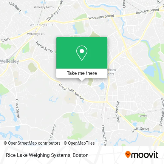
See Rice Lake Weighing Systems, Needham, on the map
Public Transit to Rice Lake Weighing Systems in Needham
Wondering how to get to Rice Lake Weighing Systems in Needham? Moovit helps you find the best way to get to Rice Lake Weighing Systems with step-by-step directions from the nearest public transit station.
Moovit provides free maps and live directions to help you navigate through your city. View schedules, routes, timetables, and find out how long does it take to get to Rice Lake Weighing Systems in real time.
Looking for the nearest stop or station to Rice Lake Weighing Systems? Check out this list of stops closest to your destination: Hersey; Wellesley Square.
Bus: 59.Train: NEEDHAM, FRAMINGHAM/WORCESTER.
Want to see if there’s another route that gets you there at an earlier time? Moovit helps you find alternative routes or times. Get directions from and directions to Rice Lake Weighing Systems easily from the Moovit App or Website.
We make riding to Rice Lake Weighing Systems easy, which is why over 1.7 million users, including users in Needham, trust Moovit as the best app for public transit. You don’t need to download an individual bus app or train app, Moovit is your all-in-one transit app that helps you find the best bus time or train time available.
For information on prices of bus and train, costs and ride fares to Rice Lake Weighing Systems, please check the Moovit app.
Use the app to navigate to popular places including to the airport, hospital, stadium, grocery store, mall, coffee shop, school, college, and university.
Rice Lake Weighing Systems Address: 930 Central Ave street in Needham
- Apl Appliance Repair,
- Bshia,
- Good Manner,
- Chambers Cove,
- Vered Hasharon Travel & Tours,
- Abba Landscaping,
- West Street Apts,
- Hillside Place,
- Wellesley Family Care Associates,
- Lilly,
- Heafitz Development Co.,
- Me4sure,
- Souper Salad Corporation Office,
- Joslin Diabetes Center,
- Firstlight Home Care,
- Irs Help,
- Daniel Melville MD,
- Beth Israel Deaconess Medical Center,
- Choice Surrogacy,
- Winged Heating & Cooling Repair
Places Near Rice Lake Weighing Systems (Needham)
- Boston Medical Center, Boston,
- Leader Bank Pavilion (Leader Bank Pavillion), Boston,
- House Of Blues, Boston,
- Mgm Music Hall, Boston,
- Museum Of Science, Boston,
- Castle Island, Boston,
- Boston Convention & Exhibition Center, Boston,
- Isabella Stewart Gardner Museum, Boston,
- Td Garden, Boston,
- Wang Theater, Boston,
- Massachusetts General Hospital, Boston,
- Quincy Market, Boston,
- Boston Common, Boston,
- North End, Boston,
- Wilbur Theatre, Boston,
- Seaport District, Boston,
- Cheers, Boston,
- Faneuil Hall, Boston,
- Boston Children's Hospital, Boston,
- Prudential Center, Boston
How to get to popular places in Boston with public transit
Get around Needham by public transit!
Traveling around Needham has never been so easy. See step by step directions as you travel to any attraction, street or major public transit station. View bus and train schedules, arrival times, service alerts and detailed routes on a map, so you know exactly how to get to anywhere in Needham.
When traveling to any destination around Needham use Moovit's Live Directions with Get Off Notifications to know exactly where and how far to walk, how long to wait for your line, and how many stops are left. Moovit will alert you when it's time to get off — no need to constantly re-check whether yours is the next stop.
Wondering how to use public transit in Needham or how to pay for public transit in Needham? Moovit public transit app can help you navigate your way with public transit easily, and at minimum cost. It includes public transit fees, ticket prices, and costs. Looking for a map of Needham public transit lines? Moovit public transit app shows all public transit maps in Needham with all Bus, Train, Subway and Ferry routes and stops on an interactive map.
Boston has 4 transit type(s), including: Bus, Train, Subway and Ferry, operated by several transit agencies, including MBTA, Southeastern Regional Transit Authority, MetroWest Regional Transit Authority, Rhode Island Public Transit Authority, WRTA, Lowell Regional Transit Authority, Merrimack Valley Transit, Montachusett Regional Transit Authority, Cape Cod Regional Transit Authority, Brockton Area Transit Authority, Martha's Vineyard Transit Authority, the WAVE - Nantucket Regional Transit Authority, GATRA, Cape Ann Transportation Authority and Massport