Directions to Rice Post (Boston) with public transportation
The following transit lines have routes that pass near Rice Post
 Bus: 16, 18, 41, 8, RED LINE SHUTTLE.
- Train: FAIRMOUNT, FRANKLIN/FOXBORO, PROVIDENCE/STOUGHTON, FALL RIVER/NEW BEDFORD, GREENBUSH.
- Subway: RED LINE.
How to get to Rice Post by bus?
Click on the bus route to see step by step directions with maps, line arrival times and updated time schedules.
From 401 Park, Boston
59 minFrom Georgetown, Massachusetts, Boston
80 minFrom Academy Of the Pacific Rim Charter Public School, Boston
75 minFrom crown Colony Shuttle, Quincy
102 minFrom Old North Church, Boston
77 minFrom CambridgeSide (Cambridgeside Galleria), Cambridge
61 minFrom Mount Auburn, Cambridge
82 minFrom Charles River, Boston
59 minFrom Hampton Inn & Suites-Hampton Watertown Boston (Hampton Inn & Suites Watertown Boston), Watertown Town
78 minFrom The Mall At Chestnut Hill, Newton
92 min
How to get to Rice Post by train?
Click on the train route to see step by step directions with maps, line arrival times and updated time schedules.
How to get to Rice Post by subway?
Click on the subway route to see step by step directions with maps, line arrival times and updated time schedules.
Bus stops near Rice Post in Boston
Subway station near Rice Post in Boston
- Andrew, 17 min walk,VIEW
Bus lines to Rice Post in Boston
- 18, Andrew - Ashmont,VIEW
- RED LINE SHUTTLE, Ashmont - JFK/UMass (Shuttle),VIEW
- RED LINE SHUTTLE, Ashmont - JFK/UMass,VIEW
- RED/MATTAPAN LINE SHUTTLE, Mattapan - JFK/UMass,VIEW
- RED LINE SHUTTLE, Ashmont (Shuttle),VIEW
- 8, Harbor Point Via South Bay Center,VIEW
- 41, Jfk/Umass,VIEW
- RED LINE SHUTTLE, Park Street (Shuttle),VIEW
What are the closest stations to Rice Post?
The closest stations to Rice Post are:
- Dorchester Ave @ Crescent Ave is 34 yards away, 1 min walk.
- Uphams Corner is 214 yards away, 3 min walk.
- Dorchester Ave @ Thornley Rd is 271 yards away, 4 min walk.
- Columbia Rd @ Buttonwood St is 336 yards away, 5 min walk.
- Dorchester Ave @ Melvinside Ter is 511 yards away, 7 min walk.
- Andrew is 1422 yards away, 17 min walk.
- Jfk/Umass is 1561 yards away, 19 min walk.
Which bus lines stop near Rice Post?
These bus lines stop near Rice Post: 16, 18, 41, 8.
Which train line stops near Rice Post?
FAIRMOUNT (#1619 | Fairmount)
Which subway line stops near Rice Post?
RED LINE (Ashmont/Braintree)
What’s the nearest subway station to Rice Post in Boston?
The nearest subway station to Rice Post in Boston is Andrew. It’s a 17 min walk away.
What’s the nearest train station to Rice Post in Boston?
The nearest train station to Rice Post in Boston is Uphams Corner. It’s a 3 min walk away.
What’s the nearest bus station to Rice Post in Boston?
The nearest bus station to Rice Post in Boston is Dorchester Ave @ Crescent Ave. It’s a 1 min walk away.
What time is the first subway to Rice Post in Boston?
The RED LINE is the first subway that goes to Rice Post in Boston. It stops nearby at 5:21 AM.
What time is the last subway to Rice Post in Boston?
The RED LINE is the last subway that goes to Rice Post in Boston. It stops nearby at 1:57 AM.
What time is the first train to Rice Post in Boston?
The FAIRMOUNT is the first train that goes to Rice Post in Boston. It stops nearby at 4:47 AM.
What time is the last train to Rice Post in Boston?
The FAIRMOUNT is the last train that goes to Rice Post in Boston. It stops nearby at 11:57 PM.
What time is the first bus to Rice Post in Boston?
The 41 is the first bus that goes to Rice Post in Boston. It stops nearby at 5:08 AM.
What time is the last bus to Rice Post in Boston?
The 8 is the last bus that goes to Rice Post in Boston. It stops nearby at 12:51 AM.
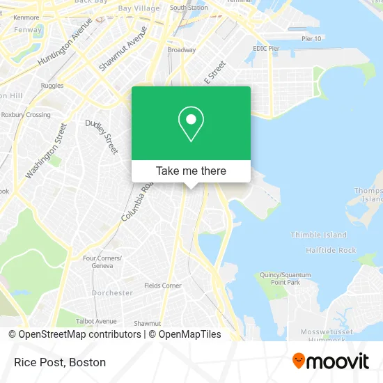
See Rice Post, Boston, on the map
Public Transit to Rice Post in Boston
Wondering how to get to Rice Post in Boston? Moovit helps you find the best way to get to Rice Post with step-by-step directions from the nearest public transit station.
Moovit provides free maps and live directions to help you navigate through your city. View schedules, routes, timetables, and find out how long does it take to get to Rice Post in real time.
Looking for the nearest stop or station to Rice Post? Check out this list of stops closest to your destination: Dorchester Ave @ Crescent Ave; Uphams Corner; Dorchester Ave @ Thornley Rd; Columbia Rd @ Buttonwood St; Dorchester Ave @ Melvinside Ter; Andrew; Jfk/Umass.
Bus: 16, 18, 41, 8, RED LINE SHUTTLE, RED LINE SHUTTLE, RED/MATTAPAN LINE SHUTTLE, RED LINE SHUTTLE.Train: FAIRMOUNT, FRANKLIN/FOXBORO, PROVIDENCE/STOUGHTON, FALL RIVER/NEW BEDFORD, GREENBUSH, KINGSTON.Subway: RED LINE.
Want to see if there’s another route that gets you there at an earlier time? Moovit helps you find alternative routes or times. Get directions from and directions to Rice Post easily from the Moovit App or Website.
We make riding to Rice Post easy, which is why over 1.7 million users, including users in Boston, trust Moovit as the best app for public transit. You don’t need to download an individual bus app or train app, Moovit is your all-in-one transit app that helps you find the best bus time or train time available.
For information on prices of subway, bus and train, costs and ride fares to Rice Post, please check the Moovit app.
Use the app to navigate to popular places including to the airport, hospital, stadium, grocery store, mall, coffee shop, school, college, and university.
Rice Post Address: 33 Romsey St street in Boston
- Scott W Sensabaugh Electrician,
- Luca Air,
- MCK Promax Cleaning Services,
- Real Estate Jacqui,
- Machado House Cleaning and Yard Work,
- She Gets It Done Notary Services,
- Ramos Management & Maintenance,
- Bay State Paving and Masonry,
- Bears Creations,
- Canine Command Dog Training,
- Above All Masonry and Construction,
- Verde Management,
- Beautyaide,
- Shannon Painting,
- Ty's Plumbing and Heating,
- MWB Road Side,
- Constellation Glass and Glazing,
- Stubborn Scapes Landscaping,
- Seacoast Sewer & Drain,
- Royalshine Service
Places Near Rice Post (Boston)
- Quincy Market, Boston,
- Museum Of Science, Boston,
- Cheers, Boston,
- North End, Boston,
- Castle Island, Boston,
- Seaport District, Boston,
- Wilbur Theatre, Boston,
- Td Garden, Boston,
- Mgm Music Hall, Boston,
- Isabella Stewart Gardner Museum, Boston,
- Boston Children's Hospital, Boston,
- Boston Medical Center, Boston,
- Wang Theater, Boston,
- House Of Blues, Boston,
- Prudential Center, Boston,
- Faneuil Hall, Boston,
- Leader Bank Pavilion (Leader Bank Pavillion), Boston,
- Boston Common, Boston,
- Massachusetts General Hospital, Boston,
- Boston Convention & Exhibition Center, Boston
How to get to popular places in Boston with public transit
Get around Boston by public transit!
Traveling around Boston has never been so easy. See step by step directions as you travel to any attraction, street or major public transit station. View bus and train schedules, arrival times, service alerts and detailed routes on a map, so you know exactly how to get to anywhere in Boston.
When traveling to any destination around Boston use Moovit's Live Directions with Get Off Notifications to know exactly where and how far to walk, how long to wait for your line, and how many stops are left. Moovit will alert you when it's time to get off — no need to constantly re-check whether yours is the next stop.
Wondering how to use public transit in Boston or how to pay for public transit in Boston? Moovit public transit app can help you navigate your way with public transit easily, and at minimum cost. It includes public transit fees, ticket prices, and costs. Looking for a map of Boston public transit lines? Moovit public transit app shows all public transit maps in Boston with all Bus, Train, Subway and Ferry routes and stops on an interactive map.
Boston has 4 transit type(s), including: Bus, Train, Subway and Ferry, operated by several transit agencies, including MBTA, Southeastern Regional Transit Authority, MetroWest Regional Transit Authority, Rhode Island Public Transit Authority, WRTA, Lowell Regional Transit Authority, Merrimack Valley Transit, Montachusett Regional Transit Authority, Cape Cod Regional Transit Authority, Brockton Area Transit Authority, Martha's Vineyard Transit Authority, the WAVE - Nantucket Regional Transit Authority, GATRA, Cape Ann Transportation Authority and Massport