Directions to Ridder Arena (Minneapolis) with public transportation
The following transit lines have routes that pass near Ridder Arena
 Bus: 113, 2, 3, 490, METRO E LINE.
How to get to Ridder Arena by bus?
Click on the bus route to see step by step directions with maps, line arrival times and updated time schedules.
From Cathedral Of St. Paul, St. Paul
60 minFrom 44th And France, Minneapolis
43 minFrom Italy by Web, Minneapolis
41 minFrom La Fitness, St. Louis Park
36 minFrom North Minneapolis, Minneapolis
42 minFrom Coffee Beanery, St. Paul
35 minFrom Capitol/Rice Street LRT Station, St. Paul
41 minFrom Animal Humane Society, Golden Valley
49 minFrom Pride Transportation Bus Services, St. Paul
52 min
Bus stops near Ridder Arena in Minneapolis
Light Rail stations near Ridder Arena in Minneapolis
Bus lines to Ridder Arena in Minneapolis
- METRO E LINE, Henn-France / Southdale,VIEW
- 2, Franklin Av / To Central / U Of M,VIEW
- 33, Elm-Kasota / Westgate Sta,VIEW
- 113, Ltd Stop / Grand / Lyndale-56th,VIEW
- 114, Ltd Stop / Hennepin-36 / Bryant-38st,VIEW
- 121, Campus Connector,VIEW
- 252, Express / 95ave P&R,VIEW
- 465, Burnsville-Minneapolis-U of M,VIEW
- 475, Apple Valley-Cedar Grove-Mpls/U of M,VIEW
- 490, Prior Lake-Shakopee-Minneapolis,VIEW
- 789, Trip 1 / Maple Grove / Transit Sta,VIEW
- 122, University Av / Circulator,VIEW
- 3, Como / To Snelling / Energy Park,VIEW
What are the closest stations to Ridder Arena?
The closest stations to Ridder Arena are:
- 4th St Se & Ridder Arena is 65 yards away, 2 min walk.
- 4 St SE at 18 Av NE Corner (Ridder Arena is 83 yards away, 2 min walk.
- Oak St SE & 4th St SE is 278 yards away, 4 min walk.
- University & U Of M Rec Center Station is 303 yards away, 4 min walk.
- 15th Ave SE & 4th St SE is 478 yards away, 6 min walk.
- East Bank is 655 yards away, 9 min walk.
- Cedar-Riverside is 1198 yards away, 14 min walk.
Which bus lines stop near Ridder Arena?
These bus lines stop near Ridder Arena: 113, 2, 3, 490, METRO E LINE.
What’s the nearest light rail station to Ridder Arena in Minneapolis?
The nearest light rail station to Ridder Arena in Minneapolis is East Bank. It’s a 9 min walk away.
What’s the nearest bus station to Ridder Arena in Minneapolis?
The nearest bus stations to Ridder Arena in Minneapolis are 4th St Se & Ridder Arena and 4 St SE at 18 Av NE Corner (Ridder Arena. The closest one is a 2 min walk away.
What time is the first light rail to Ridder Arena in Minneapolis?
The METRO BLUE LINE is the first light rail that goes to Ridder Arena in Minneapolis. It stops nearby at 3:19 AM.
What time is the last light rail to Ridder Arena in Minneapolis?
The METRO BLUE LINE is the last light rail that goes to Ridder Arena in Minneapolis. It stops nearby at 12:40 AM.
What time is the first bus to Ridder Arena in Minneapolis?
The 3 is the first bus that goes to Ridder Arena in Minneapolis. It stops nearby at 4:19 AM.
What time is the last bus to Ridder Arena in Minneapolis?
The 3 is the last bus that goes to Ridder Arena in Minneapolis. It stops nearby at 1:50 AM.
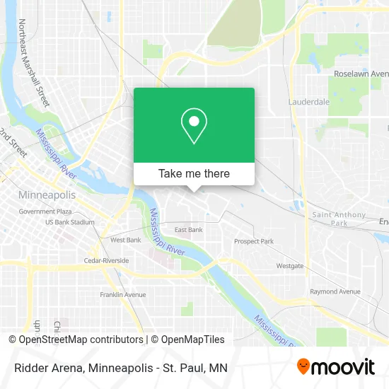
See Ridder Arena, Minneapolis, on the map
Public Transit to Ridder Arena in Minneapolis
Wondering how to get to Ridder Arena in Minneapolis? Moovit helps you find the best way to get to Ridder Arena with step-by-step directions from the nearest public transit station.
Moovit provides free maps and live directions to help you navigate through your city. View schedules, routes, timetables, and find out how long does it take to get to Ridder Arena in real time.
Looking for the nearest stop or station to Ridder Arena? Check out this list of stops closest to your destination: 4th St Se & Ridder Arena; 4 St SE at 18 Av NE Corner (Ridder Arena; Oak St SE & 4th St SE; University & U Of M Rec Center Station; 15th Ave SE & 4th St SE; East Bank; Cedar-Riverside.
Bus: 113, 2, 3, 490, METRO E LINE, 33, 114, 465, 475, 789, 122.
Want to see if there’s another route that gets you there at an earlier time? Moovit helps you find alternative routes or times. Get directions from and directions to Ridder Arena easily from the Moovit App or Website.
We make riding to Ridder Arena easy, which is why over 1.5 million users, including users in Minneapolis, trust Moovit as the best app for public transit. You don’t need to download an individual bus app or train app, Moovit is your all-in-one transit app that helps you find the best bus time or train time available.
For information on prices of bus and light rail, costs and ride fares to Ridder Arena, please check the Moovit app.
Use the app to navigate to popular places including to the airport, hospital, stadium, grocery store, mall, coffee shop, school, college, and university.
Ridder Arena Address: 1815 4th St SE street in Minneapolis
- Baseline Tennis Center,
- 3m Arena at Mariucci,
- 17th Avenue Residence Hall,
- 3m Arena at Mariucci (Mariucci Arena),
- 19th Avenue Parking Ramp,
- Fraternity Row,
- Williams Arena -Section 102,
- Williams Arena,
- Maturi Pavilion,
- University of Minnesota Armory,
- Armory,
- Maroon Parking Lot,
- Lot C33 - U of MN,
- Minnesota Transport Observatory (MTO - Minnesota Traffic Observatory),
- Bell Museum Of Natural History,
- Jane Sage Cowles Stadium,
- Dorthy L Sheppard Pool,
- Station 19 Architects,
- Mcnamara Alumni Center,
- 16th Ave M 8056
Places Near Ridder Arena (Minneapolis)
- Minneapolis Sculpture Garden, Minneapolis,
- Xcel Energy Center, St. Paul,
- Minnehaha Falls, Minneapolis,
- 3m Arena at Mariucci, Minneapolis,
- Huntington Bank Stadium, Minneapolis,
- Target Field, Minneapolis,
- St. Paul College, St. Paul,
- Target Center, Minneapolis,
- Harriet Island Regional Park, St. Paul,
- Bishop Henry Whipple Federal Building,
- Mystic lake casino bus, Minneapolis,
- Surly Brewing Co., Minneapolis,
- Grand Casino Hinckley,MN, Minneapolis,
- Orpheum Theatre (Minneapolis, Minnesota), Minneapolis,
- Minneapolis Institute of Art, Minneapolis,
- Minneapolis Armory, Minneapolis,
- Minnesota State Capitol, St. Paul,
- Mpls. Convention Center, Minneapolis,
- Northrop Auditorium, Minneapolis,
- Treasure Island Resort & Casino, St. Paul
How to get to popular places in Minneapolis - St. Paul, MN with public transit
Get around Minneapolis by public transit!
Traveling around Minneapolis has never been so easy. See step by step directions as you travel to any attraction, street or major public transit station. View bus and train schedules, arrival times, service alerts and detailed routes on a map, so you know exactly how to get to anywhere in Minneapolis.
When traveling to any destination around Minneapolis use Moovit's Live Directions with Get Off Notifications to know exactly where and how far to walk, how long to wait for your line, and how many stops are left. Moovit will alert you when it's time to get off — no need to constantly re-check whether yours is the next stop.
Wondering how to use public transit in Minneapolis or how to pay for public transit in Minneapolis? Moovit public transit app can help you navigate your way with public transit easily, and at minimum cost. It includes public transit fees, ticket prices, and costs. Looking for a map of Minneapolis public transit lines? Moovit public transit app shows all public transit maps in Minneapolis with all Bus, Train and Light Rail routes and stops on an interactive map.
Minneapolis - St. Paul, MN has 3 transit type(s), including: Bus, Train and Light Rail, operated by several transit agencies, including Metro Transit , Metro Transit, MVTA, Plymouth Metrolink, SouthWest Transit, Maple Grove, University of Minnesota, Airport (MAC), Amtrak, Mankato Transit System, SMART, FlixBus-us and Greyhound-us