How to get to Rim & Wheel Works by bus?
Click on the bus route to see step by step directions with maps, line arrival times and updated time schedules.
From Arsenal Mall, Watertown Town
44 minFrom Allston, Boston
52 minFrom Harvard Business School, Boston
54 minFrom Vertex Pharmaceuticals, Inc., Boston
60 minFrom AWACS (Bldg 1612), Hanscom Afb
159 minFrom Boston College (BC), Boston
59 minFrom Newton, MA, Newton
52 minFrom Boston University Track and Tennis Center, Boston
53 minFrom Brattle St / Harvard Sq, Cambridge
57 minFrom Heartbreak Hill, Newton
52 min
How to get to Rim & Wheel Works by train?
Click on the train route to see step by step directions with maps, line arrival times and updated time schedules.
Bus stops near Rim & Wheel Works in Waltham
Train stations near Rim & Wheel Works in Waltham
Bus lines to Rim & Wheel Works in Waltham
What are the closest stations to Rim & Wheel Works?
The closest stations to Rim & Wheel Works are:
- Hope Ave @ Boston Children's Waltham is 155 yards away, 3 min walk.
- West Newton is 165 yards away, 2 min walk.
- 113 Crescent St is 173 yards away, 3 min walk.
- Brandeis/Roberts is 2262 yards away, 27 min walk.
Which bus lines stop near Rim & Wheel Works?
These bus lines stop near Rim & Wheel Works: 553, 554, 558, 70.
Which train lines stop near Rim & Wheel Works?
These train lines stop near Rim & Wheel Works: FITCHBURG, FRAMINGHAM/WORCESTER.
What’s the nearest train station to Rim & Wheel Works in Waltham?
The nearest train station to Rim & Wheel Works in Waltham is West Newton. It’s a 2 min walk away.
What’s the nearest bus station to Rim & Wheel Works in Waltham?
The nearest bus stations to Rim & Wheel Works in Waltham are Hope Ave @ Boston Children's Waltham and 113 Crescent St. The closest one is a 3 min walk away.
What time is the first train to Rim & Wheel Works in Waltham?
The FRAMINGHAM/WORCESTER is the first train that goes to Rim & Wheel Works in Waltham. It stops nearby at 5:19 AM.
What time is the last train to Rim & Wheel Works in Waltham?
The FRAMINGHAM/WORCESTER is the last train that goes to Rim & Wheel Works in Waltham. It stops nearby at 12:22 AM.
What time is the first bus to Rim & Wheel Works in Waltham?
The 505 is the first bus that goes to Rim & Wheel Works in Waltham. It stops nearby at 5:55 AM.
What time is the last bus to Rim & Wheel Works in Waltham?
The 553 is the last bus that goes to Rim & Wheel Works in Waltham. It stops nearby at 8:56 PM.
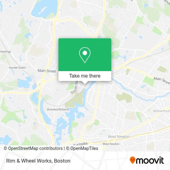
See Rim & Wheel Works, Waltham, on the map
Public Transit to Rim & Wheel Works in Waltham
Wondering how to get to Rim & Wheel Works in Waltham? Moovit helps you find the best way to get to Rim & Wheel Works with step-by-step directions from the nearest public transit station.
Moovit provides free maps and live directions to help you navigate through your city. View schedules, routes, timetables, and find out how long does it take to get to Rim & Wheel Works in real time.
Looking for the nearest stop or station to Rim & Wheel Works? Check out this list of stops closest to your destination: Hope Ave @ Boston Children's Waltham; West Newton; 113 Crescent St; Brandeis/Roberts.
Bus: 553, 554, 558, 70, 505, 556.Train: FITCHBURG, FRAMINGHAM/WORCESTER.
Want to see if there’s another route that gets you there at an earlier time? Moovit helps you find alternative routes or times. Get directions from and directions to Rim & Wheel Works easily from the Moovit App or Website.
We make riding to Rim & Wheel Works easy, which is why over 1.7 million users, including users in Waltham, trust Moovit as the best app for public transit. You don’t need to download an individual bus app or train app, Moovit is your all-in-one transit app that helps you find the best bus time or train time available.
For information on prices of bus, train and subway, costs and ride fares to Rim & Wheel Works, please check the Moovit app.
Use the app to navigate to popular places including to the airport, hospital, stadium, grocery store, mall, coffee shop, school, college, and university.
Rim & Wheel Works Address: 50 Sun St street in Waltham
- Landbird,
- Penske Truck Rental,
- Garden City Trailer,
- Awol Print Shop,
- Synthcube,
- AJ Glass,
- Citie Group,
- Teo Mini Market,
- Watch City Diner,
- Italian Kitchen,
- A 24 Hour Emergency Locksmith,
- Felton Sewer & Drain,
- Bedford Village,
- The Foot Specialist, Dr. Robert Kelemen,
- Hope Ave Therapy, LLC,
- Dweik Rifat,
- First Response Clincal,
- Karavolas Dentistry,
- All Day & Night Emergency Locksmith,
- Salgueros Market
Places Near Rim & Wheel Works (Waltham)
- Boston Medical Center, Boston,
- Prudential Center, Boston,
- House Of Blues, Boston,
- Quincy Market, Boston,
- Boston Common, Boston,
- Museum Of Science, Boston,
- Isabella Stewart Gardner Museum, Boston,
- Seaport District, Boston,
- Leader Bank Pavilion (Leader Bank Pavillion), Boston,
- Castle Island, Boston,
- North End, Boston,
- Boston Children's Hospital, Boston,
- Boston Convention & Exhibition Center, Boston,
- Massachusetts General Hospital, Boston,
- Wilbur Theatre, Boston,
- Faneuil Hall, Boston,
- Cheers, Boston,
- Mgm Music Hall, Boston,
- Wang Theater, Boston,
- Td Garden, Boston
How to get to popular places in Boston with public transit
Get around Waltham by public transit!
Traveling around Waltham has never been so easy. See step by step directions as you travel to any attraction, street or major public transit station. View bus and train schedules, arrival times, service alerts and detailed routes on a map, so you know exactly how to get to anywhere in Waltham.
When traveling to any destination around Waltham use Moovit's Live Directions with Get Off Notifications to know exactly where and how far to walk, how long to wait for your line, and how many stops are left. Moovit will alert you when it's time to get off — no need to constantly re-check whether yours is the next stop.
Wondering how to use public transit in Waltham or how to pay for public transit in Waltham? Moovit public transit app can help you navigate your way with public transit easily, and at minimum cost. It includes public transit fees, ticket prices, and costs. Looking for a map of Waltham public transit lines? Moovit public transit app shows all public transit maps in Waltham with all Bus, Train, Subway and Ferry routes and stops on an interactive map.
Boston has 4 transit type(s), including: Bus, Train, Subway and Ferry, operated by several transit agencies, including MBTA, Southeastern Regional Transit Authority, MetroWest Regional Transit Authority, Rhode Island Public Transit Authority, WRTA, Lowell Regional Transit Authority, Merrimack Valley Transit, Montachusett Regional Transit Authority, Cape Cod Regional Transit Authority, Brockton Area Transit Authority, Martha's Vineyard Transit Authority, the WAVE - Nantucket Regional Transit Authority, GATRA, Cape Ann Transportation Authority and Massport