How to get to Rio Bravo Madrid by bus?
Click on the bus route to see step by step directions with maps, line arrival times and updated time schedules.
From Museo Nacional de Ciencias Naturales
50 minFrom Calle Lope De Haro
56 minFrom Calle caleruega
69 minFrom Torrejon De La Calzada
58 minFrom Barrio de Santa Eugenia
61 minFrom Fabrik Club @ Madrid
50 minFrom AUTOCINE Madrid
84 minFrom Calle de la Isla de Java 2
84 minFrom Paseo de la Castellana
59 minFrom Calle Condesa de Venadito 1
69 min
How to get to Rio Bravo Madrid by train?
Click on the train route to see step by step directions with maps, line arrival times and updated time schedules.
How to get to Rio Bravo Madrid by metro?
Click on the metro route to see step by step directions with maps, line arrival times and updated time schedules.
From Museo Nacional de Ciencias Naturales
44 minFrom Calle Lope De Haro
47 minFrom Calle caleruega
60 minFrom Torrejon De La Calzada
73 minFrom Barrio de Santa Eugenia
73 minFrom Fabrik Club @ Madrid
38 minFrom AUTOCINE Madrid
76 minFrom Calle de la Isla de Java 2
76 minFrom Paseo de la Castellana
47 minFrom Calle Condesa de Venadito 1
61 min
Bus stops near Rio Bravo Madrid
Metro station near Rio Bravo Madrid
- Marqués De Vadillo, 6 min walk,VIEW
Train station near Rio Bravo Madrid
- Pirámides, 16 min walk,VIEW
Bus lines to Rio Bravo Madrid
What are the closest stations to Rio Bravo Madrid?
The closest stations to Rio Bravo Madrid are:
- San Dámaso is 82 meters away, 2 min walk.
- Puente San Isidro - Ermita Del Santo is 394 meters away, 6 min walk.
- Marqués De Vadillo is 411 meters away, 6 min walk.
- Virgen Del Puerto - Mármol is 500 meters away, 7 min walk.
- Puente San Isidro - Melancólicos is 632 meters away, 9 min walk.
- Pirámides is 1229 meters away, 16 min walk.
Which bus lines stop near Rio Bravo Madrid?
These bus lines stop near Rio Bravo Madrid: 17, 25, 36, 50, 62.
Which train line stops near Rio Bravo Madrid?
C10 (Pinar De Las Rozas)
Which metro line stops near Rio Bravo Madrid?
M-5 (Casa de Campo)
What’s the nearest metro station to Rio Bravo Madrid?
The nearest metro station to Rio Bravo Madrid is Marqués De Vadillo. It’s a 6 min walk away.
What’s the nearest train station to Rio Bravo Madrid?
The nearest train station to Rio Bravo Madrid is Pirámides. It’s a 16 min walk away.
What’s the nearest bus station to Rio Bravo Madrid?
The nearest bus station to Rio Bravo Madrid is San Dámaso. It’s a 2 min walk away.
What time is the first metro to Rio Bravo Madrid?
The M-5 is the first metro that goes to Rio Bravo Madrid. It stops nearby at 6:05 AM.
What time is the last metro to Rio Bravo Madrid?
The M-5 is the last metro that goes to Rio Bravo Madrid. It stops nearby at 2:12 AM.
What time is the first train to Rio Bravo Madrid?
The C10 is the first train that goes to Rio Bravo Madrid. It stops nearby at 6:30 AM.
What time is the last train to Rio Bravo Madrid?
The C10 is the last train that goes to Rio Bravo Madrid. It stops nearby at 11:55 PM.
What time is the first bus to Rio Bravo Madrid?
The 50 is the first bus that goes to Rio Bravo Madrid. It stops nearby at 7:01 AM.
What time is the last bus to Rio Bravo Madrid?
The N16 is the last bus that goes to Rio Bravo Madrid. It stops nearby at 3:12 AM.
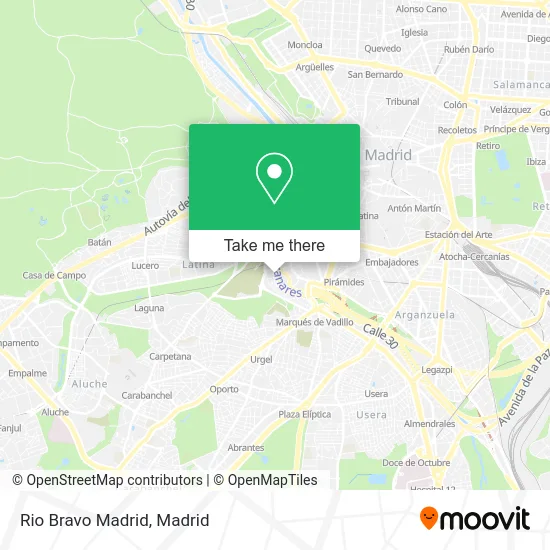
See Rio Bravo Madrid on the map
Public Transportation to Rio Bravo Madrid
Wondering how to get to Rio Bravo Madrid? Moovit helps you find the best way to get to Rio Bravo Madrid with step-by-step directions from the nearest public transit station.
Moovit provides free maps and live directions to help you navigate through your city. View schedules, routes, timetables, and find out how long does it take to get to Rio Bravo Madrid in real time.
Looking for the nearest stop or station to Rio Bravo Madrid? Check out this list of stops closest to your destination: San Dámaso; Puente San Isidro - Ermita Del Santo; Marqués De Vadillo; Virgen Del Puerto - Mármol; Puente San Isidro - Melancólicos; Pirámides.
Bus: 17, 25, 36, 50, 62, N16.Train: C10.Metro: M-5.
Want to see if there’s another route that gets you there at an earlier time? Moovit helps you find alternative routes or times. Get directions from and directions to Rio Bravo Madrid easily from the Moovit App or Website.
We make riding to Rio Bravo Madrid easy, which is why over 1.5 million users, including users in Madrid, trust Moovit as the best app for public transit. You don’t need to download an individual bus app or train app, Moovit is your all-in-one transit app that helps you find the best bus time or train time available.
For information on prices of bus, metro and train, costs and ride fares to Rio Bravo Madrid, please check the Moovit app.
Use the app to navigate to popular places including to the airport, hospital, stadium, grocery store, mall, coffee shop, school, college, and university.
Rio Bravo Madrid Address: Avenida del Manzanares, 62 28019 San Isidro Madrid street in Madrid
- Eduardo Muñoz Yáñez Sedeño,
- La Mulata Latina,
- Oposport,
- Pizzería Central,
- Alimentación Chen,
- Cafetería Ruls,
- Centro Diwaliyoga,
- TALLER019,
- Asociación Española de Padres y Niños con Alergia y Alimentos,
- Puente de Toledo,
- Herukas,
- Calle San Dámaso,
- Antonio Rodríguez Espinosa,
- Avenida del Manzanares 68,
- Colegio San Alberto Magno,
- Parroquia San Fulgencio Y San Bernardo,
- Casa Lucía,
- Calle Hacienda,
- Julio Cesar Tobias Yanci,
- Calle de San Dámaso, 16
Places Near Rio Bravo Madrid
- Hospital Universitario La Paz, Madrid,
- Mercadillo de Majadahonda, Majadahonda,
- Palacio De Vistalegre, Área Metropolitana De Madrid Y Corredor Del Henares,
- Nassica, Área Metropolitana De Madrid Y Corredor Del Henares,
- Centro Comercial Oasiz Madrid, Área Metropolitana De Madrid Y Corredor Del Henares,
- Centro Comercial La Vaguada, Área Metropolitana De Madrid Y Corredor Del Henares,
- Tres Aguas, Alcorcón,
- Estadio Wanda Metropolitano, Área Metropolitana De Madrid Y Corredor Del Henares,
- Calle de López de Hoyos 169, Madrid,
- Wizink Center, Madrid,
- Centro Comercial La Gavia, Área Metropolitana De Madrid Y Corredor Del Henares,
- Plenilunio, Área Metropolitana De Madrid Y Corredor Del Henares,
- Hospital Clínico Universitario San Carlos, Madrid,
- Plaza Mayor, Madrid,
- Hospital Universitario Ramón y Cajal, Madrid,
- Estacion de Chamartin, Madrid,
- Sala La Riviera, Madrid,
- Centro Comercial Islazul, Área Metropolitana De Madrid Y Corredor Del Henares,
- Rastro De Madrid, Área Metropolitana De Madrid Y Corredor Del Henares,
- Mendez Alvaro, Madrid
How to get to popular places in Madrid with public transit
Get around Madrid by public transit!
Traveling around Madrid has never been so easy. See step by step directions as you travel to any attraction, street or major public transit station. View bus and train schedules, arrival times, service alerts and detailed routes on a map, so you know exactly how to get to anywhere in Madrid.
When traveling to any destination around Madrid use Moovit's Live Directions with Get Off Notifications to know exactly where and how far to walk, how long to wait for your line, and how many stops are left. Moovit will alert you when it's time to get off — no need to constantly re-check whether yours is the next stop.
Wondering how to use public transit in Madrid or how to pay for public transit in Madrid? Moovit public transit app can help you navigate your way with public transit easily, and at minimum cost. It includes public transit fees, ticket prices, and costs. Looking for a map of Madrid public transit lines? Moovit public transit app shows all public transit maps in Madrid with all Bus, Train, Metro and Light Rail routes and stops on an interactive map.
Madrid has 4 transit type(s), including: Bus, Train, Metro and Light Rail, operated by several transit agencies, including Metro de Madrid, Metro Ligero, Tranvía de Parla, Renfe Cercanías - Servicios de Autobús especiales, Renfe Cercanias, Renfe Cercanías, EMT, Interurbanos, Urbanos de Alcalá de Henares, Urbanos de Alcobendas, Urbanos de Alcorcón, Urbanos de Algete, Urbanos de Aranjuez, Urbanos de Arganda del Rey and Urbanos de Arroyomolinos