How to get to Ripin by bus?
Click on the bus route to see step by step directions with maps, line arrival times and updated time schedules.
Bus stops near Ripin in Boston
Bus lines to Ripin in Boston
What are the closest stations to Ripin?
The closest stations to Ripin are:
- Pontiac After Slater is 443 yards away, 6 min walk.
- Midway Before Sockanossett is 530 yards away, 7 min walk.
Which bus line stops near Ripin?
22 (Ccri Warwick Via Pontiac Ave)
What’s the nearest bus station to Ripin in Boston?
The nearest bus station to Ripin in Boston is Pontiac After Slater. It’s a 6 min walk away.
What time is the first bus to Ripin in Boston?
The 22 is the first bus that goes to Ripin in Boston. It stops nearby at 6:40 AM.
What time is the last bus to Ripin in Boston?
The 21 is the last bus that goes to Ripin in Boston. It stops nearby at 10:38 PM.
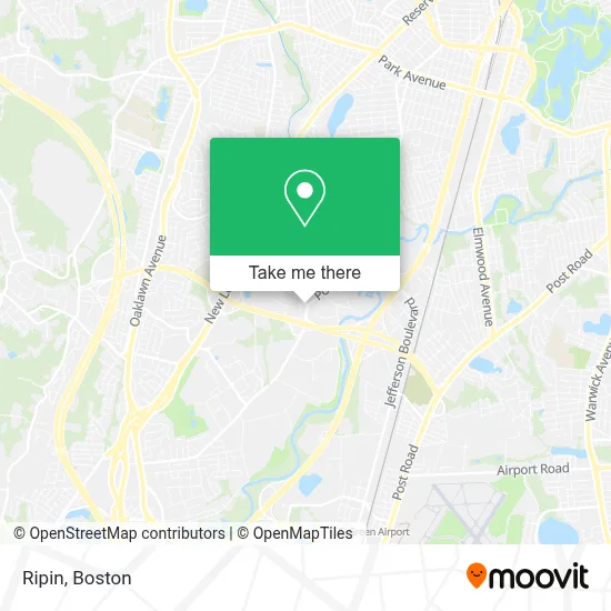
See Ripin, Boston, on the map
Public Transit to Ripin in Boston
Wondering how to get to Ripin in Boston? Moovit helps you find the best way to get to Ripin with step-by-step directions from the nearest public transit station.
Moovit provides free maps and live directions to help you navigate through your city. View schedules, routes, timetables, and find out how long does it take to get to Ripin in real time.
Looking for the nearest stop or station to Ripin? Check out this list of stops closest to your destination: Pontiac After Slater; Midway Before Sockanossett.
Bus: 22, 21.
Want to see if there’s another route that gets you there at an earlier time? Moovit helps you find alternative routes or times. Get directions from and directions to Ripin easily from the Moovit App or Website.
We make riding to Ripin easy, which is why over 1.7 million users, including users in Boston, trust Moovit as the best app for public transit. You don’t need to download an individual bus app or train app, Moovit is your all-in-one transit app that helps you find the best bus time or train time available.
For information on prices of bus, costs and ride fares to Ripin, please check the Moovit app.
Use the app to navigate to popular places including to the airport, hospital, stadium, grocery store, mall, coffee shop, school, college, and university.
Ripin Address: 300 Jefferson Boulevard, Suite 300 street in Boston
- Michael L Desimone Attorney,
- John Russo Esq PC,
- TFT Cranston,
- Jenny Clement,
- Renee Lovelace,
- Keller Williams Realty (Keller Williams-Mirian Mercado),
- Adt Security Services,
- Coastal1 Credit Union,
- Crystaline North America,
- Rhode Island Historical Cemetery,
- Floor Coverings International of Greater Providence,
- Farmers Insurance - Tammy Weaver,
- ART Jewelry,
- Citizens Bank & Trust,
- Pathways Healthcare,
- Lathrop Insurance,
- Exit 1E/Pontiac Ave/E,
- 2pq,
- Center for Massage Therapy and Skin Care,
- Coworx Staffing Services
Places Near Ripin (Boston)
- Wilbur Theatre, Boston,
- Isabella Stewart Gardner Museum, Boston,
- Boston Medical Center, Boston,
- Boston Convention & Exhibition Center, Boston,
- Quincy Market, Boston,
- Faneuil Hall, Boston,
- House Of Blues, Boston,
- Wang Theater, Boston,
- Seaport District, Boston,
- Cheers, Boston,
- Boston Children's Hospital, Boston,
- Td Garden, Boston,
- Castle Island, Boston,
- North End, Boston,
- Museum Of Science, Boston,
- Boston Common, Boston,
- Mgm Music Hall, Boston,
- Massachusetts General Hospital, Boston,
- Leader Bank Pavilion (Leader Bank Pavillion), Boston,
- Prudential Center, Boston
How to get to popular places in Boston with public transit
Get around Boston by public transit!
Traveling around Boston has never been so easy. See step by step directions as you travel to any attraction, street or major public transit station. View bus and train schedules, arrival times, service alerts and detailed routes on a map, so you know exactly how to get to anywhere in Boston.
When traveling to any destination around Boston use Moovit's Live Directions with Get Off Notifications to know exactly where and how far to walk, how long to wait for your line, and how many stops are left. Moovit will alert you when it's time to get off — no need to constantly re-check whether yours is the next stop.
Wondering how to use public transit in Boston or how to pay for public transit in Boston? Moovit public transit app can help you navigate your way with public transit easily, and at minimum cost. It includes public transit fees, ticket prices, and costs. Looking for a map of Boston public transit lines? Moovit public transit app shows all public transit maps in Boston with all Bus, Train, Subway and Ferry routes and stops on an interactive map.
Boston has 4 transit type(s), including: Bus, Train, Subway and Ferry, operated by several transit agencies, including MBTA, Southeastern Regional Transit Authority, MetroWest Regional Transit Authority, Rhode Island Public Transit Authority, WRTA, Lowell Regional Transit Authority, Merrimack Valley Transit, Montachusett Regional Transit Authority, Cape Cod Regional Transit Authority, Brockton Area Transit Authority, Martha's Vineyard Transit Authority, the WAVE - Nantucket Regional Transit Authority, GATRA, Cape Ann Transportation Authority and Massport