How to get to Ritmos Y Costumbres by bus?
Click on the bus route to see step by step directions with maps, line arrival times and updated time schedules.
From Calle de Castelló 77, Madrid
61 minFrom Avenida Felipe II S/N, Madrid
74 minFrom Rastro De Madrid, Área Metropolitana De Madrid Y Corredor Del Henares
45 minFrom Teatros Luchana, Madrid
62 minFrom Mercado De La Paz, Área Metropolitana De Madrid Y Corredor Del Henares
61 minFrom Centro Comercial Loranca, Área Metropolitana De Madrid Y Corredor Del Henares
81 minFrom Hospital Fundación Jiménez Díaz, Área Metropolitana De Madrid Y Corredor Del Henares
70 minFrom San Jose De Valderas, Área Metropolitana De Madrid Y Corredor Del Henares
76 minFrom Hospital Universitario Fundación Jiménez Díaz, Madrid
70 minFrom Hospital Universitario De Fuenlabrada., Área Metropolitana De Madrid Y Corredor Del Henares
74 min
How to get to Ritmos Y Costumbres by train?
Click on the train route to see step by step directions with maps, line arrival times and updated time schedules.
From Calle de Castelló 77, Madrid
71 minFrom Avenida Felipe II S/N, Madrid
73 minFrom Rastro De Madrid, Área Metropolitana De Madrid Y Corredor Del Henares
56 minFrom Teatros Luchana, Madrid
67 minFrom Mercado De La Paz, Área Metropolitana De Madrid Y Corredor Del Henares
62 minFrom San Jose De Valderas, Área Metropolitana De Madrid Y Corredor Del Henares
71 minFrom Hospital Universitario De Fuenlabrada., Área Metropolitana De Madrid Y Corredor Del Henares
65 min
How to get to Ritmos Y Costumbres by metro?
Click on the metro route to see step by step directions with maps, line arrival times and updated time schedules.
From Calle de Castelló 77, Madrid
70 minFrom Avenida Felipe II S/N, Madrid
63 minFrom Rastro De Madrid, Área Metropolitana De Madrid Y Corredor Del Henares
58 minFrom Teatros Luchana, Madrid
70 minFrom Mercado De La Paz, Área Metropolitana De Madrid Y Corredor Del Henares
76 minFrom Centro Comercial Loranca, Área Metropolitana De Madrid Y Corredor Del Henares
71 minFrom Hospital Fundación Jiménez Díaz, Área Metropolitana De Madrid Y Corredor Del Henares
70 minFrom San Jose De Valderas, Área Metropolitana De Madrid Y Corredor Del Henares
59 minFrom Hospital Universitario De Fuenlabrada., Área Metropolitana De Madrid Y Corredor Del Henares
55 minFrom Hospital Universitario Fundación Jiménez Díaz, Madrid
70 min
Metro stations near Ritmos Y Costumbres in Leganés
Train station near Ritmos Y Costumbres in Leganés
- Villaverde Alto, 3 min walk,VIEW
Bus stop near Ritmos Y Costumbres in Leganés
- Ctra. A-42 - Pol. Ind. Prado Overa, 11 min walk,VIEW
Bus lines to Ritmos Y Costumbres in Leganés
- 441, Madrid (Plaza Elíptica) - Getafe (Sector III - Paseo Juan José Rosón),VIEW
- 442, Madrid (Plaza Elíptica) - Getafe (Juan de la Cierva),VIEW
- 443, Madrid (Plaza Elíptica) - Getafe (Barrio Las Margaritas),VIEW
- 444, Madrid (Plaza Elíptica) - Getafe (Sector III - Islas Canarias),VIEW
- 446, Madrid (Plaza Elíptica) - Getafe (El Bercial),VIEW
- 460, Madrid (Plaza Elíptica) - Parla - Batres,VIEW
- 461, Madrid (Plaza Elíptica) - Parla,VIEW
- 463, Madrid (Plaza Elíptica) - Parla - Torrejón de Velasco,VIEW
- 464, Madrid (Plaza Elíptica) - Parla - Yunclillos,VIEW
- 469, Madrid (Plaza Elíptica) - Parla (Parla Este),VIEW
- 470, Madrid (Plaza Elíptica) - Humanes - Griñón - Serranillos,VIEW
- N801, Madrid (Atocha) - Getafe (Buenavista - Sector III),VIEW
- N805, Madrid (Atocha) - Getafe (Los Molinos),VIEW
- N806, Madrid (Atocha) - Parla,VIEW
- N807, Madrid (Atocha) - Getafe - Humanes - Griñón,VIEW
What are the closest stations to Ritmos Y Costumbres?
The closest stations to Ritmos Y Costumbres are:
- Villaverde Alto is 224 meters away, 3 min walk.
- Ctra. A-42 - Pol. Ind. Prado Overa is 826 meters away, 11 min walk.
- El Carrascal is 1638 meters away, 21 min walk.
Which bus lines stop near Ritmos Y Costumbres?
These bus lines stop near Ritmos Y Costumbres: 1, 441, 442, 444, 461, 485.
Which train lines stop near Ritmos Y Costumbres?
These train lines stop near Ritmos Y Costumbres: C4, C5.
Which metro lines stop near Ritmos Y Costumbres?
These metro lines stop near Ritmos Y Costumbres: M-12, M-3.
What’s the nearest metro station to Ritmos Y Costumbres in Leganés?
The nearest metro station to Ritmos Y Costumbres in Leganés is Villaverde Alto. It’s a 3 min walk away.
What’s the nearest train station to Ritmos Y Costumbres in Leganés?
The nearest train station to Ritmos Y Costumbres in Leganés is Villaverde Alto. It’s a 3 min walk away.
What’s the nearest bus station to Ritmos Y Costumbres in Leganés?
The nearest bus station to Ritmos Y Costumbres in Leganés is Ctra. A-42 - Pol. Ind. Prado Overa. It’s a 11 min walk away.
What time is the first metro to Ritmos Y Costumbres in Leganés?
The M-3 is the first metro that goes to Ritmos Y Costumbres in Leganés. It stops nearby at 6:05 AM.
What time is the last metro to Ritmos Y Costumbres in Leganés?
The M-12 is the last metro that goes to Ritmos Y Costumbres in Leganés. It stops nearby at 2:06 AM.
What time is the first train to Ritmos Y Costumbres in Leganés?
The C4 is the first train that goes to Ritmos Y Costumbres in Leganés. It stops nearby at 5:18 AM.
What time is the last train to Ritmos Y Costumbres in Leganés?
The C5 is the last train that goes to Ritmos Y Costumbres in Leganés. It stops nearby at 12:26 AM.
What time is the first bus to Ritmos Y Costumbres in Leganés?
The N806 is the first bus that goes to Ritmos Y Costumbres in Leganés. It stops nearby at 3:09 AM.
What time is the last bus to Ritmos Y Costumbres in Leganés?
The N805 is the last bus that goes to Ritmos Y Costumbres in Leganés. It stops nearby at 3:42 AM.
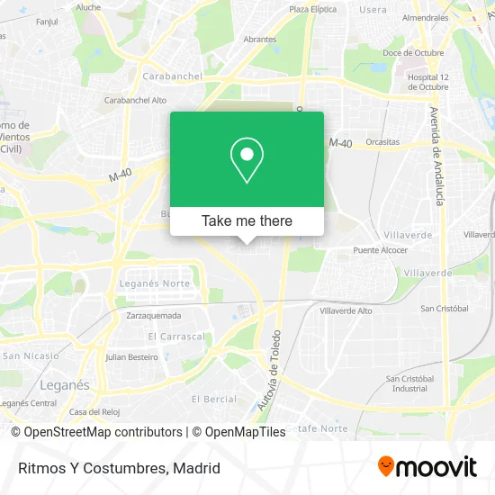
See Ritmos Y Costumbres, Leganés, on the map
Public Transit to Ritmos Y Costumbres in Leganés
Wondering how to get to Ritmos Y Costumbres in Leganés? Moovit helps you find the best way to get to Ritmos Y Costumbres with step-by-step directions from the nearest public transit station.
Moovit provides free maps and live directions to help you navigate through your city. View schedules, routes, timetables, and find out how long does it take to get to Ritmos Y Costumbres in real time.
Looking for the nearest stop or station to Ritmos Y Costumbres? Check out this list of stops closest to your destination: Villaverde Alto; Ctra. A-42 - Pol. Ind. Prado Overa; El Carrascal.
Bus: 1, 441, 442, 444, 461, 485, 443, 446.Train: C4, C5, C4A, C4B.Metro: M-12, M-3.
Want to see if there’s another route that gets you there at an earlier time? Moovit helps you find alternative routes or times. Get directions from and directions to Ritmos Y Costumbres easily from the Moovit App or Website.
We make riding to Ritmos Y Costumbres easy, which is why over 1.5 million users, including users in Leganés, trust Moovit as the best app for public transit. You don’t need to download an individual bus app or train app, Moovit is your all-in-one transit app that helps you find the best bus time or train time available.
For information on prices of bus, metro and train, costs and ride fares to Ritmos Y Costumbres, please check the Moovit app.
Use the app to navigate to popular places including to the airport, hospital, stadium, grocery store, mall, coffee shop, school, college, and university.
Location: Leganés, Madrid
- Calle Puerto de Navafría 31,
- Auto Desguaces de Blas,
- Poligono Industrial Prado Overa,
- Polígono Industrial Prado Overa,
- Calle Puerto del Atazar,
- Julian Restaurante,
- Calle Puerto de Pajares 6,
- Pol. Ind. Prado Overa,
- Nuevo Amanecer 2,
- Calle Puerto de Las Cañadas del Teide 3,
- Local Mil Amores,
- Chatarreria,
- Bermudez de Castro y Sanchez,
- Talleres Bimarcauto,
- Productos Zabala,
- Tecresa Proteccion Pasiva,
- Productos Atocha,
- Diesel Prado Overa,
- Persianas Vicar,
- Zapatos de Baile Reina Outlet
Places Near Ritmos Y Costumbres (Leganés)
- Tres Aguas, Alcorcón,
- Mendez Alvaro, Madrid,
- Calle de López de Hoyos 169, Madrid,
- Plaza Mayor, Madrid,
- Hospital Universitario Ramón y Cajal, Madrid,
- Wizink Center, Madrid,
- Centro Comercial La Vaguada, Área Metropolitana De Madrid Y Corredor Del Henares,
- Mercadillo de Majadahonda, Majadahonda,
- Plenilunio, Área Metropolitana De Madrid Y Corredor Del Henares,
- Nassica, Área Metropolitana De Madrid Y Corredor Del Henares,
- Rastro De Madrid, Área Metropolitana De Madrid Y Corredor Del Henares,
- Estadio Wanda Metropolitano, Área Metropolitana De Madrid Y Corredor Del Henares,
- Estacion de Chamartin, Madrid,
- Sala La Riviera, Madrid,
- Centro Comercial La Gavia, Área Metropolitana De Madrid Y Corredor Del Henares,
- Hospital Universitario La Paz, Madrid,
- Centro Comercial Oasiz Madrid, Área Metropolitana De Madrid Y Corredor Del Henares,
- Hospital Clínico Universitario San Carlos, Madrid,
- Palacio De Vistalegre, Área Metropolitana De Madrid Y Corredor Del Henares,
- Centro Comercial Islazul, Área Metropolitana De Madrid Y Corredor Del Henares
How to get to popular places in Madrid with public transit
Get around Leganés by public transit!
Traveling around Leganés has never been so easy. See step by step directions as you travel to any attraction, street or major public transit station. View bus and train schedules, arrival times, service alerts and detailed routes on a map, so you know exactly how to get to anywhere in Leganés.
When traveling to any destination around Leganés use Moovit's Live Directions with Get Off Notifications to know exactly where and how far to walk, how long to wait for your line, and how many stops are left. Moovit will alert you when it's time to get off — no need to constantly re-check whether yours is the next stop.
Wondering how to use public transit in Leganés or how to pay for public transit in Leganés? Moovit public transit app can help you navigate your way with public transit easily, and at minimum cost. It includes public transit fees, ticket prices, and costs. Looking for a map of Leganés public transit lines? Moovit public transit app shows all public transit maps in Leganés with all Bus, Train, Metro and Light Rail routes and stops on an interactive map.
Madrid has 4 transit type(s), including: Bus, Train, Metro and Light Rail, operated by several transit agencies, including Metro de Madrid, Metro Ligero, Tranvía de Parla, Renfe Cercanías - Servicios de Autobús especiales, Renfe Cercanias, Renfe Cercanías, EMT, Interurbanos, Urbanos de Alcalá de Henares, Urbanos de Alcobendas, Urbanos de Alcorcón, Urbanos de Algete, Urbanos de Aranjuez, Urbanos de Arganda del Rey and Urbanos de Arroyomolinos
Public transit lines with stations closest to Ritmos Y Costumbres in Leganés
Metro lines with stations closest to Ritmos Y Costumbres in Leganés
Train lines with stations closest to Ritmos Y Costumbres in Leganés
Bus lines with stations closest to Ritmos Y Costumbres in Leganés
Ctra. A-42 - Pol. Ind. Prado Overa
 441Madrid (Plaza Elíptica) - Getafe (Sector III - Paseo Juan José Rosón)
- 442Madrid (Plaza Elíptica) - Getafe (Juan de la Cierva)
- 443Madrid (Plaza Elíptica) - Getafe (Barrio Las Margaritas)
- 444Madrid (Plaza Elíptica) - Getafe (Sector III - Islas Canarias)
- 446Madrid (Plaza Elíptica) - Getafe (El Bercial)