Directions to Rivabem's Farm (Campo) with public transportation
The following transit lines have routes that pass near Rivabem's Farm
 Bus: 107 BATEIAS, 114 MIQUELETO.
How to get to Rivabem's Farm by bus?
Click on the bus route to see step by step directions with maps, line arrival times and updated time schedules.
From Hospital do Rocio, Campo
35 minFrom Hospital São Lucas, Campo
35 minFrom Volvo do Brasil, Cic
84 minFrom Avenida Juscelino Kubitschek de Oliveira 2600, Cic
95 minFrom Campo Largo, Campo
28 minFrom Upa Campo Largo, Campo
34 minFrom Rua Brasilio Cuman, São Braz
96 minFrom Campo Largo, Campo
27 minFrom Orleans, Orleans
69 min
Bus stops near Rivabem's Farm in Campo
Bus lines to Rivabem's Farm in Campo
What are the closest stations to Rivabem's Farm?
The closest stations to Rivabem's Farm are:
- Rodovia Pr 510 is 816 meters away, 11 min walk.
- Miqueleto - Rodovia Pr 510 is 1102 meters away, 15 min walk.
Which bus lines stop near Rivabem's Farm?
These bus lines stop near Rivabem's Farm: 107 BATEIAS, 114 MIQUELETO.
What’s the nearest bus station to Rivabem's Farm in Campo?
The nearest bus station to Rivabem's Farm in Campo is Rodovia Pr 510. It’s a 11 min walk away.
What time is the first bus to Rivabem's Farm in Campo?
The 107 BATEIAS is the first bus that goes to Rivabem's Farm in Campo. It stops nearby at 5:20 AM.
What time is the last bus to Rivabem's Farm in Campo?
The 107 BATEIAS is the last bus that goes to Rivabem's Farm in Campo. It stops nearby at 11:32 PM.
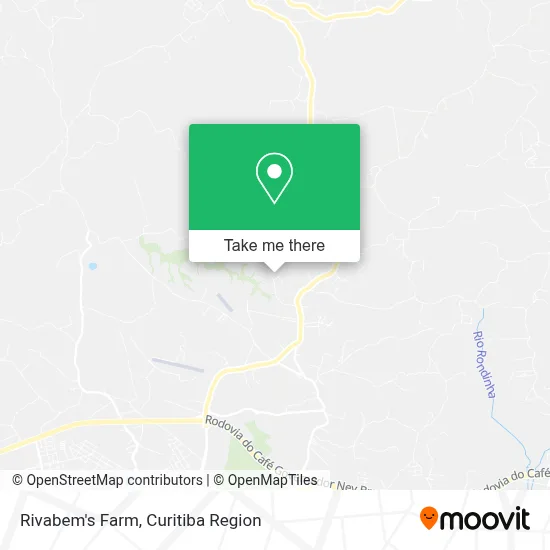
See Rivabem's Farm, Campo, on the map
Public Transit to Rivabem's Farm in Campo
Wondering how to get to Rivabem's Farm in Campo? Moovit helps you find the best way to get to Rivabem's Farm with step-by-step directions from the nearest public transit station.
Moovit provides free maps and live directions to help you navigate through your city. View schedules, routes, timetables, and find out how long does it take to get to Rivabem's Farm in real time.
Looking for the nearest stop or station to Rivabem's Farm? Check out this list of stops closest to your destination: Rodovia Pr 510; Miqueleto - Rodovia Pr 510.
Bus: 107 BATEIAS, 114 MIQUELETO.
Want to see if there’s another route that gets you there at an earlier time? Moovit helps you find alternative routes or times. Get directions from and directions to Rivabem's Farm easily from the Moovit App or Website.
We make riding to Rivabem's Farm easy, which is why over 1.5 million users, including users in Campo, trust Moovit as the best app for public transit. You don’t need to download an individual bus app or train app, Moovit is your all-in-one transit app that helps you find the best bus time or train time available.
For information on prices of bus, costs and ride fares to Rivabem's Farm, please check the Moovit app.
Use the app to navigate to popular places including to the airport, hospital, stadium, grocery store, mall, coffee shop, school, college, and university.
Rivabem's Farm Address: Campo Largo Campo Largo-PR street in Campo
- Rua Estrada De Bateias,
- Quadra de Society Miqueleto,
- Rua Raul Azevedo De Macedo,
- Estância Hidromineral Ouro Fino,
- Serralheria do Sartori,
- Swarm,
- Transp Sabim,
- Batatas Wanflo,
- Jwl Assistencia Especializada,
- Oficina das Unhas,
- New Pet Distribuicao e Logistica,
- New Pet,
- Campos Gerais Pet,
- Rodovia Engenheiro Raul Azevedo Macedo 5700,
- Pcr,
- Doc Natur,
- Luisfernando,
- Recanto Colorado,
- Salão Kania's Hair,
- Salute Producao e Comércio de Produtos Agricolas
Places Near Rivabem's Farm (Campo)
- Parque Barigui, Mercês,
- Rua Martim Afonso 558, Mercês,
- Hhhhh, Fazendinha,
- Campo Largo, Campo,
- Hospital Angelina Caron, Campina Grande Do Sul,
- Jockey Plaza Shopping Center, Tarumã,
- Rua General Mário Tourinho, Campina Do Siqueira,
- Arena Da Baixada - Curitiba,
- Shopping Palladium, Portão,
- Park Shopping Barigüi, Mossunguê,
- Hospital Da Cruz Vermelha, Batel,
- Pontifícia Universidade Católica do Paraná (PUCPR), Prado Velho,
- Hospital Erasto Gaertner, Jardim Das Américas,
- Shopping Estação, Rebouças,
- Hospital Nossa Senhora Das Graças, Mercês,
- Hospital Universitário Evangélico de Curitiba, Bigorrilho,
- Hospital Madalena Sofia, Bairro Alto,
- Hospital de Clínicas (HC - UFPR), Centro,
- Jardim Botânico de Curitiba PR, Centro,
- Hospital do Rocio, Campo
How to get to popular places in Curitiba Region with public transit
Get around Campo by public transit!
Traveling around Campo has never been so easy. See step by step directions as you travel to any attraction, street or major public transit station. View bus and train schedules, arrival times, service alerts and detailed routes on a map, so you know exactly how to get to anywhere in Campo.
When traveling to any destination around Campo use Moovit's Live Directions with Get Off Notifications to know exactly where and how far to walk, how long to wait for your line, and how many stops are left. Moovit will alert you when it's time to get off — no need to constantly re-check whether yours is the next stop.
Wondering how to use public transit in Campo or how to pay for public transit in Campo? Moovit public transit app can help you navigate your way with public transit easily, and at minimum cost. It includes public transit fees, ticket prices, and costs. Looking for a map of Campo public transit lines? Moovit public transit app shows all public transit maps in Campo with all Bus and Cable Car routes and stops on an interactive map.
Curitiba Region has 2 transit type(s), including: Bus and Cable Car, operated by several transit agencies, including Sistema Integrado de Mobilidade (URBS), Sistema Integrado de Mobilidade (AMEP), URBS (Cartões bancários e Dinheiro), URBS (Cartões bancários / Cartão URBS), AMEP (Cartões bancários / Cartão MetroCard), AMEP (Cartões bancários / Cartão MetroCard / Dinheiro), Viação Colombo (Dinheiro), TRIAR (Cartão TRIAR / Dinheiro), Empresa Curitiba Cerro Azul (Dinheiro), Expresso Nossa Senhora da Penha (Dinheiro), Empresa Campo Alto Tijucas (Dinheiro), Auto Viação São José (Cartão VEM / Dinheiro), BRT S/A (Cartão VEM / Dinheiro), TransPiedade (Cartão Cidadão / Dinheiro) and Oceânica Sul (Cartão Transporte / Dinheiro)