Directions to Riverbend Park (Medford) with public transportation
The following transit lines have routes that pass near Riverbend Park
 Bus: 134, 354, 95, 96.
- Train: LOWELL.
- Subway: ORANGE LINE, GREEN LINE B, GREEN LINE C, GREEN LINE E.
How to get to Riverbend Park by bus?
Click on the bus route to see step by step directions with maps, line arrival times and updated time schedules.
From Boston College (BC), Boston
97 minFrom Conte Forum, Boston
98 minFrom Carson Beach, Boston
104 minFrom Marina Bay, Boston
37 minFrom Boston Temple, Boston
73 minFrom Alumni Stadium, Boston
97 minFrom Trader Joe's, Boston
73 minFrom Boston College, Boston
98 minFrom Watertown, MA, Watertown Town
77 minFrom Maverick Station, Boston
74 min
How to get to Riverbend Park by train?
Click on the train route to see step by step directions with maps, line arrival times and updated time schedules.
How to get to Riverbend Park by subway?
Click on the subway route to see step by step directions with maps, line arrival times and updated time schedules.
Bus stops near Riverbend Park in Medford
Subway stations near Riverbend Park in Medford
Bus lines to Riverbend Park in Medford
What are the closest stations to Riverbend Park?
The closest stations to Riverbend Park are:
- Riverside Ave @ Maverick St is 399 yards away, 5 min walk.
- Mystic Ave Opp Billings Ave is 404 yards away, 5 min walk.
- Gilman Square is 706 yards away, 9 min walk.
- Wellington is 3095 yards away, 37 min walk.
Which bus lines stop near Riverbend Park?
These bus lines stop near Riverbend Park: 134, 354, 95, 96.
Which train line stops near Riverbend Park?
LOWELL (#327 | Lowell)
Which subway line stops near Riverbend Park?
ORANGE LINE (Oak Grove)
What’s the nearest subway station to Riverbend Park in Medford?
The nearest subway station to Riverbend Park in Medford is Gilman Square. It’s a 9 min walk away.
What’s the nearest bus station to Riverbend Park in Medford?
The nearest bus stations to Riverbend Park in Medford are Riverside Ave @ Maverick St and Mystic Ave Opp Billings Ave. The closest one is a 5 min walk away.
What time is the first subway to Riverbend Park in Medford?
The GREEN LINE E is the first subway that goes to Riverbend Park in Medford. It stops nearby at 4:51 AM.
What time is the last subway to Riverbend Park in Medford?
The GREEN LINE E is the last subway that goes to Riverbend Park in Medford. It stops nearby at 2:41 AM.
What time is the first bus to Riverbend Park in Medford?
The 95 is the first bus that goes to Riverbend Park in Medford. It stops nearby at 4:50 AM.
What time is the last bus to Riverbend Park in Medford?
The 95 is the last bus that goes to Riverbend Park in Medford. It stops nearby at 1:27 AM.
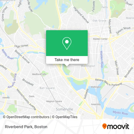
See Riverbend Park, Medford, on the map
Public Transit to Riverbend Park in Medford
Wondering how to get to Riverbend Park in Medford? Moovit helps you find the best way to get to Riverbend Park with step-by-step directions from the nearest public transit station.
Moovit provides free maps and live directions to help you navigate through your city. View schedules, routes, timetables, and find out how long does it take to get to Riverbend Park in real time.
Looking for the nearest stop or station to Riverbend Park? Check out this list of stops closest to your destination: Riverside Ave @ Maverick St; Mystic Ave Opp Billings Ave; Gilman Square; Wellington.
Bus: 134, 354, 95, 96.Train: LOWELL.Subway: ORANGE LINE, GREEN LINE B, GREEN LINE C, GREEN LINE E.
Want to see if there’s another route that gets you there at an earlier time? Moovit helps you find alternative routes or times. Get directions from and directions to Riverbend Park easily from the Moovit App or Website.
We make riding to Riverbend Park easy, which is why over 1.7 million users, including users in Medford, trust Moovit as the best app for public transit. You don’t need to download an individual bus app or train app, Moovit is your all-in-one transit app that helps you find the best bus time or train time available.
For information on prices of bus, subway and train, costs and ride fares to Riverbend Park, please check the Moovit app.
Use the app to navigate to popular places including to the airport, hospital, stadium, grocery store, mall, coffee shop, school, college, and university.
Riverbend Park Address: 3000 Mystic Valley Pkwy street in Medford
- Malden Cab,
- Hormel Stadium,
- Exit 22/Mystic Valley Pkwy/N,
- Rt 93 Exit 31,
- Mystic Place (Mystic Valley Towers),
- Gurdwara Guru Nanak Darbar,
- Thrifty,
- Waterworks Mechanical,
- Set of Lashes,
- Entrance I-93 N,
- Needham Bank,
- Marriage & Family Counseling,
- MC Glynn School (John J. McGlynn Middle School),
- Kurukulla Center for Tibetan Buddhist Studies (Kurukulla Center for TBT & BDDHST),
- Wegmans Catering,
- Wegmans Sub Shop,
- Sephora at Kohl's,
- Custom Wireless,
- Marshalls,
- Marshalls-Meadow Glen Mall
Places Near Riverbend Park (Medford)
- Castle Island, Boston,
- House Of Blues, Boston,
- Leader Bank Pavilion (Leader Bank Pavillion), Boston,
- Mgm Music Hall, Boston,
- Seaport District, Boston,
- Boston Common, Boston,
- Museum Of Science, Boston,
- Prudential Center, Boston,
- North End, Boston,
- Quincy Market, Boston,
- Isabella Stewart Gardner Museum, Boston,
- Faneuil Hall, Boston,
- Boston Medical Center, Boston,
- Wilbur Theatre, Boston,
- Boston Convention & Exhibition Center, Boston,
- Massachusetts General Hospital, Boston,
- Cheers, Boston,
- Wang Theater, Boston,
- Boston Children's Hospital, Boston,
- Td Garden, Boston
How to get to popular places in Boston with public transit
Get around Medford by public transit!
Traveling around Medford has never been so easy. See step by step directions as you travel to any attraction, street or major public transit station. View bus and train schedules, arrival times, service alerts and detailed routes on a map, so you know exactly how to get to anywhere in Medford.
When traveling to any destination around Medford use Moovit's Live Directions with Get Off Notifications to know exactly where and how far to walk, how long to wait for your line, and how many stops are left. Moovit will alert you when it's time to get off — no need to constantly re-check whether yours is the next stop.
Wondering how to use public transit in Medford or how to pay for public transit in Medford? Moovit public transit app can help you navigate your way with public transit easily, and at minimum cost. It includes public transit fees, ticket prices, and costs. Looking for a map of Medford public transit lines? Moovit public transit app shows all public transit maps in Medford with all Bus, Train, Subway and Ferry routes and stops on an interactive map.
Boston has 4 transit type(s), including: Bus, Train, Subway and Ferry, operated by several transit agencies, including MBTA, Southeastern Regional Transit Authority, MetroWest Regional Transit Authority, Rhode Island Public Transit Authority, WRTA, Lowell Regional Transit Authority, Merrimack Valley Transit, Montachusett Regional Transit Authority, Cape Cod Regional Transit Authority, Brockton Area Transit Authority, Martha's Vineyard Transit Authority, the WAVE - Nantucket Regional Transit Authority, GATRA, Cape Ann Transportation Authority and Massport