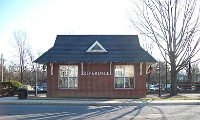
Directions to Riverdale MARC (Riverdale Park) with public transportation
The following transit lines have routes that pass near Riverdale MARC
How to get to Riverdale MARC by bus?
Click on the bus route to see step by step directions with maps, line arrival times and updated time schedules.
How to get to Riverdale MARC by train?
Click on the train route to see step by step directions with maps, line arrival times and updated time schedules.
How to get to Riverdale MARC by metro?
Click on the metro route to see step by step directions with maps, line arrival times and updated time schedules.
Bus stations near Riverdale MARC in Riverdale Park
- Queensbury Rd & Rhode Island Ave, 2 min walk,
- Baltimore Ave & Queensbury Rd *, 6 min walk,
- Baltimore Av & Sheridan St, 8 min walk,
- Baltimore Ave And Sheridan St, 9 min walk,
Metro stations near Riverdale MARC in Riverdale Park
- Prince Georges Plaza Metro Station, 26 min walk,
Train stations near Riverdale MARC in Riverdale Park
- College Park, 26 min walk,
Bus lines to Riverdale MARC in Riverdale Park
- 14, To College Park Station,
- F4, West To Silver Spring,
- 17, Mount Rainier,
- 83, North To Cherry Hill,
- 86, North To Calverton,
- 126, New Carrollton,
- 133, Grocery Shopping Shuttle,
What are the closest stations to Riverdale MARC?
The closest stations to Riverdale MARC are:
- Queensbury Rd & Rhode Island Ave is 117 yards away, 2 min walk.
- Baltimore Ave & Queensbury Rd * is 457 yards away, 6 min walk.
- Baltimore Av & Sheridan St is 666 yards away, 8 min walk.
- Baltimore Ave And Sheridan St is 685 yards away, 9 min walk.
- Prince Georges Plaza Metro Station is 2131 yards away, 26 min walk.
- College Park is 2187 yards away, 26 min walk.
Which bus lines stop near Riverdale MARC?
These bus lines stop near Riverdale MARC: 83, F4.
Which train line stops near Riverdale MARC?
MARC
Which metro lines stop near Riverdale MARC?
These metro lines stop near Riverdale MARC: METRORAIL GREEN LINE, METRORAIL YELLOW LINE.
What’s the nearest metro station to Riverdale MARC in Riverdale Park?
The nearest metro station to Riverdale MARC in Riverdale Park is Prince Georges Plaza Metro Station. It’s a 26 min walk away.
What’s the nearest train station to Riverdale MARC in Riverdale Park?
The nearest train station to Riverdale MARC in Riverdale Park is College Park. It’s a 26 min walk away.
What’s the nearest bus stop to Riverdale MARC in Riverdale Park?
The nearest bus stop to Riverdale MARC in Riverdale Park is Queensbury Rd & Rhode Island Ave. It’s a 2 min walk away.
What time is the first metro to Riverdale MARC in Riverdale Park?
The METRORAIL GREEN LINE is the first metro that goes to Riverdale MARC in Riverdale Park. It stops nearby at 5:03 AM.
What time is the last metro to Riverdale MARC in Riverdale Park?
The METRORAIL GREEN LINE is the last metro that goes to Riverdale MARC in Riverdale Park. It stops nearby at 12:41 AM.
What time is the first bus to Riverdale MARC in Riverdale Park?
The F4 is the first bus that goes to Riverdale MARC in Riverdale Park. It stops nearby at 5:10 AM.
What time is the last bus to Riverdale MARC in Riverdale Park?
The F4 is the last bus that goes to Riverdale MARC in Riverdale Park. It stops nearby at 2:37 AM.
What time is the first train to Riverdale MARC in Riverdale Park?
The MARC is the first train that goes to Riverdale MARC in Riverdale Park. It stops nearby at 5:43 AM.
What time is the last train to Riverdale MARC in Riverdale Park?
The MARC is the last train that goes to Riverdale MARC in Riverdale Park. It stops nearby at 7:57 PM.
How much is the bus fare to Riverdale MARC?
The bus fare to Riverdale MARC costs about $2.00.
How much is the metro fare to Riverdale MARC?
The metro fare to Riverdale MARC costs about $2.00 - $6.00.
See Riverdale MARC, Riverdale Park, on the map
Public Transit to Riverdale MARC in Riverdale Park
Wondering how to get to Riverdale MARC in Riverdale Park, United States? Moovit helps you find the best way to get to Riverdale MARC with step-by-step directions from the nearest public transit station.
Moovit provides free maps and live directions to help you navigate through your city. View schedules, routes, timetables, and find out how long does it take to get to Riverdale MARC in real time.
Looking for the nearest stop or station to Riverdale MARC? Check out this list of stops closest to your destination: Queensbury Rd & Rhode Island Ave; Baltimore Ave & Queensbury Rd *; Baltimore Av & Sheridan St; Baltimore Ave And Sheridan St; Prince Georges Plaza Metro Station; College Park.
Bus: 83, F4, 14, 17, 86, 126, 133.Train: MARC.Metro: METRORAIL GREEN LINE, METRORAIL YELLOW LINE.
Want to see if there’s another route that gets you there at an earlier time? Moovit helps you find alternative routes or times. Get directions from and directions to Riverdale MARC easily from the Moovit App or Website.
We make riding to Riverdale MARC easy, which is why over 1.5 million users, including users in Riverdale Park, trust Moovit as the best app for public transit. You don’t need to download an individual bus app or train app, Moovit is your all-in-one transit app that helps you find the best bus time or train time available.
For information on prices of bus, metro and train, costs and ride fares to Riverdale MARC, please check the Moovit app.
Use the app to navigate to popular places including to the airport, hospital, stadium, grocery store, mall, coffee shop, school, college, and university.
Riverdale MARC Address: Rhode Island Ave street in Riverdale Park
Attractions near Riverdale MARC
Riverdale,Riverdale MARC Station,250 Texas BBQ,Damon Catacalos, Esq.,The Law Offices Of Christopher L. Peretti, Llc,Arnold & Arnold Architecture Preservation Scale Models,Aunt Emily's Doll House,The Americas Multi Services,Ceci's Tienda Latina Grocery Store,Greenlots,Banana Blossom Bistro,Gangster Vegan Organics,Greg's Towing,Bikram Hot Yoga Riverdale Park,Bikram Yoga Riverdale Park,Town Center Market,Gangster Vegan,Riviera Tapas Bar,Riverdale,Calvert Family CemeteryHow to get to popular attractions in Riverdale Park with public transit
Looney's Pub, Baltimore,Centreville, VA, Fairfax County,Towson, MD, Baltimore County,Walmart Supercenter, Anne Arundel County,Big Bear Cafe, Washington,Bloomingdale, Washington DC, Washington,Starbucks, Washington,Columbia, MD, Howard County,The Big Hunt, Washington,Target, Howard County,Greater Baltimore Medical Center, Baltimore County,Mount Vernon, Baltimore,Murphy's Grand Irish Pub, Alexandria,Baltimore Farmers' Market & Bazaar, Baltimore,Capital One Arena, Washington,Nando's Peri-Peri, Washington,Fado Irish Pub, Washington,IKEA, Prince William County,American Ice Company, Washington,Wegmans, Howard CountyGet around Washington, D.C. - Baltimore, MD by public transit!
Traveling around Washington, D.C. - Baltimore, MD has never been so easy. See step by step directions as you travel to any attraction, street or major public transit station. View bus and train schedules, arrival times, service alerts and detailed routes on a map, so you know exactly how to get to anywhere in Washington, D.C. - Baltimore, MD.
When traveling to any destination around Washington, D.C. - Baltimore, MD use Moovit's Live Directions with Get Off Notifications to know exactly where and how far to walk, how long to wait for your line, and how many stops are left. Moovit will alert you when it's time to get off — no need to constantly re-check whether yours is the next stop.
Wondering how to use public transit in Washington, D.C. - Baltimore, MD or how to pay for public transit in Washington, D.C. - Baltimore, MD? Moovit public transit app can help you navigate your way with public transit easily, and at minimum cost. It includes public transit fees, ticket prices, and costs. Looking for a map of Washington, D.C. - Baltimore, MD public transit lines? Moovit public transit app shows all public transit maps in Washington, D.C. - Baltimore, MD with all Bus, Train, Metro, Light Rail and Ferry routes and stops on an interactive map.
Washington, D.C. - Baltimore, MD has 5 transit type(s), including: Bus, Train, Metro, Light Rail and Ferry, operated by several transit agencies, including WMATA, Montgomery County Ride On, Fairfax Connector, TheBus, DC Circulator, MDOT MTA, Marc, Virginia Railway Express (VRE), PRTC, DASH - Alexandria, Arlington Transit (ART), DC Streetcar, RTA of Central Maryland, FRED, University of Maryland Shuttle-UM