How to get to Riverwalk Park by bus?
Click on the bus route to see step by step directions with maps, line arrival times and updated time schedules.
From Allston, Boston
50 minFrom Harvard Upper Busway, Cambridge
55 minFrom Davis Sq, Somerville
73 minFrom Harvard Square T Station - Red Line, Cambridge
54 minFrom Apple Cinemas, Cambridge
75 minFrom Boston College, Boston
59 minFrom Danehy Park, Cambridge
72 minFrom The Burren, Somerville
72 minFrom Sommerville Theatre, Somerville
74 minFrom Wellesley, MA, Wellesley
67 min
How to get to Riverwalk Park by train?
Click on the train route to see step by step directions with maps, line arrival times and updated time schedules.
Bus stops near Riverwalk Park in Waltham
Train station near Riverwalk Park in Waltham
- West Newton, 35 min walk,VIEW
Bus lines to Riverwalk Park in Waltham
What are the closest stations to Riverwalk Park?
The closest stations to Riverwalk Park are:
- Moody St @ Carter St is 323 yards away, 4 min walk.
- Main St @ Daniels Ct is 401 yards away, 5 min walk.
- Waltham is 436 yards away, 6 min walk.
- West Newton is 2959 yards away, 35 min walk.
Which bus lines stop near Riverwalk Park?
These bus lines stop near Riverwalk Park: 553, 558, 70.
Which train lines stop near Riverwalk Park?
These train lines stop near Riverwalk Park: FITCHBURG, FRAMINGHAM/WORCESTER.
What’s the nearest bus station to Riverwalk Park in Waltham?
The nearest bus station to Riverwalk Park in Waltham is Moody St @ Carter St. It’s a 4 min walk away.
What time is the first train to Riverwalk Park in Waltham?
The FRAMINGHAM/WORCESTER is the first train that goes to Riverwalk Park in Waltham. It stops nearby at 5:19 AM.
What time is the last train to Riverwalk Park in Waltham?
The FRAMINGHAM/WORCESTER is the last train that goes to Riverwalk Park in Waltham. It stops nearby at 12:22 AM.
What time is the first bus to Riverwalk Park in Waltham?
The 70 is the first bus that goes to Riverwalk Park in Waltham. It stops nearby at 4:54 AM.
What time is the last bus to Riverwalk Park in Waltham?
The 70 is the last bus that goes to Riverwalk Park in Waltham. It stops nearby at 12:36 AM.
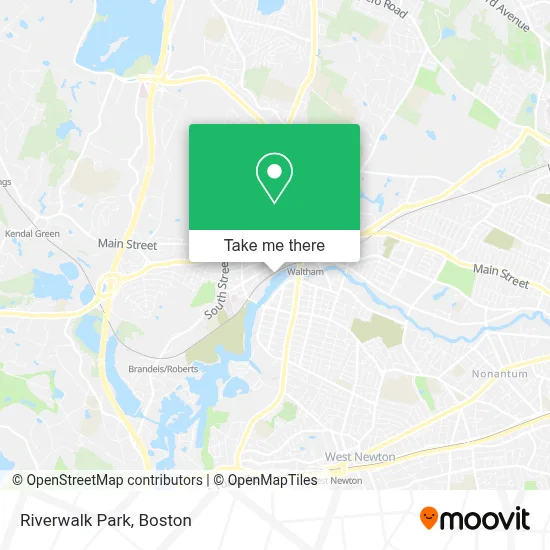
See Riverwalk Park, Waltham, on the map
Public Transit to Riverwalk Park in Waltham
Wondering how to get to Riverwalk Park in Waltham? Moovit helps you find the best way to get to Riverwalk Park with step-by-step directions from the nearest public transit station.
Moovit provides free maps and live directions to help you navigate through your city. View schedules, routes, timetables, and find out how long does it take to get to Riverwalk Park in real time.
Looking for the nearest stop or station to Riverwalk Park? Check out this list of stops closest to your destination: Moody St @ Carter St; Main St @ Daniels Ct; Waltham; West Newton.
Bus: 553, 558, 70, 505, 554, 556, 61, FITCHBURG LINE SHUTTLE, FITCHBURG.Train: FITCHBURG, FRAMINGHAM/WORCESTER.
Want to see if there’s another route that gets you there at an earlier time? Moovit helps you find alternative routes or times. Get directions from and directions to Riverwalk Park easily from the Moovit App or Website.
We make riding to Riverwalk Park easy, which is why over 1.7 million users, including users in Waltham, trust Moovit as the best app for public transit. You don’t need to download an individual bus app or train app, Moovit is your all-in-one transit app that helps you find the best bus time or train time available.
For information on prices of bus, train and subway, costs and ride fares to Riverwalk Park, please check the Moovit app.
Use the app to navigate to popular places including to the airport, hospital, stadium, grocery store, mall, coffee shop, school, college, and university.
Riverwalk Park Address: Charles Riv Greenway street in Waltham
- The Beantown Companies,
- Republic Supply,
- Astrologer and Spiritual Psychic Healer,
- J7 Builders,
- Crossfit,
- All Day & Night Emergency Locksmith,
- Salgueros Market,
- Locksmith 24 Hr,
- Plumbing & Heating,
- Charles Street Workers' Housing Historic District,
- Mind of Its Own Design,
- Coleman Spray Foam,
- Model Masonry,
- Moody Street Historic District,
- Vls Livery Service,
- Senior Solutions,
- Succor Primary Care,
- Phantom Gourmet Food Festival 2021,
- GMS Plastering,
- Dominion Assemblies International Ministries
Places Near Riverwalk Park (Waltham)
- Faneuil Hall, Boston,
- Boston Medical Center, Boston,
- Boston Children's Hospital, Boston,
- Museum Of Science, Boston,
- Wang Theater, Boston,
- Cheers, Boston,
- North End, Boston,
- House Of Blues, Boston,
- Seaport District, Boston,
- Boston Convention & Exhibition Center, Boston,
- Castle Island, Boston,
- Quincy Market, Boston,
- Boston Common, Boston,
- Prudential Center, Boston,
- Leader Bank Pavilion (Leader Bank Pavillion), Boston,
- Massachusetts General Hospital, Boston,
- Wilbur Theatre, Boston,
- Td Garden, Boston,
- Mgm Music Hall, Boston,
- Isabella Stewart Gardner Museum, Boston
How to get to popular places in Boston with public transit
Get around Waltham by public transit!
Traveling around Waltham has never been so easy. See step by step directions as you travel to any attraction, street or major public transit station. View bus and train schedules, arrival times, service alerts and detailed routes on a map, so you know exactly how to get to anywhere in Waltham.
When traveling to any destination around Waltham use Moovit's Live Directions with Get Off Notifications to know exactly where and how far to walk, how long to wait for your line, and how many stops are left. Moovit will alert you when it's time to get off — no need to constantly re-check whether yours is the next stop.
Wondering how to use public transit in Waltham or how to pay for public transit in Waltham? Moovit public transit app can help you navigate your way with public transit easily, and at minimum cost. It includes public transit fees, ticket prices, and costs. Looking for a map of Waltham public transit lines? Moovit public transit app shows all public transit maps in Waltham with all Bus, Train, Subway and Ferry routes and stops on an interactive map.
Boston has 4 transit type(s), including: Bus, Train, Subway and Ferry, operated by several transit agencies, including MBTA, Southeastern Regional Transit Authority, MetroWest Regional Transit Authority, Rhode Island Public Transit Authority, WRTA, Lowell Regional Transit Authority, Merrimack Valley Transit, Montachusett Regional Transit Authority, Cape Cod Regional Transit Authority, Brockton Area Transit Authority, Martha's Vineyard Transit Authority, the WAVE - Nantucket Regional Transit Authority, GATRA, Cape Ann Transportation Authority and Massport