Directions to Rjt Carpentry And Tile (Boston) with public transportation
The following transit lines have routes that pass near Rjt Carpentry And Tile
 Bus: 120, BB, 22, 33, 55.
- Subway: BLUE LINE.
- Ferry: HINGHAM/HULL FERRY, QUINCY FERRY, WINTHROP FERRY, WINTHROP/QUINCY FERRY.
How to get to Rjt Carpentry And Tile by bus?
Click on the bus route to see step by step directions with maps, line arrival times and updated time schedules.
From Hilton Garden Inn Boston Brookline, Brookline
57 minFrom Brighton District Court, Boston
69 minFrom Arsenal Yards, Watertown Town
80 minFrom Ac Hotel Cambridge, Cambridge
103 minFrom Mass Ave, Cambridge
57 minFrom Mount Auburn, Cambridge
80 minFrom Arnold Arboretum, Boston
83 minFrom Boston Burger Company - Boston, Boston
35 minFrom Franklin Park Zoo, Boston
88 min
How to get to Rjt Carpentry And Tile by subway?
Click on the subway route to see step by step directions with maps, line arrival times and updated time schedules.
From Ac Hotel Cambridge, Cambridge
58 minFrom Mass Ave, Cambridge
43 minFrom Franklin Park Zoo, Boston
61 minFrom Arnold Arboretum, Boston
48 minFrom Staybridge Suites Boston-Quincy, Quincy
51 minFrom Brighton District Court, Boston
78 minFrom Hilton Garden Inn Boston Brookline, Brookline
49 minFrom Boston Burger Company - Boston, Boston
37 min
Bus stops near Rjt Carpentry And Tile in Boston
Ferry stations near Rjt Carpentry And Tile in Boston
Subway station near Rjt Carpentry And Tile in Boston
- Maverick, 14 min walk,VIEW
Bus lines to Rjt Carpentry And Tile in Boston
- 120, Orient Heights Via Jeffries Point & Waldemar,VIEW
- 22, Conrac Rental Car Center, Drop Off - Conrac Rental Car Center, Pick Up,VIEW
- 33, Conrac Rental Car Center, Drop Off - Conrac Rental Car Center, Pick Up,VIEW
- 55, Conrac Rental Car Center, Drop Off - Conrac Rental Car Center, Pick Up,VIEW
- 221, 221,VIEW
- 331, 331,VIEW
- 551, 551,VIEW
- 552, 552,VIEW
- BB, Back Bay,VIEW
- BT, Braintree,VIEW
- FH, Framingham,VIEW
- 41, Blue Line - Mbta,VIEW
- 66, Water Transportation Dock,VIEW
What are the closest stations to Rjt Carpentry And Tile?
The closest stations to Rjt Carpentry And Tile are:
- Jeffries St @ Everett St is 62 yards away, 1 min walk.
- Welcome To Logan is 496 yards away, 6 min walk.
- Terminal A Next Stop (Bt, Fh, Bb) is 574 yards away, 7 min walk.
- Logan Office Center is 675 yards away, 8 min walk.
- Logan Airport Ferry Terminal is 932 yards away, 11 min walk.
- Maverick is 1181 yards away, 14 min walk.
- Lewis Mall Wharf is 1667 yards away, 20 min walk.
Which bus lines stop near Rjt Carpentry And Tile?
These bus lines stop near Rjt Carpentry And Tile: 120, BB.
Which subway line stops near Rjt Carpentry And Tile?
BLUE LINE (Wonderland)
What’s the nearest subway station to Rjt Carpentry And Tile in Boston?
The nearest subway station to Rjt Carpentry And Tile in Boston is Maverick. It’s a 14 min walk away.
What’s the nearest bus station to Rjt Carpentry And Tile in Boston?
The nearest bus station to Rjt Carpentry And Tile in Boston is Jeffries St @ Everett St. It’s a 1 min walk away.
What’s the nearest ferry station to Rjt Carpentry And Tile in Boston?
The nearest ferry station to Rjt Carpentry And Tile in Boston is Logan Airport Ferry Terminal. It’s a 11 min walk away.
What time is the first subway to Rjt Carpentry And Tile in Boston?
The BLUE LINE is the first subway that goes to Rjt Carpentry And Tile in Boston. It stops nearby at 5:12 AM.
What time is the last subway to Rjt Carpentry And Tile in Boston?
The BLUE LINE is the last subway that goes to Rjt Carpentry And Tile in Boston. It stops nearby at 1:59 AM.
What time is the first bus to Rjt Carpentry And Tile in Boston?
The 552 is the first bus that goes to Rjt Carpentry And Tile in Boston. It stops nearby at 3:00 AM.
What time is the last bus to Rjt Carpentry And Tile in Boston?
The 552 is the last bus that goes to Rjt Carpentry And Tile in Boston. It stops nearby at 3:12 AM.
What time is the first ferry to Rjt Carpentry And Tile in Boston?
The EAST is the first ferry that goes to Rjt Carpentry And Tile in Boston. It stops nearby at 5:55 AM.
What time is the last ferry to Rjt Carpentry And Tile in Boston?
The HINGHAM/HULL FERRY is the last ferry that goes to Rjt Carpentry And Tile in Boston. It stops nearby at 10:05 PM.
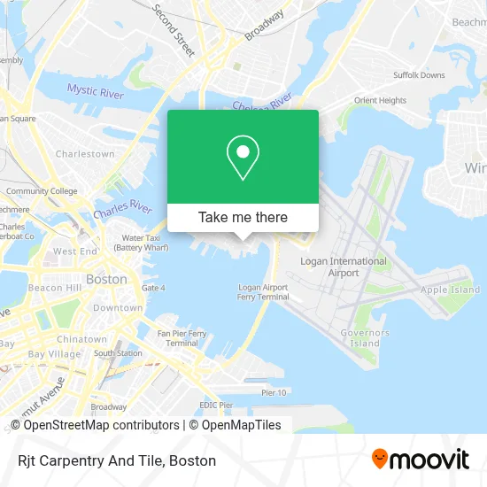
See Rjt Carpentry And Tile, Boston, on the map
Public Transit to Rjt Carpentry And Tile in Boston
Wondering how to get to Rjt Carpentry And Tile in Boston? Moovit helps you find the best way to get to Rjt Carpentry And Tile with step-by-step directions from the nearest public transit station.
Moovit provides free maps and live directions to help you navigate through your city. View schedules, routes, timetables, and find out how long does it take to get to Rjt Carpentry And Tile in real time.
Looking for the nearest stop or station to Rjt Carpentry And Tile? Check out this list of stops closest to your destination: Jeffries St @ Everett St; Welcome To Logan; Terminal A Next Stop (Bt; Logan Office Center; Logan Airport Ferry Terminal; Maverick; Lewis Mall Wharf.
Bus: 120, BB, 22, 33, 55, 221, 331, BT, FH, 41, 66.Subway: BLUE LINE.Ferry: HINGHAM/HULL FERRY, QUINCY FERRY, WINTHROP FERRY, WINTHROP/QUINCY FERRY.
Want to see if there’s another route that gets you there at an earlier time? Moovit helps you find alternative routes or times. Get directions from and directions to Rjt Carpentry And Tile easily from the Moovit App or Website.
We make riding to Rjt Carpentry And Tile easy, which is why over 1.7 million users, including users in Boston, trust Moovit as the best app for public transit. You don’t need to download an individual bus app or train app, Moovit is your all-in-one transit app that helps you find the best bus time or train time available.
For information on prices of subway and bus, costs and ride fares to Rjt Carpentry And Tile, please check the Moovit app.
Use the app to navigate to popular places including to the airport, hospital, stadium, grocery store, mall, coffee shop, school, college, and university.
Rjt Carpentry And Tile Address: 469 Sumner St street in Boston
- Downeast Cider,
- Jeffries Point,
- Ted Williams Tunnel,
- Taxi Pool,
- Boston Suburban Coach (Limo Pool - Boston Logan International Airport),
- Anna Defronzo Senior Center,
- Thrifty Car Rental,
- Budget Car Rental,
- Hertz Rent A Car Returns,
- Maverick St. Resident Gate East Boston,
- Shell - Nouria,
- Hertz,
- Sixt,
- Alamo Rent A Car,
- Enterprise Rent-A-Car,
- Alamo,
- Rental Car Return - Logan Airport,
- AVIS,
- Zipcar Pick-Up-Logan Int'l (E-Z Rent-A-Car-Pick-Up-Logan Int'l),
- Massport Harborwalk Park
Places Near Rjt Carpentry And Tile (Boston)
- Castle Island, Boston,
- Boston Medical Center, Boston,
- Massachusetts General Hospital, Boston,
- Boston Convention & Exhibition Center, Boston,
- Wang Theater, Boston,
- Mgm Music Hall, Boston,
- Leader Bank Pavilion (Leader Bank Pavillion), Boston,
- Td Garden, Boston,
- Wilbur Theatre, Boston,
- Quincy Market, Boston,
- Museum Of Science, Boston,
- House Of Blues, Boston,
- Faneuil Hall, Boston,
- North End, Boston,
- Boston Children's Hospital, Boston,
- Cheers, Boston,
- Seaport District, Boston,
- Boston Common, Boston,
- Isabella Stewart Gardner Museum, Boston,
- Prudential Center, Boston
How to get to popular places in Boston with public transit
Get around Boston by public transit!
Traveling around Boston has never been so easy. See step by step directions as you travel to any attraction, street or major public transit station. View bus and train schedules, arrival times, service alerts and detailed routes on a map, so you know exactly how to get to anywhere in Boston.
When traveling to any destination around Boston use Moovit's Live Directions with Get Off Notifications to know exactly where and how far to walk, how long to wait for your line, and how many stops are left. Moovit will alert you when it's time to get off — no need to constantly re-check whether yours is the next stop.
Wondering how to use public transit in Boston or how to pay for public transit in Boston? Moovit public transit app can help you navigate your way with public transit easily, and at minimum cost. It includes public transit fees, ticket prices, and costs. Looking for a map of Boston public transit lines? Moovit public transit app shows all public transit maps in Boston with all Bus, Train, Subway and Ferry routes and stops on an interactive map.
Boston has 4 transit type(s), including: Bus, Train, Subway and Ferry, operated by several transit agencies, including MBTA, Southeastern Regional Transit Authority, MetroWest Regional Transit Authority, Rhode Island Public Transit Authority, WRTA, Lowell Regional Transit Authority, Merrimack Valley Transit, Montachusett Regional Transit Authority, Cape Cod Regional Transit Authority, Brockton Area Transit Authority, Martha's Vineyard Transit Authority, the WAVE - Nantucket Regional Transit Authority, GATRA, Cape Ann Transportation Authority and Massport