Directions to Rlmg (Watertown Town) with public transportation
The following transit lines have routes that pass near Rlmg
 Bus: 70, 71, 73.
- Train: FRAMINGHAM/WORCESTER.
- Subway: RED LINE, GREEN LINE B.
How to get to Rlmg by bus?
Click on the bus route to see step by step directions with maps, line arrival times and updated time schedules.
From Children's Hospital, Boston
93 minFrom East Boston, Boston
96 minFrom Pine Street Inn, Boston
57 minFrom 240 Mount Vernon Street, Boston
90 minFrom The Ritz-Carlton, Boston, Boston
55 minFrom The Omni Seaport Hotel (Omni Boston Hotel at the Seaport), Boston
76 minFrom Cruiseport Boston's Black Falcon Cruise Terminal, Boston
79 minFrom Found Hotel Boston Common, Boston
52 minFrom Rental Car Center - Logan Airport, Boston
95 minFrom South End, Boston
49 min
How to get to Rlmg by train?
Click on the train route to see step by step directions with maps, line arrival times and updated time schedules.
From Children's Hospital, Boston
82 minFrom Pine Street Inn, Boston
64 minFrom 240 Mount Vernon Street, Boston
82 minFrom The Ritz-Carlton, Boston, Boston
65 minFrom The Omni Seaport Hotel (Omni Boston Hotel at the Seaport), Boston
70 minFrom Found Hotel Boston Common, Boston
61 minFrom South End, Boston
52 min
How to get to Rlmg by subway?
Click on the subway route to see step by step directions with maps, line arrival times and updated time schedules.
From Children's Hospital, Boston
76 minFrom East Boston, Boston
79 minFrom Pine Street Inn, Boston
75 minFrom 240 Mount Vernon Street, Boston
76 minFrom The Ritz-Carlton, Boston, Boston
64 minFrom The Omni Seaport Hotel (Omni Boston Hotel at the Seaport), Boston
79 minFrom Found Hotel Boston Common, Boston
71 minFrom Rental Car Center - Logan Airport, Boston
79 minFrom South End, Boston
71 min
Bus stops near Rlmg in Watertown Town
Subway station near Rlmg in Watertown Town
- Harvard Ave., 24 min walk,VIEW
What are the closest stations to Rlmg?
The closest stations to Rlmg are:
- Mt Auburn St @ Cottage St is 191 yards away, 3 min walk.
- Arsenal St @ Bond St is 217 yards away, 3 min walk.
- Belmont St @ Cushing St is 848 yards away, 11 min walk.
- Harvard Ave. is 2014 yards away, 24 min walk.
Which bus lines stop near Rlmg?
These bus lines stop near Rlmg: 70, 71.
Which train line stops near Rlmg?
FRAMINGHAM/WORCESTER (#525 | Worcester)
Which subway line stops near Rlmg?
RED LINE (Alewife)
What’s the nearest subway station to Rlmg in Watertown Town?
The nearest subway station to Rlmg in Watertown Town is Harvard Ave.. It’s a 24 min walk away.
What’s the nearest bus station to Rlmg in Watertown Town?
The nearest bus stations to Rlmg in Watertown Town are Mt Auburn St @ Cottage St and Arsenal St @ Bond St. The closest one is a 3 min walk away.
What time is the first subway to Rlmg in Watertown Town?
The GREEN LINE B is the first subway that goes to Rlmg in Watertown Town. It stops nearby at 5:10 AM.
What time is the last subway to Rlmg in Watertown Town?
The GREEN LINE B is the last subway that goes to Rlmg in Watertown Town. It stops nearby at 2:30 AM.
What time is the first bus to Rlmg in Watertown Town?
The 70 is the first bus that goes to Rlmg in Watertown Town. It stops nearby at 4:35 AM.
What time is the last bus to Rlmg in Watertown Town?
The 71 is the last bus that goes to Rlmg in Watertown Town. It stops nearby at 1:20 AM.
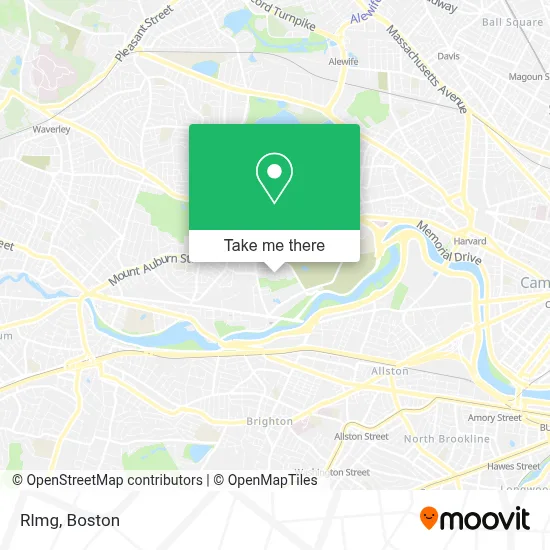
See Rlmg, Watertown Town, on the map
Public Transit to Rlmg in Watertown Town
Wondering how to get to Rlmg in Watertown Town? Moovit helps you find the best way to get to Rlmg with step-by-step directions from the nearest public transit station.
Moovit provides free maps and live directions to help you navigate through your city. View schedules, routes, timetables, and find out how long does it take to get to Rlmg in real time.
Looking for the nearest stop or station to Rlmg? Check out this list of stops closest to your destination: Mt Auburn St @ Cottage St; Arsenal St @ Bond St; Belmont St @ Cushing St; Harvard Ave..
Bus: 70, 71, 73.Train: FRAMINGHAM/WORCESTER.Subway: RED LINE, GREEN LINE B.
Want to see if there’s another route that gets you there at an earlier time? Moovit helps you find alternative routes or times. Get directions from and directions to Rlmg easily from the Moovit App or Website.
We make riding to Rlmg easy, which is why over 1.7 million users, including users in Watertown Town, trust Moovit as the best app for public transit. You don’t need to download an individual bus app or train app, Moovit is your all-in-one transit app that helps you find the best bus time or train time available.
For information on prices of bus, subway and train, costs and ride fares to Rlmg, please check the Moovit app.
Use the app to navigate to popular places including to the airport, hospital, stadium, grocery store, mall, coffee shop, school, college, and university.
Rlmg Address: 70 Coolidge Hill Rd street in Watertown Town
- Public Conversations Project,
- United Rentals,
- Phoenix Mechanical,
- Lyndra Therapeutics,
- Geovision,
- Daniel Bromberg Founder,
- The Family Institute of Cambridge,
- Compass Kitchen Designs,
- Turo Vehicle Rental,
- Filipello Park,
- Nichols Locksmith Service,
- Watertown Lock & Safe,
- Jen Schoonover,
- Armenian Relief Society of Eastern USA,
- Inquire Rehearsal Dinners,
- Linx,
- Arsenal Dog Run,
- C4 Therapeutics,
- Linx Watertown,
- Watertown-Cambridge Greenway
Places Near Rlmg (Watertown Town)
- Leader Bank Pavilion (Leader Bank Pavillion), Boston,
- Seaport District, Boston,
- North End, Boston,
- Mgm Music Hall, Boston,
- Isabella Stewart Gardner Museum, Boston,
- Boston Medical Center, Boston,
- Prudential Center, Boston,
- Museum Of Science, Boston,
- Castle Island, Boston,
- Boston Children's Hospital, Boston,
- Wilbur Theatre, Boston,
- Massachusetts General Hospital, Boston,
- Boston Convention & Exhibition Center, Boston,
- House Of Blues, Boston,
- Quincy Market, Boston,
- Cheers, Boston,
- Td Garden, Boston,
- Wang Theater, Boston,
- Boston Common, Boston,
- Faneuil Hall, Boston
How to get to popular places in Boston with public transit
Get around Watertown Town by public transit!
Traveling around Watertown Town has never been so easy. See step by step directions as you travel to any attraction, street or major public transit station. View bus and train schedules, arrival times, service alerts and detailed routes on a map, so you know exactly how to get to anywhere in Watertown Town.
When traveling to any destination around Watertown Town use Moovit's Live Directions with Get Off Notifications to know exactly where and how far to walk, how long to wait for your line, and how many stops are left. Moovit will alert you when it's time to get off — no need to constantly re-check whether yours is the next stop.
Wondering how to use public transit in Watertown Town or how to pay for public transit in Watertown Town? Moovit public transit app can help you navigate your way with public transit easily, and at minimum cost. It includes public transit fees, ticket prices, and costs. Looking for a map of Watertown Town public transit lines? Moovit public transit app shows all public transit maps in Watertown Town with all Bus, Train, Subway and Ferry routes and stops on an interactive map.
Boston has 4 transit type(s), including: Bus, Train, Subway and Ferry, operated by several transit agencies, including MBTA, Southeastern Regional Transit Authority, MetroWest Regional Transit Authority, Rhode Island Public Transit Authority, WRTA, Lowell Regional Transit Authority, Merrimack Valley Transit, Montachusett Regional Transit Authority, Cape Cod Regional Transit Authority, Brockton Area Transit Authority, Martha's Vineyard Transit Authority, the WAVE - Nantucket Regional Transit Authority, GATRA, Cape Ann Transportation Authority and Massport