How to get to Rm Food by bus?
Click on the bus route to see step by step directions with maps, line arrival times and updated time schedules.
Bus stops near Rm Food in Le Mans
Light Rail stations near Rm Food in Le Mans
- Leclerc-Fleurus, 44 min walk,VIEW
Bus lines to Rm Food in Le Mans
- T2, Bellevue - Hauts De Coulaines,VIEW
- 6, République,VIEW
- 15, Guetteloup,VIEW
- 5, Gazonfier,VIEW
- 23, Chanzy Bollee,VIEW
- 25, Champagne,VIEW
- 25EX, La Baronniere,VIEW
- 4, St-Georges / St-Joseph – Bellevue-Hauts de C.,VIEW
- 7, Éperon par Auchan,VIEW
- 11, Le Cadran / St-Aubin - Closerie,VIEW
- 14, Parc Manceau - St-Martin,VIEW
- 16, Lafayette - Californie,VIEW
- 17, Gallière - Eperon,VIEW
- 20, Éperon - Aigné,VIEW
What are the closest stations to Rm Food?
The closest stations to Rm Food are:
- Épau-Gué Bernisson is 378 meters away, 5 min walk.
- Espal is 485 meters away, 7 min walk.
- Pyrénées is 627 meters away, 9 min walk.
- Bollée is 689 meters away, 10 min walk.
- Leclerc-Fleurus is 3384 meters away, 44 min walk.
- Lafayette is 4478 meters away, 58 min walk.
Which bus lines stop near Rm Food?
These bus lines stop near Rm Food: 25EX, 6.
Which light rail line stops near Rm Food?
T2 (Espal)
What’s the nearest bus station to Rm Food in Le Mans?
The nearest bus station to Rm Food in Le Mans is Épau-Gué Bernisson. It’s a 5 min walk away.
What time is the first light rail to Rm Food in Le Mans?
The T2 is the first light rail that goes to Rm Food in Le Mans. It stops nearby at 4:57 AM.
What time is the last light rail to Rm Food in Le Mans?
The T2 is the last light rail that goes to Rm Food in Le Mans. It stops nearby at 1:16 AM.
What time is the first bus to Rm Food in Le Mans?
The 25 is the first bus that goes to Rm Food in Le Mans. It stops nearby at 5:31 AM.
What time is the last bus to Rm Food in Le Mans?
The 5 is the last bus that goes to Rm Food in Le Mans. It stops nearby at 11:55 PM.
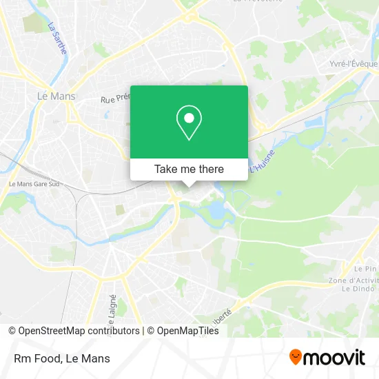
See Rm Food, Le Mans, on the map
Public Transit to Rm Food in Le Mans
Wondering how to get to Rm Food in Le Mans? Moovit helps you find the best way to get to Rm Food with step-by-step directions from the nearest public transit station.
Moovit provides free maps and live directions to help you navigate through your city. View schedules, routes, timetables, and find out how long does it take to get to Rm Food in real time.
Looking for the nearest stop or station to Rm Food? Check out this list of stops closest to your destination: Épau-Gué Bernisson; Espal; Pyrénées; Bollée; Leclerc-Fleurus; Lafayette.
Bus: 25EX, 6, T2, 15, 5, 23, 25, 4, 7, 11, 14, 16.Light Rail: T2.
Want to see if there’s another route that gets you there at an earlier time? Moovit helps you find alternative routes or times. Get directions from and directions to Rm Food easily from the Moovit App or Website.
We make riding to Rm Food easy, which is why over 1.5 million users, including users in Le Mans, trust Moovit as the best app for public transit. You don’t need to download an individual bus app or train app, Moovit is your all-in-one transit app that helps you find the best bus time or train time available.
For information on prices of bus and light rail, costs and ride fares to Rm Food, please check the Moovit app.
Use the app to navigate to popular places including to the airport, hospital, stadium, grocery store, mall, coffee shop, school, college, and university.
Rm Food Address: 3 Rue de Belgique 72100 Le Mans street in Le Mans
- École Élémentaire Gaston Bachelard,
- Hôtel de Rennes,
- Collège Costa-Gavras,
- Pae Plomberie Assainissement,
- Station Île aux Sports [T2],
- Tyrty.Magazin,
- Tour Cristal,
- Valérie Barconniere,
- Novotel,
- Bd Robert Schuman,
- Autriche,
- Novotel Le Mans,
- Rue d'Italie 16,
- Bahir Bouchaid,
- Boulevard Robert Schuman 4,
- L'Espal,
- Espal - Arche De La Nature,
- Herin Jessica,
- Arrêt Espal - Arche de la Nature [6],
- Arche de la Nature
Places Near Rm Food (Le Mans)
- Changé, Changé,
- Clinique Du Pré, Le Mans,
- Parc Des Expositions, Le Mans,
- Avenue Bollée, Le Mans,
- Family Village, Ruaudin,
- Gare SNCF du Mans, Le Mans,
- Université, Le Mans,
- Centre Hospitalier Du Mans, Le Mans,
- Auchan le Mans, La Chapelle-Saint-Aubin,
- Maison D'Arrêt Le Mans - Les Croisettes, Coulaines,
- Place des Jacobins (le Mans), Le Mans,
- Saint-Saturnin, Saint-Saturnin,
- E.Leclerc, Le Mans,
- Circuit des 24 Heures du Mans, Le Mans,
- Pôle Santé Sud-Elsan, Le Mans,
- Camp du 2e RIMa, Champagné,
- Clinique Pôle Santé Sud, Le Mans,
- Hôpital, Le Mans,
- La Chapelle-Saint-Aubin, La Chapelle-Saint-Aubin,
- Coulaines, Coulaines
How to get to popular places in Le Mans with public transit
Get around Le Mans by public transit!
Traveling around Le Mans has never been so easy. See step by step directions as you travel to any attraction, street or major public transit station. View bus and train schedules, arrival times, service alerts and detailed routes on a map, so you know exactly how to get to anywhere in Le Mans.
When traveling to any destination around Le Mans use Moovit's Live Directions with Get Off Notifications to know exactly where and how far to walk, how long to wait for your line, and how many stops are left. Moovit will alert you when it's time to get off — no need to constantly re-check whether yours is the next stop.
Wondering how to use public transit in Le Mans or how to pay for public transit in Le Mans? Moovit public transit app can help you navigate your way with public transit easily, and at minimum cost. It includes public transit fees, ticket prices, and costs. Looking for a map of Le Mans public transit lines? Moovit public transit app shows all public transit maps in Le Mans with all Bus and Light Rail routes and stops on an interactive map.
Le Mans has 2 transit type(s), including: Bus and Light Rail, operated by several transit agencies, including SETRAM