Directions to Road To Strength (Everett) with public transportation
The following transit lines have routes that pass near Road To Strength
 Bus: 104, 105, 106, 109, 110.
- Train: NEWBURYPORT/ROCKPORT.
- Subway: ORANGE LINE.
How to get to Road To Strength by bus?
Click on the bus route to see step by step directions with maps, line arrival times and updated time schedules.
From Angell Animal Medical Center (Mspca Angell), Boston
93 minFrom Mspca, Boston
93 minFrom Dana Farber Cancer Institute, Boston
68 minFrom Children's Hospital, Boston
115 minFrom The Capital Grille, Boston
60 minFrom Andrew Station - MBTA - Red Line, Boston
102 minFrom Hotel Hilton Boston/Woburn, Boston
96 minFrom davio's, Boston
61 minFrom MSPCA Angell Animal Medical Center, Boston
94 minFrom 110 Francis Street Garage, Boston
62 min
How to get to Road To Strength by subway?
Click on the subway route to see step by step directions with maps, line arrival times and updated time schedules.
From Angell Animal Medical Center (Mspca Angell), Boston
62 minFrom Mspca, Boston
62 minFrom Children's Hospital, Boston
53 minFrom The Capital Grille, Boston
55 minFrom Andrew Station - MBTA - Red Line, Boston
46 minFrom Hotel Hilton Boston/Woburn, Boston
54 minFrom davio's, Boston
45 minFrom MSPCA Angell Animal Medical Center, Boston
63 minFrom 110 Francis Street Garage, Boston
67 min
Bus stops near Road To Strength in Everett
Train station near Road To Strength in Everett
- Chelsea, 36 min walk,VIEW
Subway station near Road To Strength in Everett
- Sullivan Square, 39 min walk,VIEW
Bus lines to Road To Strength in Everett
What are the closest stations to Road To Strength?
The closest stations to Road To Strength are:
- Main St @ Winthrop St is 25 yards away, 1 min walk.
- Santilli Circle is 1626 yards away, 20 min walk.
- Chelsea is 2796 yards away, 36 min walk.
- Sullivan Square is 3239 yards away, 39 min walk.
Which bus lines stop near Road To Strength?
These bus lines stop near Road To Strength: 104, 105, 106, 109, 110, 97, 99.
Which subway line stops near Road To Strength?
ORANGE LINE (Oak Grove)
What’s the nearest bus station to Road To Strength in Everett?
The nearest bus station to Road To Strength in Everett is Main St @ Winthrop St. It’s a 1 min walk away.
What time is the first subway to Road To Strength in Everett?
The ORANGE LINE is the first subway that goes to Road To Strength in Everett. It stops nearby at 5:19 AM.
What time is the last subway to Road To Strength in Everett?
The ORANGE LINE is the last subway that goes to Road To Strength in Everett. It stops nearby at 1:53 AM.
What time is the first train to Road To Strength in Everett?
The NEWBURYPORT/ROCKPORT is the first train that goes to Road To Strength in Everett. It stops nearby at 5:40 AM.
What time is the last train to Road To Strength in Everett?
The NEWBURYPORT/ROCKPORT is the last train that goes to Road To Strength in Everett. It stops nearby at 12:06 AM.
What time is the first bus to Road To Strength in Everett?
The 110 is the first bus that goes to Road To Strength in Everett. It stops nearby at 4:52 AM.
What time is the last bus to Road To Strength in Everett?
The 110 is the last bus that goes to Road To Strength in Everett. It stops nearby at 2:06 AM.
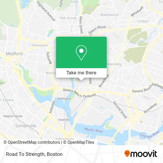
See Road To Strength, Everett, on the map
Public Transit to Road To Strength in Everett
Wondering how to get to Road To Strength in Everett? Moovit helps you find the best way to get to Road To Strength with step-by-step directions from the nearest public transit station.
Moovit provides free maps and live directions to help you navigate through your city. View schedules, routes, timetables, and find out how long does it take to get to Road To Strength in real time.
Looking for the nearest stop or station to Road To Strength? Check out this list of stops closest to your destination: Main St @ Winthrop St; Santilli Circle; Chelsea; Sullivan Square.
Bus: 104, 105, 106, 109, 110, 97, 99, 112.Train: NEWBURYPORT/ROCKPORT.Subway: ORANGE LINE.
Want to see if there’s another route that gets you there at an earlier time? Moovit helps you find alternative routes or times. Get directions from and directions to Road To Strength easily from the Moovit App or Website.
We make riding to Road To Strength easy, which is why over 1.7 million users, including users in Everett, trust Moovit as the best app for public transit. You don’t need to download an individual bus app or train app, Moovit is your all-in-one transit app that helps you find the best bus time or train time available.
For information on prices of bus and subway, costs and ride fares to Road To Strength, please check the Moovit app.
Use the app to navigate to popular places including to the airport, hospital, stadium, grocery store, mall, coffee shop, school, college, and university.
Road To Strength Address: 69 Norman St street in Everett
- Siguenza Auto Repair,
- Sky Zone Trampoline Park,
- Night Shift Brewing,
- Night Shift Brewing (Night Shift -Espl),
- Night Shift Brewing, Inc.,
- Thomas S. Rossetti Park,
- Caciatore Art,
- baldwin park,
- Killeen Electrical Services,
- Metrorock Climbing Centers,
- The Freestyle Clinic,
- Insulation smart Solutions,
- Norman Way,
- Lilly's Gourmet Pasta Express - Headquarters,
- JBS General Painting,
- Berta's Restaurant,
- BNY Mellon Cafeteria,
- Brazuka Store,
- EV Charging Station,
- Boston Orthopedic
Places Near Road To Strength (Everett)
- Boston Children's Hospital, Boston,
- House Of Blues, Boston,
- Wilbur Theatre, Boston,
- Museum Of Science, Boston,
- Prudential Center, Boston,
- Wang Theater, Boston,
- Boston Convention & Exhibition Center, Boston,
- Cheers, Boston,
- Td Garden, Boston,
- Seaport District, Boston,
- Mgm Music Hall, Boston,
- Faneuil Hall, Boston,
- Quincy Market, Boston,
- Castle Island, Boston,
- Isabella Stewart Gardner Museum, Boston,
- Boston Common, Boston,
- Boston Medical Center, Boston,
- North End, Boston,
- Massachusetts General Hospital, Boston,
- Leader Bank Pavilion (Leader Bank Pavillion), Boston
How to get to popular places in Boston with public transit
Get around Everett by public transit!
Traveling around Everett has never been so easy. See step by step directions as you travel to any attraction, street or major public transit station. View bus and train schedules, arrival times, service alerts and detailed routes on a map, so you know exactly how to get to anywhere in Everett.
When traveling to any destination around Everett use Moovit's Live Directions with Get Off Notifications to know exactly where and how far to walk, how long to wait for your line, and how many stops are left. Moovit will alert you when it's time to get off — no need to constantly re-check whether yours is the next stop.
Wondering how to use public transit in Everett or how to pay for public transit in Everett? Moovit public transit app can help you navigate your way with public transit easily, and at minimum cost. It includes public transit fees, ticket prices, and costs. Looking for a map of Everett public transit lines? Moovit public transit app shows all public transit maps in Everett with all Bus, Train, Subway and Ferry routes and stops on an interactive map.
Boston has 4 transit type(s), including: Bus, Train, Subway and Ferry, operated by several transit agencies, including MBTA, Southeastern Regional Transit Authority, MetroWest Regional Transit Authority, Rhode Island Public Transit Authority, WRTA, Lowell Regional Transit Authority, Merrimack Valley Transit, Montachusett Regional Transit Authority, Cape Cod Regional Transit Authority, Brockton Area Transit Authority, Martha's Vineyard Transit Authority, the WAVE - Nantucket Regional Transit Authority, GATRA, Cape Ann Transportation Authority and Massport