Directions to Rob's Auto Service (Olathe) with public transportation
The following transit lines have routes that pass near Rob's Auto Service
 Bus: 403.
How to get to Rob's Auto Service by bus?
Click on the bus route to see step by step directions with maps, line arrival times and updated time schedules.
From Amazon Fulfillment Center-MKC2, Lenexa
42 minFrom Overland Park Regional Medical Center, Overland Park
39 minFrom 95 and renner, Lenexa
110 minFrom Lori's Gifts, Overland Park
40 minFrom Business, Lenexa
112 minFrom Cosmo Burger, Lenexa
95 minFrom Mavs Volleyball, Lenexa
75 minFrom Court T. Kennedy, Attorney, Overland Park
38 minFrom Vinton - Moore Attorneys at Law, Lenexa
44 minFrom Roasterie Cafe, Lenexa
95 min
Bus stop near Rob's Auto Service in Olathe
- On E Santa Fe St at Cherry St Eb, 3 min walk,VIEW
Bus lines to Rob's Auto Service in Olathe
- 403, Ku Medical Center,VIEW
What are the closest stations to Rob's Auto Service?
The closest stations to Rob's Auto Service are:
- On E Santa Fe St at Cherry St Eb is 222 yards away, 3 min walk.
Which bus line stops near Rob's Auto Service?
403 (Walmart Park N Ride)
What’s the nearest bus station to Rob's Auto Service in Olathe?
The nearest bus station to Rob's Auto Service in Olathe is On E Santa Fe St at Cherry St Eb. It’s a 3 min walk away.
What time is the first bus to Rob's Auto Service in Olathe?
The 403 is the first bus that goes to Rob's Auto Service in Olathe. It stops nearby at 4:59 AM.
What time is the last bus to Rob's Auto Service in Olathe?
The 403 is the last bus that goes to Rob's Auto Service in Olathe. It stops nearby at 9:12 PM.
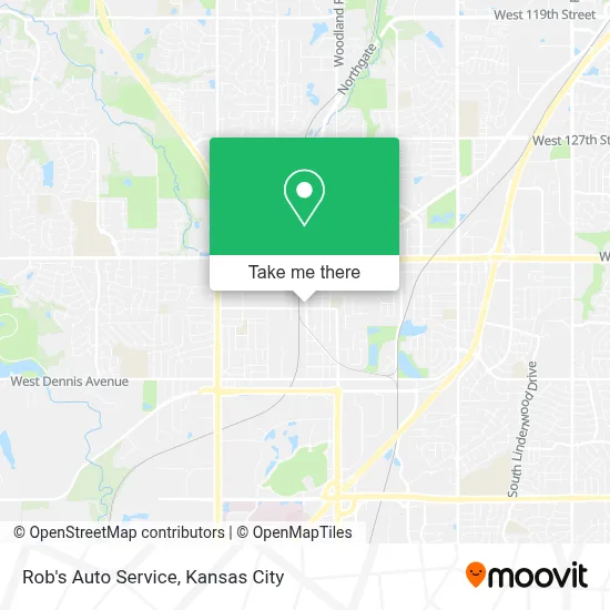
See Rob's Auto Service, Olathe, on the map
Public Transit to Rob's Auto Service in Olathe
Wondering how to get to Rob's Auto Service in Olathe? Moovit helps you find the best way to get to Rob's Auto Service with step-by-step directions from the nearest public transit station.
Moovit provides free maps and live directions to help you navigate through your city. View schedules, routes, timetables, and find out how long does it take to get to Rob's Auto Service in real time.
Looking for the nearest stop or station to Rob's Auto Service? Check out this list of stops closest to your destination: On E Santa Fe St at Cherry St Eb.
Bus: 403.
Want to see if there’s another route that gets you there at an earlier time? Moovit helps you find alternative routes or times. Get directions from and directions to Rob's Auto Service easily from the Moovit App or Website.
We make riding to Rob's Auto Service easy, which is why over 1.5 million users, including users in Olathe, trust Moovit as the best app for public transit. You don’t need to download an individual bus app or train app, Moovit is your all-in-one transit app that helps you find the best bus time or train time available.
For information on prices of bus, costs and ride fares to Rob's Auto Service, please check the Moovit app.
Use the app to navigate to popular places including to the airport, hospital, stadium, grocery store, mall, coffee shop, school, college, and university.
Rob's Auto Service Address: 325 S Kansas Ave street in Olathe
- Paradiso Pilates,
- Alcoholics Anonymous,
- Victors Tienda,
- La Comadres,
- Haul It Movers,
- Sam Auto Electric & Me,
- Credit Union 1,
- Olathedeafclub,
- Olathe Bass Club,
- Olathe Locksmith,
- Christ Gospel Church of Kansas City,
- McCalla Randy Law Offices,
- Abogada Denise Ramos,
- Gyllenborg and Dunn, P.A,
- Webb Law Center,
- Kansas Court of Appeals,
- Johnson County Administration Building,
- Johnson County Mental Health Center,
- Johnson County,
- Johnson County Wastewater
Places Near Rob's Auto Service (Olathe)
- Truman Medical Center,
- Amazon Fulfilment Center-MKC6, Kansas City,
- Stans Glory Hole,
- Ku Medical Center, Kansas City,
- T-Mobile Center,
- St. Luke's Hospital - Medical Plaza I,
- Walmart, Kansas City,
- Grandview, MO, Grandview,
- Legends Outlets Kansas City, Kansas City,
- Arrowhead Stadium,
- Kauffman Stadium,
- Worlds of Fun,
- Harrah's Casino, North Kansas City,
- GEHA Field at Arrowhead Stadium,
- Kansas City Zoo,
- The Glory Hole,
- Liberty, MO, Liberty,
- Kansas City International Airport (MCI) (Kansas City International Airport),
- Walmart Supercenter,
- Country Club Plaza
How to get to popular places in Kansas City with public transit
Get around Olathe by public transit!
Traveling around Olathe has never been so easy. See step by step directions as you travel to any attraction, street or major public transit station. View bus and train schedules, arrival times, service alerts and detailed routes on a map, so you know exactly how to get to anywhere in Olathe.
When traveling to any destination around Olathe use Moovit's Live Directions with Get Off Notifications to know exactly where and how far to walk, how long to wait for your line, and how many stops are left. Moovit will alert you when it's time to get off — no need to constantly re-check whether yours is the next stop.
Wondering how to use public transit in Olathe or how to pay for public transit in Olathe? Moovit public transit app can help you navigate your way with public transit easily, and at minimum cost. It includes public transit fees, ticket prices, and costs. Looking for a map of Olathe public transit lines? Moovit public transit app shows all public transit maps in Olathe with all Bus, Train and Light Rail routes and stops on an interactive map.
Kansas City has 3 transit type(s), including: Bus, Train and Light Rail, operated by several transit agencies, including Kansas City Area Transportation Authority, Lawrence Transit, Topeka Metro, RideKC Johnson County, Amtrak, Greyhound-us and FlixBus-us