Directions to Robby (Cambridge) with public transportation
The following transit lines have routes that pass near Robby
 Bus: 1, 109, 66, 69, 71.
- Train: FITCHBURG, FRAMINGHAM/WORCESTER.
- Subway: RED LINE, GREEN LINE B, GREEN LINE C, GREEN LINE E, GREEN LINE D.
How to get to Robby by bus?
Click on the bus route to see step by step directions with maps, line arrival times and updated time schedules.
From Pax East, Boston
54 minFrom World Trade Center MBTA Station - Silver Line, Boston
59 minFrom Four Points by Sheraton Boston Logan Airport, Revere
74 minFrom PwC, Boston
64 minFrom Codman Square, Boston
84 minFrom Macy's, Boston
49 minFrom Belle Isle Lobster & Seafood, Winthrop Town
115 minFrom Spaulding Rehabilitation Hospital, Boston
54 minFrom Uscis Biometrics Office, Revere
74 minFrom Comfort Inn & Suites Logan International Airport, Revere
76 min
How to get to Robby by train?
Click on the train route to see step by step directions with maps, line arrival times and updated time schedules.
How to get to Robby by subway?
Click on the subway route to see step by step directions with maps, line arrival times and updated time schedules.
From Pax East, Boston
36 minFrom World Trade Center MBTA Station - Silver Line, Boston
41 minFrom PwC, Boston
36 minFrom Codman Square, Boston
49 minFrom Macy's, Boston
21 minFrom Belle Isle Lobster & Seafood, Winthrop Town
56 minFrom Uscis Biometrics Office, Revere
57 minFrom Comfort Inn & Suites Logan International Airport, Revere
59 min
Bus stops near Robby in Cambridge
Subway stations near Robby in Cambridge
Train station near Robby in Cambridge
- Porter, 34 min walk,VIEW
Bus lines to Robby in Cambridge
- 66, Nubian via Allston - Harvard via Allston,VIEW
- 71, Harvard - Watertown Square,VIEW
- 73, Harvard - Waverley,VIEW
- 74, Harvard - Belmont Center,VIEW
- 75, Harvard - Belmont Center,VIEW
- 77, Harvard - Arlington Heights,VIEW
- 78, Harvard - Arlmont Village,VIEW
- 86, Reservoir - Harvard,VIEW
- 96, Harvard - Medford Square,VIEW
- 109, Harvard via Sullivan - Linden Square via Sullivan,VIEW
- 68, Kendall/MIT,VIEW
- 69, Harvard,VIEW
- 1, Nubian - Harvard,VIEW
- RED LINE SHUTTLE, Harvard - Kendall/MIT (Loop),VIEW
- RED LINE SHUTTLE, Harvard - JFK/UMass via Congress Street,VIEW
- RED LINE SHUTTLE, Alewife - Harvard via Brattle Street,VIEW
- RED LINE SHUTTLE, Harvard - South Station,VIEW
- RED LINE SHUTTLE, Alewife - Harvard via Holyoke Street,VIEW
- RED LINE SHUTTLE, Harvard - Park Street,VIEW
- RED LINE SHUTTLE, Harvard - Broadway,VIEW
What are the closest stations to Robby?
The closest stations to Robby are:
- Harvard is 300 yards away, 4 min walk.
- Quincy St @ Broadway Opp Fogg Museum is 362 yards away, 5 min walk.
- Massachusetts Ave Opp Holyoke St is 418 yards away, 6 min walk.
- Harvard - Massachusetts Ave Opp Linden St is 502 yards away, 7 min walk.
- Broadway @ Felton St is 523 yards away, 7 min walk.
- Harvard Square is 1336 yards away, 17 min walk.
- Gilman Square is 1725 yards away, 21 min walk.
- Porter is 2780 yards away, 34 min walk.
- Union Square is 2848 yards away, 34 min walk.
Which bus lines stop near Robby?
These bus lines stop near Robby: 1, 109, 66, 69.
Which train lines stop near Robby?
These train lines stop near Robby: FITCHBURG, FRAMINGHAM/WORCESTER.
Which subway line stops near Robby?
RED LINE (Alewife)
What’s the nearest subway station to Robby in Cambridge?
The nearest subway station to Robby in Cambridge is Harvard Square. It’s a 17 min walk away.
What’s the nearest bus station to Robby in Cambridge?
The nearest bus station to Robby in Cambridge is Harvard. It’s a 4 min walk away.
What time is the first subway to Robby in Cambridge?
The GREEN LINE E is the first subway that goes to Robby in Cambridge. It stops nearby at 4:50 AM.
What time is the last subway to Robby in Cambridge?
The GREEN LINE E is the last subway that goes to Robby in Cambridge. It stops nearby at 2:36 AM.
What time is the first train to Robby in Cambridge?
The FITCHBURG is the first train that goes to Robby in Cambridge. It stops nearby at 5:47 AM.
What time is the last train to Robby in Cambridge?
The FITCHBURG is the last train that goes to Robby in Cambridge. It stops nearby at 12:17 AM.
What time is the first bus to Robby in Cambridge?
The 73 is the first bus that goes to Robby in Cambridge. It stops nearby at 4:45 AM.
What time is the last bus to Robby in Cambridge?
The 66 is the last bus that goes to Robby in Cambridge. It stops nearby at 2:36 AM.
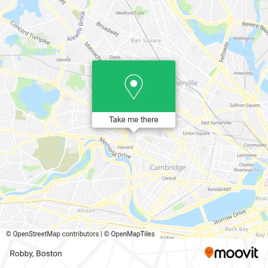
See Robby, Cambridge, on the map
Public Transit to Robby in Cambridge
Wondering how to get to Robby in Cambridge? Moovit helps you find the best way to get to Robby with step-by-step directions from the nearest public transit station.
Moovit provides free maps and live directions to help you navigate through your city. View schedules, routes, timetables, and find out how long does it take to get to Robby in real time.
Looking for the nearest stop or station to Robby? Check out this list of stops closest to your destination: Harvard; Quincy St @ Broadway Opp Fogg Museum; Massachusetts Ave Opp Holyoke St; Harvard - Massachusetts Ave Opp Linden St; Broadway @ Felton St; Harvard Square; Gilman Square; Porter; Union Square.
Bus: 1, 109, 66, 69, 71, 73, 74, 75, 68.Train: FITCHBURG, FRAMINGHAM/WORCESTER.Subway: RED LINE, GREEN LINE B, GREEN LINE C, GREEN LINE E, GREEN LINE D.
Want to see if there’s another route that gets you there at an earlier time? Moovit helps you find alternative routes or times. Get directions from and directions to Robby easily from the Moovit App or Website.
We make riding to Robby easy, which is why over 1.7 million users, including users in Cambridge, trust Moovit as the best app for public transit. You don’t need to download an individual bus app or train app, Moovit is your all-in-one transit app that helps you find the best bus time or train time available.
For information on prices of bus, subway and train, costs and ride fares to Robby, please check the Moovit app.
Use the app to navigate to popular places including to the airport, hospital, stadium, grocery store, mall, coffee shop, school, college, and university.
Location: Cambridge, Boston
- Littauer Lot,
- The Institute for Meditation and Psychotherapy,
- Clover Food Lab,
- Sanders Theatre,
- 1 Oxford Street,
- Soul Clap,
- Communication Matters Studio,
- Soul To Plate,
- Cambridge Green Clean Carpet & Upholstery Cleaning,
- John Harvard Statue,
- 69 bus Route,
- Treadwell - Sparks House,
- Harvard University-Graduate School of Design,
- Chauhaus,
- Harvard University,
- Widener Library,
- Fogg Museum Of Art,
- Harvard Johnston Gate,
- Eda Kuhn Loeb Music Library, Harvard University,
- Harvard Art Museum
Places Near Robby (Cambridge)
- Boston Children's Hospital, Boston,
- Castle Island, Boston,
- House Of Blues, Boston,
- North End, Boston,
- Seaport District, Boston,
- Faneuil Hall, Boston,
- Leader Bank Pavilion (Leader Bank Pavillion), Boston,
- Wang Theater, Boston,
- Boston Convention & Exhibition Center, Boston,
- Boston Common, Boston,
- Massachusetts General Hospital, Boston,
- Boston Medical Center, Boston,
- Prudential Center, Boston,
- Cheers, Boston,
- Td Garden, Boston,
- Mgm Music Hall, Boston,
- Quincy Market, Boston,
- Wilbur Theatre, Boston,
- Museum Of Science, Boston,
- Isabella Stewart Gardner Museum, Boston
How to get to popular places in Boston with public transit
Get around Cambridge by public transit!
Traveling around Cambridge has never been so easy. See step by step directions as you travel to any attraction, street or major public transit station. View bus and train schedules, arrival times, service alerts and detailed routes on a map, so you know exactly how to get to anywhere in Cambridge.
When traveling to any destination around Cambridge use Moovit's Live Directions with Get Off Notifications to know exactly where and how far to walk, how long to wait for your line, and how many stops are left. Moovit will alert you when it's time to get off — no need to constantly re-check whether yours is the next stop.
Wondering how to use public transit in Cambridge or how to pay for public transit in Cambridge? Moovit public transit app can help you navigate your way with public transit easily, and at minimum cost. It includes public transit fees, ticket prices, and costs. Looking for a map of Cambridge public transit lines? Moovit public transit app shows all public transit maps in Cambridge with all Bus, Train, Subway and Ferry routes and stops on an interactive map.
Boston has 4 transit type(s), including: Bus, Train, Subway and Ferry, operated by several transit agencies, including MBTA, Southeastern Regional Transit Authority, MetroWest Regional Transit Authority, Rhode Island Public Transit Authority, WRTA, Lowell Regional Transit Authority, Merrimack Valley Transit, Montachusett Regional Transit Authority, Cape Cod Regional Transit Authority, Brockton Area Transit Authority, Martha's Vineyard Transit Authority, the WAVE - Nantucket Regional Transit Authority, GATRA, Cape Ann Transportation Authority and Massport