See Robert Mcqueen High School, Reno, on the map
Directions to Robert Mcqueen High School (Reno) with public transportation
The following transit lines have routes that pass near Robert Mcqueen High School
 Bus:
Bus:
How to get to Robert Mcqueen High School by bus?
Click on the bus route to see step by step directions with maps, line arrival times and updated time schedules.
Bus stations near Robert Mcqueen High School in Reno
- W 7th Street And Montego Drive,3 min walk,
Bus lines to Robert Mcqueen High School in Reno
- 4,Rtc 4th Street Station,
What are the closest stations to Robert Mcqueen High School?
The closest stations to Robert Mcqueen High School are:
- W 7th Street And Montego Drive is 182 yards away, 3 min walk.
Which bus line stops near Robert Mcqueen High School?
4
What’s the nearest bus stop to Robert Mcqueen High School in Reno?
The nearest bus stop to Robert Mcqueen High School in Reno is W 7th Street And Montego Drive. It’s a 3 min walk away.
What time is the first bus to Robert Mcqueen High School in Reno?
The 4 is the first bus that goes to Robert Mcqueen High School in Reno. It stops nearby at 5:16 AM.
What time is the last bus to Robert Mcqueen High School in Reno?
The 4 is the last bus that goes to Robert Mcqueen High School in Reno. It stops nearby at 11:12 PM.
How much is the bus fare to Robert Mcqueen High School?
The bus fare to Robert Mcqueen High School costs about $2.00.
See Robert Mcqueen High School, Reno, on the map
Public Transit to Robert Mcqueen High School in Reno
Wondering how to get to Robert Mcqueen High School in Reno, United States? Moovit helps you find the best way to get to Robert Mcqueen High School with step-by-step directions from the nearest public transit station.
Moovit provides free maps and live directions to help you navigate through your city. View schedules, routes, timetables, and find out how long does it take to get to Robert Mcqueen High School in real time.
Looking for the nearest stop or station to Robert Mcqueen High School? Check out this list of stops closest to your destination: W 7th Street And Montego Drive.
Bus:
Want to see if there’s another route that gets you there at an earlier time? Moovit helps you find alternative routes or times. Get directions from and directions to Robert Mcqueen High School easily from the Moovit App or Website.
We make riding to Robert Mcqueen High School easy, which is why over 1.5 million users, including users in Reno, trust Moovit as the best app for public transit. You don’t need to download an individual bus app or train app, Moovit is your all-in-one transit app that helps you find the best bus time or train time available.
For information on prices of bus, costs and ride fares to Robert Mcqueen High School, please check the Moovit app.
Use the app to navigate to popular places including to the airport, hospital, stadium, grocery store, mall, coffee shop, school, college, and university.
Location: Reno, Lake Tahoe - Reno, NV
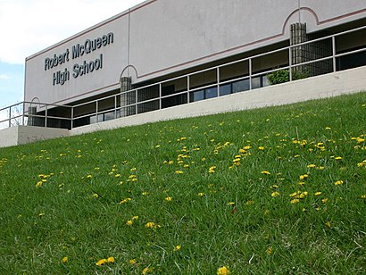
Robert McQueen High School is a public secondary school in Reno, Nevada, United States. It is part of the Washoe County School District.Wiki
Attractions near Robert Mcqueen High School
McQueen High School,McQueen High Football Field,Tahoe Moving Company,Handy Kathy Vinyl Leather and Cloth Repair,Marvin Lee,Triple E Forestry,Covid-19 Testing Site: CVS Health Covid-19 Drive Thru Testing Site - by Appointment Only,Inverters R US,Bus Stop @robb/mae Anne,Foodhandler,Fresenius Kidney Care,Allstate Insurance,Koko's Korean Kitchen,Bathroom Remodeling,Ann Designs,Board Members,Dragonfly Culinary,Dahle Communication Consulting,Republican National Commitee,Places Consulting ServicesHow to get to popular attractions in Reno with public transit
Environmental Inspection & Control Services, Reno,The Trap, Sun Valley,Nevada's Center for Entreprene, Reno,Heavenly Mountain Resort, South Lake Tahoe,Richard A Klein, DDS, Carson City,JM Apparel, Truckee,Reno Ice Raiders Hockey Club,Tahoe Asian Massage, South Lake Tahoe,Amazon Locker-Bonario, Sparks,William Kent Campground, Sunnyside-Tahoe City,CA-28 E, Kings Beach,Amazon Locker-Brunero, Reno,Lake Tahoe Community College, South Lake Tahoe,Olympic Valley, CA,Concentra Medical Center, Reno,Casino Fandango, Carson City,Spa At The Landing Resort Tahoe, South Lake Tahoe,Carson Nugget, Carson City,Lake Tahoe, South Lake Tahoe,99 Cent Emporium, RenoGet around Reno by public transit!
Traveling around Reno has never been so easy. See step by step directions as you travel to any attraction, street or major public transit station. View bus and train schedules, arrival times, service alerts and detailed routes on a map, so you know exactly how to get to anywhere in Reno.
When traveling to any destination around Reno use Moovit's Live Directions with Get Off Notifications to know exactly where and how far to walk, how long to wait for your line, and how many stops are left. Moovit will alert you when it's time to get off — no need to constantly re-check whether yours is the next stop.
Wondering how to use public transit in Reno or how to pay for public transit in Reno? Moovit public transit app can help you navigate your way with public transit easily, and at minimum cost. It includes public transit fees, ticket prices, and costs. Looking for a map of Reno public transit lines? Moovit public transit app shows all public transit maps in Reno with all bus routes and stops on an interactive map.
Reno has 1 transit type(s), including: bus, operated by several transit agencies, including RTC RIDE, Tahoe Truckee Area Regional Transit, North Lake Tahoe Express - 24 hour advance reservations required, Tahoe Transportation District, Amtrak, FlixBus-us and Greyhound-us