See Robert S. Davis House, Brookline, on the map
Directions to Robert S. Davis House (Brookline) with public transportation
The following transit lines have routes that pass near Robert S. Davis House
 Bus:
Bus: - Train:
- Subway:
How to get to Robert S. Davis House by bus?
Click on the bus route to see step by step directions with maps, line arrival times and updated time schedules.
How to get to Robert S. Davis House by train?
Click on the train route to see step by step directions with maps, line arrival times and updated time schedules.
How to get to Robert S. Davis House by subway?
Click on the subway route to see step by step directions with maps, line arrival times and updated time schedules.
Bus stations near Robert S. Davis House in Brookline
- Washington St Opp Greenough St,1 min walk,
- Harvard St @ Aspinwall Ave,6 min walk,
- Cypress St @ Milton Rd,9 min walk,
Subway stations near Robert S. Davis House in Brookline
- Brookline Hills,9 min walk,
- Brandon Hall,11 min walk,
Bus lines to Robert S. Davis House in Brookline
- 65,Kenmore,
- 66,Harvard Via Allston,
- 60,Brookline Village,
What are the closest stations to Robert S. Davis House?
The closest stations to Robert S. Davis House are:
- Washington St Opp Greenough St is 21 yards away, 1 min walk.
- Harvard St @ Aspinwall Ave is 453 yards away, 6 min walk.
- Brookline Hills is 690 yards away, 9 min walk.
- Cypress St @ Milton Rd is 741 yards away, 9 min walk.
- Brandon Hall is 849 yards away, 11 min walk.
Which bus lines stop near Robert S. Davis House?
These bus lines stop near Robert S. Davis House: 39, 47, 66.
Which train lines stop near Robert S. Davis House?
These train lines stop near Robert S. Davis House: FRAMINGHAM/WORCESTER, PROVIDENCE/STOUGHTON.
Which subway line stops near Robert S. Davis House?
GREEN LINE D
What’s the nearest subway station to Robert S. Davis House in Brookline?
The nearest subway station to Robert S. Davis House in Brookline is Brookline Hills. It’s a 9 min walk away.
What’s the nearest bus stop to Robert S. Davis House in Brookline?
The nearest bus stop to Robert S. Davis House in Brookline is Washington St Opp Greenough St. It’s a 1 min walk away.
What time is the first subway to Robert S. Davis House in Brookline?
The GREEN LINE C is the first subway that goes to Robert S. Davis House in Brookline. It stops nearby at 4:55 AM.
What time is the last subway to Robert S. Davis House in Brookline?
The GREEN LINE C is the last subway that goes to Robert S. Davis House in Brookline. It stops nearby at 1:19 AM.
What time is the first bus to Robert S. Davis House in Brookline?
The 66 is the first bus that goes to Robert S. Davis House in Brookline. It stops nearby at 4:46 AM.
What time is the last bus to Robert S. Davis House in Brookline?
The 66 is the last bus that goes to Robert S. Davis House in Brookline. It stops nearby at 1:21 AM.
How much is the train fare to Robert S. Davis House?
The train fare to Robert S. Davis House costs about $2.40 - $13.25.
How much is the subway fare to Robert S. Davis House?
The subway fare to Robert S. Davis House costs about $2.40.
How much is the bus fare to Robert S. Davis House?
The bus fare to Robert S. Davis House costs about $1.70.
See Robert S. Davis House, Brookline, on the map
Public Transit to Robert S. Davis House in Brookline
Wondering how to get to Robert S. Davis House in Brookline, United States? Moovit helps you find the best way to get to Robert S. Davis House with step-by-step directions from the nearest public transit station.
Moovit provides free maps and live directions to help you navigate through your city. View schedules, routes, timetables, and find out how long does it take to get to Robert S. Davis House in real time.
Looking for the nearest stop or station to Robert S. Davis House? Check out this list of stops closest to your destination: Washington St Opp Greenough St; Harvard St @ Aspinwall Ave; Brookline Hills; Cypress St @ Milton Rd; Brandon Hall.
Bus:Train:Subway:
Want to see if there’s another route that gets you there at an earlier time? Moovit helps you find alternative routes or times. Get directions from and directions to Robert S. Davis House easily from the Moovit App or Website.
We make riding to Robert S. Davis House easy, which is why over 1.5 million users, including users in Brookline, trust Moovit as the best app for public transit. You don’t need to download an individual bus app or train app, Moovit is your all-in-one transit app that helps you find the best bus time or train time available.
For information on prices of bus, subway and train, costs and ride fares to Robert S. Davis House, please check the Moovit app.
Use the app to navigate to popular places including to the airport, hospital, stadium, grocery store, mall, coffee shop, school, college, and university.
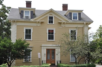
Robert S. Davis House Address: Stanton Rd Brookline, MA 02445 street in Brookline
Attractions near Robert S. Davis House
Lasky Homesmith,Hammond Residential Real Estate,Channing & Popai Liem Education Foundation,Jonas Health,Washington St Opp Greenough St,Libertyx Bitcoin ATM,Santander,Santander Bank Atm,Citibank,BMO Harris Bank,MoneyGram,Carole Sousa Jewelry,Stephen Simon Interactive,Select Wine Imports,Lushan McCarthy & Goonan,German Services,Brookline High School ,Aerobiology Instruction,Brookline Beauty Nails & Spa,Appliance Repair SamsungHow to get to popular attractions in Brookline with public transit
Ruggles Station, Boston,Planet Fitness, Malden,Redbones Barbecue, Somerville,Walmart Supercenter, Worcester,Shabu Zen, Boston,The Landing at Long Wharf, Boston,Warwick, RI,Boston Sail Loft, Boston,Dillon's, Boston,MET Back Bay, Boston,MBTA Commuter Rail South Attleboro, Attleboro,Joe's American Bar & Grill, Boston,Brighton Center, Boston,East Providence, RI,Golds Gym,California Pizza Kitchen, Boston,Samuel Adams Brewery, Boston,South Bay Mall, Boston,WaterFire Providence - Waterplace Park,Worcester, MA, WorcesterGet around Brookline by public transit!
Traveling around Brookline has never been so easy. See step by step directions as you travel to any attraction, street or major public transit station. View bus and train schedules, arrival times, service alerts and detailed routes on a map, so you know exactly how to get to anywhere in Brookline.
When traveling to any destination around Brookline use Moovit's Live Directions with Get Off Notifications to know exactly where and how far to walk, how long to wait for your line, and how many stops are left. Moovit will alert you when it's time to get off — no need to constantly re-check whether yours is the next stop.
Wondering how to use public transit in Brookline or how to pay for public transit in Brookline? Moovit public transit app can help you navigate your way with public transit easily, and at minimum cost. It includes public transit fees, ticket prices, and costs. Looking for a map of Brookline public transit lines? Moovit public transit app shows all public transit maps in Brookline with all bus, subway or train routes and stops on an interactive map.
Brookline has 3 transit type(s), including: bus, subway or train, operated by several transit agencies, including MBTA, MBTA, MBTA, Southeastern Regional Transit Authority, MetroWest Regional Transit Authority, Rhode Island Public Transit Authority, WRTA, Lowell Regional Transit Authority, Merrimack Valley Transit, Montachusett Regional Transit Authority, Cape Cod Regional Transit Authority, Brockton Area Transit Authority, Cape Cod Regional Transit Authority, Martha's Vineyard Transit Authority and the WAVE - Nantucket Regional Transit Authority