Directions to Robinson Michael A (Brookline) with public transportation
The following transit lines have routes that pass near Robinson Michael A
 Bus: 65, 66, GREEN LINE C SHUTTLE, GREEN LINE C SHUTTLE, SHUTTLE.
- Train: FRAMINGHAM/WORCESTER, PROVIDENCE/STOUGHTON.
- Subway: GREEN LINE C.
How to get to Robinson Michael A by bus?
Click on the bus route to see step by step directions with maps, line arrival times and updated time schedules.
From Milton, MA, Milton
110 minFrom Georgetown, Massachusetts, Boston
73 minFrom J.J. Foley's Cafe, Boston
50 minFrom City Hall Plaza, Boston
56 minFrom Milton Academy, Milton
109 minFrom Canobie Lake Park, Chelsea
93 minFrom Boston Opera House (Citizens Bank Opera House), Boston
51 minFrom Shubert Theatre, Boston
44 minFrom Massachusetts Water Resource Authority (MWRA), Chelsea
84 minFrom Holiday Inn Express & Suites Boston - Cambridge, Cambridge
57 min
How to get to Robinson Michael A by train?
Click on the train route to see step by step directions with maps, line arrival times and updated time schedules.
How to get to Robinson Michael A by subway?
Click on the subway route to see step by step directions with maps, line arrival times and updated time schedules.
From Milton, MA, Milton
98 minFrom J.J. Foley's Cafe, Boston
38 minFrom City Hall Plaza, Boston
29 minFrom Milton Academy, Milton
79 minFrom Boston Opera House (Citizens Bank Opera House), Boston
27 minFrom Shubert Theatre, Boston
28 minFrom Massachusetts Water Resource Authority (MWRA), Chelsea
64 minFrom Holiday Inn Express & Suites Boston - Cambridge, Cambridge
49 min
Subway station near Robinson Michael A in Brookline
- Summit Avenue, 1 min walk,VIEW
Bus stops near Robinson Michael A in Brookline
Bus lines to Robinson Michael A in Brookline
- GREEN LINE C SHUTTLE, Saint Mary's Street (Shuttle),VIEW
- GREEN LINE C SHUTTLE, Coolidge Corner (Shuttle),VIEW
- SHUTTLE, Cleveland Circle (Shuttle),VIEW
- 65, Kenmore,VIEW
- FLIXBUS 2610, New York (Hudson Yards),VIEW
- FLIXBUS N2605, Henrico (Parham Rd Park & Ride),VIEW
- FLIXBUS N2610, Boston (South Station),VIEW
- 66, Brighton Center Via Brookline,VIEW
What are the closest stations to Robinson Michael A?
The closest stations to Robinson Michael A are:
- Summit Avenue is 68 yards away, 1 min walk.
- Washington St @ Fairbanks St is 399 yards away, 5 min walk.
- Brookline is 441 yards away, 6 min walk.
- Harvard St @ Shailer St is 609 yards away, 8 min walk.
Which bus lines stop near Robinson Michael A?
These bus lines stop near Robinson Michael A: 65, 66.
Which train lines stop near Robinson Michael A?
These train lines stop near Robinson Michael A: FRAMINGHAM/WORCESTER, PROVIDENCE/STOUGHTON.
Which subway line stops near Robinson Michael A?
GREEN LINE C (Cleveland Circle)
What’s the nearest subway station to Robinson Michael A in Brookline?
The nearest subway station to Robinson Michael A in Brookline is Summit Avenue. It’s a 1 min walk away.
What’s the nearest bus station to Robinson Michael A in Brookline?
The nearest bus station to Robinson Michael A in Brookline is Summit Avenue. It’s a 1 min walk away.
What time is the first subway to Robinson Michael A in Brookline?
The GREEN LINE C is the first subway that goes to Robinson Michael A in Brookline. It stops nearby at 5:05 AM.
What time is the last subway to Robinson Michael A in Brookline?
The GREEN LINE C is the last subway that goes to Robinson Michael A in Brookline. It stops nearby at 2:17 AM.
What time is the first bus to Robinson Michael A in Brookline?
The 66 is the first bus that goes to Robinson Michael A in Brookline. It stops nearby at 5:01 AM.
What time is the last bus to Robinson Michael A in Brookline?
The FLIXBUS N2605 is the last bus that goes to Robinson Michael A in Brookline. It stops nearby at 9:05 AM.
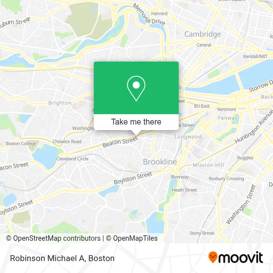
See Robinson Michael A, Brookline, on the map
Public Transit to Robinson Michael A in Brookline
Wondering how to get to Robinson Michael A in Brookline? Moovit helps you find the best way to get to Robinson Michael A with step-by-step directions from the nearest public transit station.
Moovit provides free maps and live directions to help you navigate through your city. View schedules, routes, timetables, and find out how long does it take to get to Robinson Michael A in real time.
Looking for the nearest stop or station to Robinson Michael A? Check out this list of stops closest to your destination: Summit Avenue; Washington St @ Fairbanks St; Brookline; Harvard St @ Shailer St.
Bus: 65, 66, GREEN LINE C SHUTTLE, GREEN LINE C SHUTTLE, SHUTTLE, FLIXBUS 2610, FLIXBUS N2605, FLIXBUS N2610.Train: FRAMINGHAM/WORCESTER, PROVIDENCE/STOUGHTON.Subway: GREEN LINE C.
Want to see if there’s another route that gets you there at an earlier time? Moovit helps you find alternative routes or times. Get directions from and directions to Robinson Michael A easily from the Moovit App or Website.
We make riding to Robinson Michael A easy, which is why over 1.7 million users, including users in Brookline, trust Moovit as the best app for public transit. You don’t need to download an individual bus app or train app, Moovit is your all-in-one transit app that helps you find the best bus time or train time available.
For information on prices of subway, bus and train, costs and ride fares to Robinson Michael A, please check the Moovit app.
Use the app to navigate to popular places including to the airport, hospital, stadium, grocery store, mall, coffee shop, school, college, and university.
Robinson Michael A Address: 1443 Beacon St street in Brookline
- 1443 Beacon Apartments,
- Metro Realty Corp,
- One-Bedroom on Beacon Street Apt 714,
- Sydney Associates,
- Beacon Street Apartments,
- Fenway Financial Services LLC,
- Michael Robinson Dr,
- Hancock Village,
- Sinha' Capoeira Boston,
- Rockland Trust,
- Oasit's Sweet,
- Liquor Express,
- Rod D by Sitti Thai Cuisine,
- Atm,
- Perry L Belfer, PHD,
- Emily Pilowa Licsw,
- Hannon Veronica,
- Summit Av Dog Park,
- Behind the Veil,
- Appliance Repair Viking
Places Near Robinson Michael A (Brookline)
- Wang Theater, Boston,
- Isabella Stewart Gardner Museum, Boston,
- Td Garden, Boston,
- Faneuil Hall, Boston,
- Seaport District, Boston,
- Boston Medical Center, Boston,
- North End, Boston,
- Wilbur Theatre, Boston,
- Mgm Music Hall, Boston,
- Castle Island, Boston,
- Quincy Market, Boston,
- Boston Children's Hospital, Boston,
- House Of Blues, Boston,
- Prudential Center, Boston,
- Boston Common, Boston,
- Boston Convention & Exhibition Center, Boston,
- Leader Bank Pavilion (Leader Bank Pavillion), Boston,
- Massachusetts General Hospital, Boston,
- Cheers, Boston,
- Museum Of Science, Boston
How to get to popular places in Boston with public transit
Get around Brookline by public transit!
Traveling around Brookline has never been so easy. See step by step directions as you travel to any attraction, street or major public transit station. View bus and train schedules, arrival times, service alerts and detailed routes on a map, so you know exactly how to get to anywhere in Brookline.
When traveling to any destination around Brookline use Moovit's Live Directions with Get Off Notifications to know exactly where and how far to walk, how long to wait for your line, and how many stops are left. Moovit will alert you when it's time to get off — no need to constantly re-check whether yours is the next stop.
Wondering how to use public transit in Brookline or how to pay for public transit in Brookline? Moovit public transit app can help you navigate your way with public transit easily, and at minimum cost. It includes public transit fees, ticket prices, and costs. Looking for a map of Brookline public transit lines? Moovit public transit app shows all public transit maps in Brookline with all Bus, Train, Subway and Ferry routes and stops on an interactive map.
Boston has 4 transit type(s), including: Bus, Train, Subway and Ferry, operated by several transit agencies, including MBTA, Southeastern Regional Transit Authority, MetroWest Regional Transit Authority, Rhode Island Public Transit Authority, WRTA, Lowell Regional Transit Authority, Merrimack Valley Transit, Montachusett Regional Transit Authority, Cape Cod Regional Transit Authority, Brockton Area Transit Authority, Martha's Vineyard Transit Authority, the WAVE - Nantucket Regional Transit Authority, GATRA, Cape Ann Transportation Authority and Massport