Directions to Rock Island Depot and Freight House (Peoria) with public transportation
The following transit lines have routes that pass near Rock Island Depot and Freight House
How to get to Rock Island Depot and Freight House by bus?
Click on the bus route to see step by step directions with maps, line arrival times and updated time schedules.
Bus stations near Rock Island Depot and Freight House in Peoria
- Adams And Hamilton,3 min walk,
- Hamilton And Jefferson,4 min walk,
- Jefferson And Hamilton,4 min walk,
- Hamilton And Madison,5 min walk,
- Main And Jefferson/Peoria County Courtho,6 min walk,
- Peoria Amtrak Station,7 min walk,
- Citylink Transit Center,18 min walk,
Bus lines to Rock Island Depot and Freight House in Peoria
- 2,To Forest Park Apts,
- 4,Knoxville Crossing,
- 10,Glen Hollow Shopping Plaza,
- 3,Northwest Peoria,
- 14,Wisconsin,
- 11,To Harrison Homes,
- AMTRAK THRUWAY CONNECTING SERVICE,Normal,
- AMTRAK THRUWAY CONNECTING SERVICE,Galesburg,
- 1,University,
- 5,West Peoria,
- 7,John Gwynn,
- 8,East Peoria,
- 12,Heights,
- 13,South Adams,
- 15,Lincoln,
- 20,ICC Express,
- 23,Peoria to Pekin,
What are the closest stations to Rock Island Depot and Freight House?
The closest stations to Rock Island Depot and Freight House are:
- Adams And Hamilton is 219 yards away, 3 min walk.
- Hamilton And Jefferson is 277 yards away, 4 min walk.
- Jefferson And Hamilton is 287 yards away, 4 min walk.
- Hamilton And Madison is 324 yards away, 5 min walk.
- Main And Jefferson/Peoria County Courtho is 467 yards away, 6 min walk.
- Peoria Amtrak Station is 507 yards away, 7 min walk.
- Citylink Transit Center is 1424 yards away, 18 min walk.
Which bus lines stop near Rock Island Depot and Freight House?
These bus lines stop near Rock Island Depot and Freight House: 20, 4, 7.
What’s the nearest bus stop to Rock Island Depot and Freight House in Peoria?
The nearest bus stop to Rock Island Depot and Freight House in Peoria is Adams And Hamilton. It’s a 3 min walk away.
What time is the first bus to Rock Island Depot and Freight House in Peoria?
The 1 is the first bus that goes to Rock Island Depot and Freight House in Peoria. It stops nearby at 5:45 AM.
What time is the last bus to Rock Island Depot and Freight House in Peoria?
The 10 is the last bus that goes to Rock Island Depot and Freight House in Peoria. It stops nearby at 11:46 PM.
See Rock Island Depot and Freight House, Peoria, on the map
Public Transit to Rock Island Depot and Freight House in Peoria
Wondering how to get to Rock Island Depot and Freight House in Peoria, United States? Moovit helps you find the best way to get to Rock Island Depot and Freight House with step-by-step directions from the nearest public transit station.
Moovit provides free maps and live directions to help you navigate through your city. View schedules, routes, timetables, and find out how long does it take to get to Rock Island Depot and Freight House in real time.
Looking for the nearest stop or station to Rock Island Depot and Freight House? Check out this list of stops closest to your destination: Adams And Hamilton; Hamilton And Jefferson; Jefferson And Hamilton; Hamilton And Madison; Main And Jefferson/Peoria County Courtho; Peoria Amtrak Station; Citylink Transit Center.
Bus:204721031411AMTRAK THRUWAY CONNECTING SERVICEAMTRAK THRUWAY CONNECTING SERVICE
Want to see if there’s another route that gets you there at an earlier time? Moovit helps you find alternative routes or times. Get directions from and directions to Rock Island Depot and Freight House easily from the Moovit App or Website.
We make riding to Rock Island Depot and Freight House easy, which is why over 1.5 million users, including users in Peoria, trust Moovit as the best app for public transit. You don’t need to download an individual bus app or train app, Moovit is your all-in-one transit app that helps you find the best bus time or train time available.
For information on prices of bus, costs and ride fares to Rock Island Depot and Freight House, please check the Moovit app.
Use the app to navigate to popular places including to the airport, hospital, stadium, grocery store, mall, coffee shop, school, college, and university.
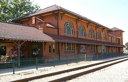
Rock Island Depot and Freight House Address: 32 Liberty St Peoria, IL 61602 street in Peoria
Attractions near Rock Island Depot and Freight House
Fiber Universe,Design Farm,Sarah Grace USA,Water Front Place Condominium,Ecco,Manpower,Gelia,Nailon,Kagan Masters Art,Academy of Fretted Instruments,Side View Gallery,Tiffany Hale - Barberologist,Ahern Fire Protection,Bollywood Bites Bistro & Events Center,The Maxam Building,Simformotion+ A Licensee,309 Marketing,The O'Brien Team with Jim Maloof Realtor,Lofts at Waterfront Place,Investment PlannersHow to get to popular attractions in Peoria with public transit
Good Shepherd Lutheran School, Pekin,ICC Softball Field, East Peoria,W Millman St Building 2317, Peoria,R.P. Home & Harvest 10, Pekin,Carver & Assoc Wealth Management Group, Peoria,Devon Grocery And Foods, Peoria,Holiday Inn Express, East Peoria,Sherwin-Williams Paint Store, Peoria,Quality Inn & Suites, Peoria,Richard Pryor Statue by Preston Jackson, Peoria,Hines Exteriors, Peoria Heights,Moore Skillz Kitchen, Peoria,1208 e hines St, Peoria Heights,Bradley University - Visitors Parking Lot, Peoria,Vecc Exteriors, Pekin,3 Reales Tienda Mexicana, Peoria,The Bat Cave, Peoria,Pekin Hospital, Pekin,W Nebraska Ave Building 2613, Peoria,Grand View Park Bench, Peoria HeightsGet around Peoria by public transit!
Traveling around Peoria has never been so easy. See step by step directions as you travel to any attraction, street or major public transit station. View bus and train schedules, arrival times, service alerts and detailed routes on a map, so you know exactly how to get to anywhere in Peoria.
When traveling to any destination around Peoria use Moovit's Live Directions with Get Off Notifications to know exactly where and how far to walk, how long to wait for your line, and how many stops are left. Moovit will alert you when it's time to get off — no need to constantly re-check whether yours is the next stop.
Wondering how to use public transit in Peoria or how to pay for public transit in Peoria? Moovit public transit app can help you navigate your way with public transit easily, and at minimum cost. It includes public transit fees, ticket prices, and costs. Looking for a map of Peoria public transit lines? Moovit public transit app shows all public transit maps in Peoria with all bus routes and stops on an interactive map.
Peoria has 1 transit type(s), including: bus, operated by several transit agencies, including CityLink, Peoria Charter and Executive Transportation