Directions to Rock Revival (Boston) with public transportation
The following transit lines have routes that pass near Rock Revival
 Bus: 501, 57, 65, 66, 86.
- Train: FRAMINGHAM/WORCESTER.
- Subway: GREEN LINE B.
How to get to Rock Revival by bus?
Click on the bus route to see step by step directions with maps, line arrival times and updated time schedules.
From Cheers, Boston
32 minFrom Charlestown, Boston
68 minFrom Boston Harbor, Boston
51 minFrom Seaport Boston Hotel, Boston
51 minFrom The Westin Waltham Boston, Waltham
65 minFrom Trader Joe's, Boston
31 minFrom Primark Boston, Boston
38 minFrom Santarpio's Pizza, Boston
55 minFrom Downeast Cider, Boston
51 minFrom moakley federal court house, Boston
56 min
How to get to Rock Revival by train?
Click on the train route to see step by step directions with maps, line arrival times and updated time schedules.
How to get to Rock Revival by subway?
Click on the subway route to see step by step directions with maps, line arrival times and updated time schedules.
Bus stops near Rock Revival in Boston
Subway station near Rock Revival in Boston
- Chiswick Road, 15 min walk,VIEW
Bus lines to Rock Revival in Boston
What are the closest stations to Rock Revival?
The closest stations to Rock Revival are:
- Washington St @ Waldo Terr is 37 yards away, 1 min walk.
- 7 Winship St is 163 yards away, 3 min walk.
- Chestnut Hill Ave @ Academy Hill Rd is 328 yards away, 4 min walk.
- Chiswick Road is 1252 yards away, 15 min walk.
Which bus lines stop near Rock Revival?
These bus lines stop near Rock Revival: 501, 57.
Which train line stops near Rock Revival?
FRAMINGHAM/WORCESTER (#525 | Worcester)
Which subway line stops near Rock Revival?
GREEN LINE B (Boston College)
What’s the nearest subway station to Rock Revival in Boston?
The nearest subway station to Rock Revival in Boston is Chiswick Road. It’s a 15 min walk away.
What’s the nearest bus station to Rock Revival in Boston?
The nearest bus station to Rock Revival in Boston is Washington St @ Waldo Terr. It’s a 1 min walk away.
What time is the first subway to Rock Revival in Boston?
The GREEN LINE B is the first subway that goes to Rock Revival in Boston. It stops nearby at 5:04 AM.
What time is the last subway to Rock Revival in Boston?
The GREEN LINE B is the last subway that goes to Rock Revival in Boston. It stops nearby at 2:36 AM.
What time is the first bus to Rock Revival in Boston?
The 57 is the first bus that goes to Rock Revival in Boston. It stops nearby at 4:36 AM.
What time is the last bus to Rock Revival in Boston?
The 57 is the last bus that goes to Rock Revival in Boston. It stops nearby at 2:26 AM.
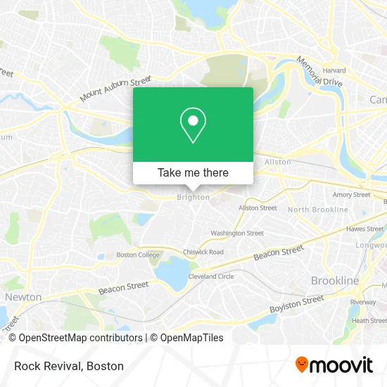
See Rock Revival, Boston, on the map
Public Transit to Rock Revival in Boston
Wondering how to get to Rock Revival in Boston? Moovit helps you find the best way to get to Rock Revival with step-by-step directions from the nearest public transit station.
Moovit provides free maps and live directions to help you navigate through your city. View schedules, routes, timetables, and find out how long does it take to get to Rock Revival in real time.
Looking for the nearest stop or station to Rock Revival? Check out this list of stops closest to your destination: Washington St @ Waldo Terr; 7 Winship St; Chestnut Hill Ave @ Academy Hill Rd; Chiswick Road.
Bus: 501, 57, 65, 66, 86.Train: FRAMINGHAM/WORCESTER.Subway: GREEN LINE B.
Want to see if there’s another route that gets you there at an earlier time? Moovit helps you find alternative routes or times. Get directions from and directions to Rock Revival easily from the Moovit App or Website.
We make riding to Rock Revival easy, which is why over 1.7 million users, including users in Boston, trust Moovit as the best app for public transit. You don’t need to download an individual bus app or train app, Moovit is your all-in-one transit app that helps you find the best bus time or train time available.
For information on prices of bus, subway and train, costs and ride fares to Rock Revival, please check the Moovit app.
Use the app to navigate to popular places including to the airport, hospital, stadium, grocery store, mall, coffee shop, school, college, and university.
Location: Boston
- Sapphire Masonry and Construction,
- Corrib Pub,
- Blue Yama,
- Martinez & Sons Construction,
- Right Choice Paving & Masonry,
- Alamo Garage Doors & Installation,
- MBTA Bus Stop | Market St & Washington St,
- Sunny Massage Spa,
- Brighton Center,
- Artango Dance School,
- Walgreens,
- Veronica Smith Senior Center (Victoria B. Smith Multi Service Senior Citizen Center),
- Studio 28,
- Brighton Common,
- Indigo Strategy,
- Master Shine,
- Mother Birth,
- Boston Public Library - Brighton Branch,
- Boston Public Library,
- Brighton
Places Near Rock Revival (Boston)
- Wang Theater, Boston,
- Massachusetts General Hospital, Boston,
- Cheers, Boston,
- Td Garden, Boston,
- Boston Medical Center, Boston,
- Quincy Market, Boston,
- North End, Boston,
- Seaport District, Boston,
- Faneuil Hall, Boston,
- Isabella Stewart Gardner Museum, Boston,
- Boston Convention & Exhibition Center, Boston,
- Museum Of Science, Boston,
- Boston Common, Boston,
- Leader Bank Pavilion (Leader Bank Pavillion), Boston,
- Wilbur Theatre, Boston,
- Mgm Music Hall, Boston,
- Prudential Center, Boston,
- Castle Island, Boston,
- House Of Blues, Boston,
- Boston Children's Hospital, Boston
How to get to popular places in Boston with public transit
Get around Boston by public transit!
Traveling around Boston has never been so easy. See step by step directions as you travel to any attraction, street or major public transit station. View bus and train schedules, arrival times, service alerts and detailed routes on a map, so you know exactly how to get to anywhere in Boston.
When traveling to any destination around Boston use Moovit's Live Directions with Get Off Notifications to know exactly where and how far to walk, how long to wait for your line, and how many stops are left. Moovit will alert you when it's time to get off — no need to constantly re-check whether yours is the next stop.
Wondering how to use public transit in Boston or how to pay for public transit in Boston? Moovit public transit app can help you navigate your way with public transit easily, and at minimum cost. It includes public transit fees, ticket prices, and costs. Looking for a map of Boston public transit lines? Moovit public transit app shows all public transit maps in Boston with all Bus, Train, Subway and Ferry routes and stops on an interactive map.
Boston has 4 transit type(s), including: Bus, Train, Subway and Ferry, operated by several transit agencies, including MBTA, Southeastern Regional Transit Authority, MetroWest Regional Transit Authority, Rhode Island Public Transit Authority, WRTA, Lowell Regional Transit Authority, Merrimack Valley Transit, Montachusett Regional Transit Authority, Cape Cod Regional Transit Authority, Brockton Area Transit Authority, Martha's Vineyard Transit Authority, the WAVE - Nantucket Regional Transit Authority, GATRA, Cape Ann Transportation Authority and Massport