Directions to Rockland Trust Bank (Boston) with public transportation
The following transit lines have routes that pass near Rockland Trust Bank
 Bus: 66, 70, 86.
- Train: FRAMINGHAM/WORCESTER.
- Subway: GREEN LINE B, RED LINE.
How to get to Rockland Trust Bank by bus?
Click on the bus route to see step by step directions with maps, line arrival times and updated time schedules.
From Massachusetts State House, Boston
36 minFrom Boston Black Falcon Cruise Terminal, Boston
45 minFrom Amtrak-Boston South Station, Boston
29 minFrom West Roxbury VA Medical Center, Boston
74 minFrom Tufts University, Medford
43 minFrom Newton-Wellesley Hospital, Newton
74 minFrom Newton Wellesley Hospital Green Building, Newton
74 minFrom VA Hospital, Boston
75 minFrom Malden Catholic High School, Malden
74 minFrom Faneuil Hall, Boston
38 min
How to get to Rockland Trust Bank by train?
Click on the train route to see step by step directions with maps, line arrival times and updated time schedules.
How to get to Rockland Trust Bank by subway?
Click on the subway route to see step by step directions with maps, line arrival times and updated time schedules.
Bus stops near Rockland Trust Bank in Boston
Subway station near Rockland Trust Bank in Boston
- Harvard Ave., 4 min walk,VIEW
Bus lines to Rockland Trust Bank in Boston
What are the closest stations to Rockland Trust Bank?
The closest stations to Rockland Trust Bank are:
- N Harvard St @ Empire St is 73 yards away, 1 min walk.
- Harvard Ave. is 308 yards away, 4 min walk.
- Western Ave @ N Harvard St is 437 yards away, 6 min walk.
- N Harvard St @ S Campus Dr is 475 yards away, 7 min walk.
Which bus lines stop near Rockland Trust Bank?
These bus lines stop near Rockland Trust Bank: 66, 70, 86.
Which train line stops near Rockland Trust Bank?
FRAMINGHAM/WORCESTER (#525 | Worcester)
Which subway lines stop near Rockland Trust Bank?
These subway lines stop near Rockland Trust Bank: GREEN LINE B, RED LINE.
What’s the nearest subway station to Rockland Trust Bank in Boston?
The nearest subway station to Rockland Trust Bank in Boston is Harvard Ave.. It’s a 4 min walk away.
What’s the nearest bus station to Rockland Trust Bank in Boston?
The nearest bus station to Rockland Trust Bank in Boston is N Harvard St @ Empire St. It’s a 1 min walk away.
What time is the first subway to Rockland Trust Bank in Boston?
The GREEN LINE B is the first subway that goes to Rockland Trust Bank in Boston. It stops nearby at 5:13 AM.
What time is the last subway to Rockland Trust Bank in Boston?
The GREEN LINE B is the last subway that goes to Rockland Trust Bank in Boston. It stops nearby at 2:27 AM.
What time is the first bus to Rockland Trust Bank in Boston?
The 70 is the first bus that goes to Rockland Trust Bank in Boston. It stops nearby at 4:31 AM.
What time is the last bus to Rockland Trust Bank in Boston?
The 66 is the last bus that goes to Rockland Trust Bank in Boston. It stops nearby at 2:29 AM.
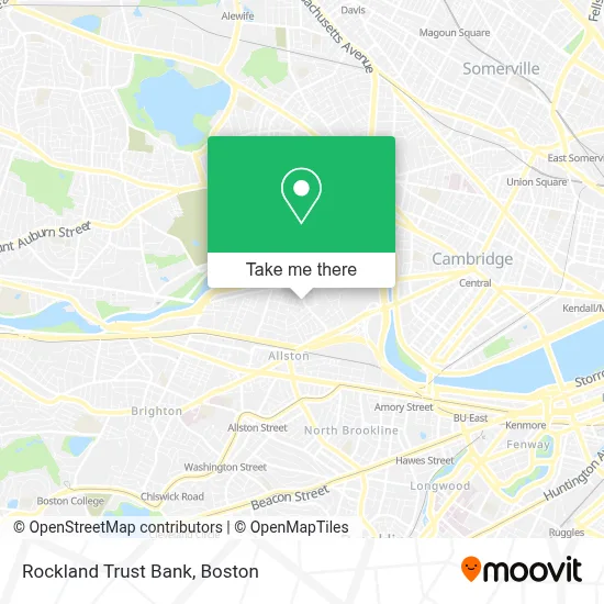
See Rockland Trust Bank, Boston, on the map
Public Transit to Rockland Trust Bank in Boston
Wondering how to get to Rockland Trust Bank in Boston? Moovit helps you find the best way to get to Rockland Trust Bank with step-by-step directions from the nearest public transit station.
Moovit provides free maps and live directions to help you navigate through your city. View schedules, routes, timetables, and find out how long does it take to get to Rockland Trust Bank in real time.
Looking for the nearest stop or station to Rockland Trust Bank? Check out this list of stops closest to your destination: N Harvard St @ Empire St; Harvard Ave.; Western Ave @ N Harvard St; N Harvard St @ S Campus Dr.
Bus: 66, 70, 86.Train: FRAMINGHAM/WORCESTER.Subway: GREEN LINE B, RED LINE.
Want to see if there’s another route that gets you there at an earlier time? Moovit helps you find alternative routes or times. Get directions from and directions to Rockland Trust Bank easily from the Moovit App or Website.
We make riding to Rockland Trust Bank easy, which is why over 1.7 million users, including users in Boston, trust Moovit as the best app for public transit. You don’t need to download an individual bus app or train app, Moovit is your all-in-one transit app that helps you find the best bus time or train time available.
For information on prices of bus, subway and train, costs and ride fares to Rockland Trust Bank, please check the Moovit app.
Use the app to navigate to popular places including to the airport, hospital, stadium, grocery store, mall, coffee shop, school, college, and university.
Rockland Trust Bank Address: 229 N Harvard St street in Boston
- Harvard Ed Portal,
- Trader Joe's,
- 219 Western Ave & N Harvard St (Continuum),
- Teele Hall (Harvard Business School),
- Continuum,
- Smith Park Pumptrack,
- Western Ave (western avenue and stadium),
- Office of University Publisher,
- Air Express Div Rea Express,
- William E. Smith Playground,
- Gardner Pilot Academy (Thomas Gardner School),
- Gordon Indoor Track- Harvard University,
- German International School Boston (GISBOS),
- St Anthony Catholic Church,
- Harvard University Science And Engineering Complex (Sec),
- Empire Records,
- Petco,
- Miki Miki Japanese Sushi Restaurant (Maki Maki Japanese Sushi and Seafood Buffet Restaurant),
- WBZ-TV ( CBS ),
- Cumnock Fields
Places Near Rockland Trust Bank (Boston)
- Seaport District, Boston,
- Prudential Center, Boston,
- Boston Children's Hospital, Boston,
- North End, Boston,
- Boston Medical Center, Boston,
- Mgm Music Hall, Boston,
- Cheers, Boston,
- Boston Convention & Exhibition Center, Boston,
- Faneuil Hall, Boston,
- Wang Theater, Boston,
- Massachusetts General Hospital, Boston,
- Museum Of Science, Boston,
- House Of Blues, Boston,
- Isabella Stewart Gardner Museum, Boston,
- Boston Common, Boston,
- Wilbur Theatre, Boston,
- Leader Bank Pavilion (Leader Bank Pavillion), Boston,
- Td Garden, Boston,
- Castle Island, Boston,
- Quincy Market, Boston
How to get to popular places in Boston with public transit
Get around Boston by public transit!
Traveling around Boston has never been so easy. See step by step directions as you travel to any attraction, street or major public transit station. View bus and train schedules, arrival times, service alerts and detailed routes on a map, so you know exactly how to get to anywhere in Boston.
When traveling to any destination around Boston use Moovit's Live Directions with Get Off Notifications to know exactly where and how far to walk, how long to wait for your line, and how many stops are left. Moovit will alert you when it's time to get off — no need to constantly re-check whether yours is the next stop.
Wondering how to use public transit in Boston or how to pay for public transit in Boston? Moovit public transit app can help you navigate your way with public transit easily, and at minimum cost. It includes public transit fees, ticket prices, and costs. Looking for a map of Boston public transit lines? Moovit public transit app shows all public transit maps in Boston with all Bus, Train, Subway and Ferry routes and stops on an interactive map.
Boston has 4 transit type(s), including: Bus, Train, Subway and Ferry, operated by several transit agencies, including MBTA, Southeastern Regional Transit Authority, MetroWest Regional Transit Authority, Rhode Island Public Transit Authority, WRTA, Lowell Regional Transit Authority, Merrimack Valley Transit, Montachusett Regional Transit Authority, Cape Cod Regional Transit Authority, Brockton Area Transit Authority, Martha's Vineyard Transit Authority, the WAVE - Nantucket Regional Transit Authority, GATRA, Cape Ann Transportation Authority and Massport