Directions to Rocky's Ace Hardware (Gloucester) with public transportation
The following transit lines have routes that pass near Rocky's Ace Hardware
How to get to Rocky's Ace Hardware by bus?
Click on the bus route to see step by step directions with maps, line arrival times and updated time schedules.
Bus stops near Rocky's Ace Hardware in Gloucester
Bus lines to Rocky's Ace Hardware in Gloucester
What are the closest stations to Rocky's Ace Hardware?
The closest stations to Rocky's Ace Hardware are:
- Market Basket (Glaucester) is 177 yards away, 3 min walk.
- Gloucester Crossing is 710 yards away, 9 min walk.
Which bus lines stop near Rocky's Ace Hardware?
These bus lines stop near Rocky's Ace Hardware: GLOUCESTER CROSSING/BLACKBURN EXPRESS, GLOUCESTER CROSSING/BUSINESS EXPRESS.
What’s the nearest bus station to Rocky's Ace Hardware in Gloucester?
The nearest bus station to Rocky's Ace Hardware in Gloucester is Market Basket (Glaucester). It’s a 3 min walk away.
What time is the first bus to Rocky's Ace Hardware in Gloucester?
The GLOUCESTER CROSSING/BUSINESS EXPRESS is the first bus that goes to Rocky's Ace Hardware in Gloucester. It stops nearby at 6:20 AM.
What time is the last bus to Rocky's Ace Hardware in Gloucester?
The GLOUCESTER CROSSING/BUSINESS EXPRESS is the last bus that goes to Rocky's Ace Hardware in Gloucester. It stops nearby at 6:16 PM.
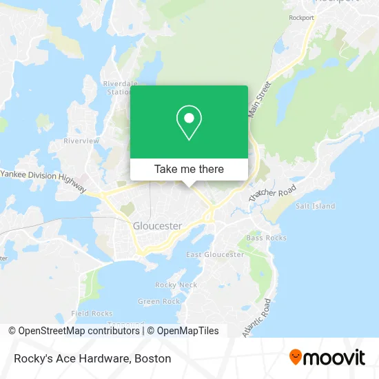
See Rocky's Ace Hardware, Gloucester, on the map
Public Transit to Rocky's Ace Hardware in Gloucester
Wondering how to get to Rocky's Ace Hardware in Gloucester? Moovit helps you find the best way to get to Rocky's Ace Hardware with step-by-step directions from the nearest public transit station.
Moovit provides free maps and live directions to help you navigate through your city. View schedules, routes, timetables, and find out how long does it take to get to Rocky's Ace Hardware in real time.
Looking for the nearest stop or station to Rocky's Ace Hardware? Check out this list of stops closest to your destination: Market Basket (Glaucester); Gloucester Crossing.
Bus: GLOUCESTER CROSSING/BLACKBURN EXPRESS, GLOUCESTER CROSSING/BUSINESS EXPRESS.
Want to see if there’s another route that gets you there at an earlier time? Moovit helps you find alternative routes or times. Get directions from and directions to Rocky's Ace Hardware easily from the Moovit App or Website.
We make riding to Rocky's Ace Hardware easy, which is why over 1.7 million users, including users in Gloucester, trust Moovit as the best app for public transit. You don’t need to download an individual bus app or train app, Moovit is your all-in-one transit app that helps you find the best bus time or train time available.
For information on prices of bus and train, costs and ride fares to Rocky's Ace Hardware, please check the Moovit app.
Use the app to navigate to popular places including to the airport, hospital, stadium, grocery store, mall, coffee shop, school, college, and university.
Rocky's Ace Hardware Address: 231 Gloucester Crossing Rd street in Gloucester
- Starbucks,
- Cape Ann Fresh Catch,
- Cape Ann Travel Service,
- Vitillo-USA,
- Autozone Auto Parts,
- Personal Injury Gloucester Lawyer,
- Individual Plans Medicare,
- Harbor 9 Golf,
- Frank Long Distance Moves,
- Physical Therapy North,
- Gloucester Medicare Insurance,
- Salem Five Bank,
- Gloucester Long Distance Movers,
- WW Weight Watchers,
- Angelica Seafoods,
- Davis Standard,
- Ocean Breeze Cultivators,
- Online Hearing Test,
- Physical Therapy Insurances Accepted Therapist,
- Jrog's Perch
Places Near Rocky's Ace Hardware (Gloucester)
- Boston Common, Boston,
- Boston Medical Center, Boston,
- Td Garden, Boston,
- Seaport District, Boston,
- Massachusetts General Hospital, Boston,
- Castle Island, Boston,
- Museum Of Science, Boston,
- Boston Children's Hospital, Boston,
- Wilbur Theatre, Boston,
- Quincy Market, Boston,
- Cheers, Boston,
- House Of Blues, Boston,
- Wang Theater, Boston,
- Leader Bank Pavilion (Leader Bank Pavillion), Boston,
- Mgm Music Hall, Boston,
- Prudential Center, Boston,
- Isabella Stewart Gardner Museum, Boston,
- North End, Boston,
- Faneuil Hall, Boston,
- Boston Convention & Exhibition Center, Boston
How to get to popular places in Boston with public transit
Get around Gloucester by public transit!
Traveling around Gloucester has never been so easy. See step by step directions as you travel to any attraction, street or major public transit station. View bus and train schedules, arrival times, service alerts and detailed routes on a map, so you know exactly how to get to anywhere in Gloucester.
When traveling to any destination around Gloucester use Moovit's Live Directions with Get Off Notifications to know exactly where and how far to walk, how long to wait for your line, and how many stops are left. Moovit will alert you when it's time to get off — no need to constantly re-check whether yours is the next stop.
Wondering how to use public transit in Gloucester or how to pay for public transit in Gloucester? Moovit public transit app can help you navigate your way with public transit easily, and at minimum cost. It includes public transit fees, ticket prices, and costs. Looking for a map of Gloucester public transit lines? Moovit public transit app shows all public transit maps in Gloucester with all Bus, Train, Subway and Ferry routes and stops on an interactive map.
Boston has 4 transit type(s), including: Bus, Train, Subway and Ferry, operated by several transit agencies, including MBTA, Southeastern Regional Transit Authority, MetroWest Regional Transit Authority, Rhode Island Public Transit Authority, WRTA, Lowell Regional Transit Authority, Merrimack Valley Transit, Montachusett Regional Transit Authority, Cape Cod Regional Transit Authority, Brockton Area Transit Authority, Martha's Vineyard Transit Authority, the WAVE - Nantucket Regional Transit Authority, GATRA, Cape Ann Transportation Authority and Massport