Directions to Rodeio Country Quatro Barras (São José Dos Pinhais) with public transportation
The following transit lines have routes that pass near Rodeio Country Quatro Barras
How to get to Rodeio Country Quatro Barras by bus?
Click on the bus route to see step by step directions with maps, line arrival times and updated time schedules.
From Rua Paulo Turkiewicz, Tarumã
83 minFrom Unidade De Saúde Boqueirão, Boqueirão
50 minFrom Barro Preto, São José Dos Pinhais
57 minFrom Rua Salvador Ferrante, Boqueirão
47 minFrom Jardim Botânico, Jardim Botânico
52 minFrom Avenida Presidente Affonso Camargo, Cajuru
70 minFrom Rua Barão de Santo Ângelo, Xaxim
77 minFrom Rua Konrad Adenauer, Tarumã
84 minFrom Terminal Boqueirão, Boqueirão
33 minFrom Rua Izaac Ferreira da Cruz, Sítio Cercado
60 min
Bus stops near Rodeio Country Quatro Barras in São José Dos Pinhais
- R. Lourenço José De Paula, 1894, 4 min walk,VIEW
- R. Lourenço José De Paula, 2279, 5 min walk,VIEW
- Casa Do Papai Noel (Almirante Alexandrino), 7 min walk,VIEW
- R. Professora Marieta De Souza E Silva, 2002, 7 min walk,VIEW
- Av. Rui Barbosa, 5068, 7 min walk,VIEW
- Casa Do Papai Noel (Almirante Alexandrino, 1253), 7 min walk,VIEW
Bus lines to Rodeio Country Quatro Barras in São José Dos Pinhais
- 143 T. AFONSO PENA / INDEPENDÊNCIA, Terminal Afonso Pena ↺ Independência (Circular),VIEW
- 120 FÁTIMA / RIACHO DOCE, Fátima / Riacho Doce → Terminal Afonso Pena,VIEW
- 125 RENAULT, Terminal Afonso Pena → Renault,VIEW
- 130 T. AFONSO PENA / JUREMA, Terminal Afonso Pena → Jurema,VIEW
- 530 BAIRRO A BAIRRO - 2, Terminal Afonso Pena → Terminal Central São José,VIEW
- 154 PRIMAVERA, Terminal Afonso Pena ↺ Primavera (Circular),VIEW
- E01 URANO / GUADALUPE, Terminal Afonso Pena → Terminal Guadalupe,VIEW
- E11 AFONSO PENA / BOQUEIRÃO, Terminal Boqueirão → Terminal Afonso Pena,VIEW
- 101 T. AFONSO PENA / T. CENTRAL, Sentido Anti-horário (via SENAC),VIEW
- 109 VILA BOND, Terminal Afonso Pena → Vila Bond,VIEW
- 115 INÁ - APOLO / AVIAÇÃO, Sentido Horário,VIEW
- 200 PIT PRAÇA DA JUVENTUDE / CENTRO (VIA IZABEL REDENTORA), Sentido Horário (recolhe Terminal Central),VIEW
- 531 BAIRRO A BAIRRO - 1, Terminal Central São José → Terminal Afonso Pena,VIEW
What are the closest stations to Rodeio Country Quatro Barras?
The closest stations to Rodeio Country Quatro Barras are:
- R. Lourenço José De Paula, 1894 is 260 meters away, 4 min walk.
- R. Lourenço José De Paula, 2279 is 311 meters away, 5 min walk.
- Casa Do Papai Noel (Almirante Alexandrino) is 458 meters away, 7 min walk.
- R. Professora Marieta De Souza E Silva, 2002 is 485 meters away, 7 min walk.
- Av. Rui Barbosa, 5068 is 501 meters away, 7 min walk.
- Casa Do Papai Noel (Almirante Alexandrino, 1253) is 514 meters away, 7 min walk.
Which bus lines stop near Rodeio Country Quatro Barras?
These bus lines stop near Rodeio Country Quatro Barras: 200 PIT PRAÇA DA JUVENTUDE / CENTRO (VIA IZABEL REDENTORA), E01 URANO / GUADALUPE, E11 AFONSO PENA / BOQUEIRÃO.
What’s the nearest bus station to Rodeio Country Quatro Barras in São José Dos Pinhais?
The nearest bus station to Rodeio Country Quatro Barras in São José Dos Pinhais is R. Lourenço José De Paula, 1894. It’s a 4 min walk away.
What time is the first bus to Rodeio Country Quatro Barras in São José Dos Pinhais?
The 120 FÁTIMA / RIACHO DOCE is the first bus that goes to Rodeio Country Quatro Barras in São José Dos Pinhais. It stops nearby at 4:34 AM.
What time is the last bus to Rodeio Country Quatro Barras in São José Dos Pinhais?
The 143 T. AFONSO PENA / INDEPENDÊNCIA is the last bus that goes to Rodeio Country Quatro Barras in São José Dos Pinhais. It stops nearby at 1:02 AM.
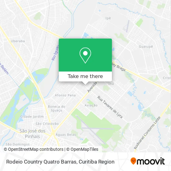
See Rodeio Country Quatro Barras, São José Dos Pinhais, on the map
Public Transit to Rodeio Country Quatro Barras in São José Dos Pinhais
Wondering how to get to Rodeio Country Quatro Barras in São José Dos Pinhais? Moovit helps you find the best way to get to Rodeio Country Quatro Barras with step-by-step directions from the nearest public transit station.
Moovit provides free maps and live directions to help you navigate through your city. View schedules, routes, timetables, and find out how long does it take to get to Rodeio Country Quatro Barras in real time.
Looking for the nearest stop or station to Rodeio Country Quatro Barras? Check out this list of stops closest to your destination: R. Lourenço José De Paula; R. Lourenço José De Paula; Casa Do Papai Noel (Almirante Alexandrino); R. Professora Marieta De Souza E Silva; Av. Rui Barbosa; Casa Do Papai Noel (Almirante Alexandrino.
Bus: 200 PIT PRAÇA DA JUVENTUDE / CENTRO (VIA IZABEL REDENTORA), E01 URANO / GUADALUPE, E11 AFONSO PENA / BOQUEIRÃO, 143 T. AFONSO PENA / INDEPENDÊNCIA, 120 FÁTIMA / RIACHO DOCE, 125 RENAULT, 130 T. AFONSO PENA / JUREMA, 530 BAIRRO A BAIRRO - 2, 154 PRIMAVERA, 101 T. AFONSO PENA / T. CENTRAL, 109 VILA BOND, 115 INÁ - APOLO / AVIAÇÃO, 531 BAIRRO A BAIRRO - 1.
Want to see if there’s another route that gets you there at an earlier time? Moovit helps you find alternative routes or times. Get directions from and directions to Rodeio Country Quatro Barras easily from the Moovit App or Website.
We make riding to Rodeio Country Quatro Barras easy, which is why over 1.5 million users, including users in São José Dos Pinhais, trust Moovit as the best app for public transit. You don’t need to download an individual bus app or train app, Moovit is your all-in-one transit app that helps you find the best bus time or train time available.
For information on prices of bus, costs and ride fares to Rodeio Country Quatro Barras, please check the Moovit app.
Use the app to navigate to popular places including to the airport, hospital, stadium, grocery store, mall, coffee shop, school, college, and university.
Location: São José Dos Pinhais, Curitiba Region
- Aramesul Comercio de Arames,
- Rua Genoveva kuboski kapuchin 759,
- Infinity Boutique,
- Rjml Arte Em Couro,
- Rua Boleslau Sochaczewski 75,
- Comasec Comercio de Madeiras,
- Lastro Industria Metalurgica,
- Nandacar-Locacao de Veiculos e Equipamentos,
- Escola Educat,
- RR Centro Automotivo,
- Roleparts Comercio de Pecas P Tratores,
- Apr Comercios Em Geral,
- Rua Leopoldo Précoma 645,
- Vondel Industria e Comercio de Mquinas e Componentes,
- Rua Nicolau Pampuch 210,
- Associação De Moradores Do Conjunto Urano,
- Clinica Cisabem,
- Grupo Lufer,
- Master Car Multi Marcas,
- Loterica
Places Near Rodeio Country Quatro Barras (São José Dos Pinhais)
- Hospital Madalena Sofia, Bairro Alto,
- Hospital do Rocio, Campo,
- Shopping Estação, Rebouças,
- Park Shopping Barigüi, Mossunguê,
- Hospital Da Cruz Vermelha, Batel,
- Rua General Mário Tourinho, Campina Do Siqueira,
- Parque Barigui, Mercês,
- Arena Da Baixada - Curitiba,
- Hospital Erasto Gaertner, Jardim Das Américas,
- Jockey Plaza Shopping Center, Tarumã,
- Jardim Botânico de Curitiba PR, Centro,
- Hospital Angelina Caron, Campina Grande Do Sul,
- Hospital Universitário Evangélico de Curitiba, Bigorrilho,
- Pontifícia Universidade Católica do Paraná (PUCPR), Prado Velho,
- Shopping Palladium, Portão,
- Campo Largo, Campo,
- Rua Martim Afonso 558, Mercês,
- Hospital Nossa Senhora Das Graças, Mercês,
- Hospital de Clínicas (HC - UFPR), Centro,
- Hhhhh, Fazendinha
How to get to popular places in Curitiba Region with public transit
Get around São José Dos Pinhais by public transit!
Traveling around São José Dos Pinhais has never been so easy. See step by step directions as you travel to any attraction, street or major public transit station. View bus and train schedules, arrival times, service alerts and detailed routes on a map, so you know exactly how to get to anywhere in São José Dos Pinhais.
When traveling to any destination around São José Dos Pinhais use Moovit's Live Directions with Get Off Notifications to know exactly where and how far to walk, how long to wait for your line, and how many stops are left. Moovit will alert you when it's time to get off — no need to constantly re-check whether yours is the next stop.
Wondering how to use public transit in São José Dos Pinhais or how to pay for public transit in São José Dos Pinhais? Moovit public transit app can help you navigate your way with public transit easily, and at minimum cost. It includes public transit fees, ticket prices, and costs. Looking for a map of São José Dos Pinhais public transit lines? Moovit public transit app shows all public transit maps in São José Dos Pinhais with all Bus and Cable Car routes and stops on an interactive map.
Curitiba Region has 2 transit type(s), including: Bus and Cable Car, operated by several transit agencies, including Sistema Integrado de Mobilidade (URBS), Sistema Integrado de Mobilidade (AMEP), URBS (Cartões bancários e Dinheiro), URBS (Cartões bancários / Cartão URBS), AMEP (Cartões bancários / Cartão MetroCard), AMEP (Cartões bancários / Cartão MetroCard / Dinheiro), Viação Colombo (Dinheiro), TRIAR (Cartão TRIAR / Dinheiro), Empresa Curitiba Cerro Azul (Dinheiro), Expresso Nossa Senhora da Penha (Dinheiro), Empresa Campo Alto Tijucas (Dinheiro), Auto Viação São José (Cartão VEM / Dinheiro), BRT S/A (Cartão VEM / Dinheiro), TransPiedade (Cartão Cidadão / Dinheiro) and Oceânica Sul (Cartão Transporte / Dinheiro)