How to get to Rodriguez Sneakers by bus?
Click on the bus route to see step by step directions with maps, line arrival times and updated time schedules.
From Sonia, Boston
92 minFrom Aloft-Boston Seaport Dist, Boston
36 minFrom New Balance, Boston
87 minFrom Roadrunner, Boston
88 minFrom Castle Island, Boston
64 minFrom Spaulding Rehabilitation Center, Boston
87 minFrom Cambridge Health Alliance (CHA), Cambridge
60 minFrom Regent Theatre, Arlington
73 minFrom Old Town Trolley Tours of Boston, Boston
40 minFrom Maggiano's Little Italy, Boston
41 min
How to get to Rodriguez Sneakers by train?
Click on the train route to see step by step directions with maps, line arrival times and updated time schedules.
How to get to Rodriguez Sneakers by subway?
Click on the subway route to see step by step directions with maps, line arrival times and updated time schedules.
From Sonia, Boston
94 minFrom Aloft-Boston Seaport Dist, Boston
71 minFrom New Balance, Boston
97 minFrom Roadrunner, Boston
96 minFrom Spaulding Rehabilitation Center, Boston
97 minFrom Cambridge Health Alliance (CHA), Cambridge
69 minFrom Old Town Trolley Tours of Boston, Boston
50 minFrom Maggiano's Little Italy, Boston
51 min
Bus stop near Rodriguez Sneakers in Chelsea
- Washington Ave @ Broadway, 1 min walk,VIEW
Train station near Rodriguez Sneakers in Chelsea
- Chelsea, 10 min walk,VIEW
Subway station near Rodriguez Sneakers in Chelsea
- Wood Island, 36 min walk,VIEW
Bus lines to Rodriguez Sneakers in Chelsea
What are the closest stations to Rodriguez Sneakers?
The closest stations to Rodriguez Sneakers are:
- Washington Ave @ Broadway is 78 yards away, 1 min walk.
- Chelsea is 856 yards away, 10 min walk.
- Wood Island is 3006 yards away, 36 min walk.
Which bus lines stop near Rodriguez Sneakers?
These bus lines stop near Rodriguez Sneakers: 104, 111, SL3.
Which train line stops near Rodriguez Sneakers?
NEWBURYPORT/ROCKPORT (#27 | Rockport)
Which subway line stops near Rodriguez Sneakers?
BLUE LINE (Wonderland)
What’s the nearest train station to Rodriguez Sneakers in Chelsea?
The nearest train station to Rodriguez Sneakers in Chelsea is Chelsea. It’s a 10 min walk away.
What’s the nearest bus station to Rodriguez Sneakers in Chelsea?
The nearest bus station to Rodriguez Sneakers in Chelsea is Washington Ave @ Broadway. It’s a 1 min walk away.
What time is the first subway to Rodriguez Sneakers in Chelsea?
The BLUE LINE is the first subway that goes to Rodriguez Sneakers in Chelsea. It stops nearby at 5:08 AM.
What time is the last subway to Rodriguez Sneakers in Chelsea?
The BLUE LINE is the last subway that goes to Rodriguez Sneakers in Chelsea. It stops nearby at 2:03 AM.
What time is the first train to Rodriguez Sneakers in Chelsea?
The NEWBURYPORT/ROCKPORT is the first train that goes to Rodriguez Sneakers in Chelsea. It stops nearby at 5:40 AM.
What time is the last train to Rodriguez Sneakers in Chelsea?
The NEWBURYPORT/ROCKPORT is the last train that goes to Rodriguez Sneakers in Chelsea. It stops nearby at 12:06 AM.
What time is the first bus to Rodriguez Sneakers in Chelsea?
The 104 is the first bus that goes to Rodriguez Sneakers in Chelsea. It stops nearby at 4:31 AM.
What time is the last bus to Rodriguez Sneakers in Chelsea?
The 111 is the last bus that goes to Rodriguez Sneakers in Chelsea. It stops nearby at 2:28 AM.
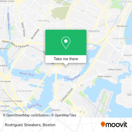
See Rodriguez Sneakers, Chelsea, on the map
Public Transit to Rodriguez Sneakers in Chelsea
Wondering how to get to Rodriguez Sneakers in Chelsea? Moovit helps you find the best way to get to Rodriguez Sneakers with step-by-step directions from the nearest public transit station.
Moovit provides free maps and live directions to help you navigate through your city. View schedules, routes, timetables, and find out how long does it take to get to Rodriguez Sneakers in real time.
Looking for the nearest stop or station to Rodriguez Sneakers? Check out this list of stops closest to your destination: Washington Ave @ Broadway; Chelsea; Wood Island.
Bus: 104, 111, SL3, 112, 114, 116.Train: NEWBURYPORT/ROCKPORT.Subway: BLUE LINE.
Want to see if there’s another route that gets you there at an earlier time? Moovit helps you find alternative routes or times. Get directions from and directions to Rodriguez Sneakers easily from the Moovit App or Website.
We make riding to Rodriguez Sneakers easy, which is why over 1.7 million users, including users in Chelsea, trust Moovit as the best app for public transit. You don’t need to download an individual bus app or train app, Moovit is your all-in-one transit app that helps you find the best bus time or train time available.
For information on prices of bus, subway and train, costs and ride fares to Rodriguez Sneakers, please check the Moovit app.
Use the app to navigate to popular places including to the airport, hospital, stadium, grocery store, mall, coffee shop, school, college, and university.
Rodriguez Sneakers Address: 600 Broadway street in Chelsea
- Chelsea MA USA,
- Chelsea Community Garden,
- Brightline Management,
- Iglesia Vida Nueva,
- BHCC Shuttle Bus,
- Bellingham Fruit & Pro,
- F & S Djs',
- Bunker Hill Community College Chelsea,
- Las Orquideas Market,
- Como en Casa Chelsea,
- Stop and Compare Office,
- Restaurant El Pecas,
- Flag Pharmacy,
- Cataldo Ambulance,
- Transportes Lorenzana,
- Veteran Services,
- Bellingham Square,
- Chelsea Discount Stop,
- Queens Beauty Salon,
- 4th St
Places Near Rodriguez Sneakers (Chelsea)
- Quincy Market, Boston,
- Museum Of Science, Boston,
- Cheers, Boston,
- North End, Boston,
- Castle Island, Boston,
- Seaport District, Boston,
- Wilbur Theatre, Boston,
- Td Garden, Boston,
- Mgm Music Hall, Boston,
- Isabella Stewart Gardner Museum, Boston,
- Boston Children's Hospital, Boston,
- Boston Medical Center, Boston,
- Wang Theater, Boston,
- House Of Blues, Boston,
- Prudential Center, Boston,
- Faneuil Hall, Boston,
- Leader Bank Pavilion (Leader Bank Pavillion), Boston,
- Boston Common, Boston,
- Massachusetts General Hospital, Boston,
- Boston Convention & Exhibition Center, Boston
How to get to popular places in Boston with public transit
Get around Chelsea by public transit!
Traveling around Chelsea has never been so easy. See step by step directions as you travel to any attraction, street or major public transit station. View bus and train schedules, arrival times, service alerts and detailed routes on a map, so you know exactly how to get to anywhere in Chelsea.
When traveling to any destination around Chelsea use Moovit's Live Directions with Get Off Notifications to know exactly where and how far to walk, how long to wait for your line, and how many stops are left. Moovit will alert you when it's time to get off — no need to constantly re-check whether yours is the next stop.
Wondering how to use public transit in Chelsea or how to pay for public transit in Chelsea? Moovit public transit app can help you navigate your way with public transit easily, and at minimum cost. It includes public transit fees, ticket prices, and costs. Looking for a map of Chelsea public transit lines? Moovit public transit app shows all public transit maps in Chelsea with all Bus, Train, Subway and Ferry routes and stops on an interactive map.
Boston has 4 transit type(s), including: Bus, Train, Subway and Ferry, operated by several transit agencies, including MBTA, Southeastern Regional Transit Authority, MetroWest Regional Transit Authority, Rhode Island Public Transit Authority, WRTA, Lowell Regional Transit Authority, Merrimack Valley Transit, Montachusett Regional Transit Authority, Cape Cod Regional Transit Authority, Brockton Area Transit Authority, Martha's Vineyard Transit Authority, the WAVE - Nantucket Regional Transit Authority, GATRA, Cape Ann Transportation Authority and Massport