Directions to Roju Delicias (Almirante Tamandaré) with public transportation
The following transit lines have routes that pass near Roju Delicias
How to get to Roju Delicias by bus?
Click on the bus route to see step by step directions with maps, line arrival times and updated time schedules.
From Santa Quitéria, Santa Quitéria
75 minFrom Rua Doutor Pedrosa, Centro
49 minFrom Avenida Sete de Setembro 6665, Seminário
60 minFrom Rua 24 de Maio, Rebouças
54 minFrom Rua Alferes Poli, Rebouças
53 minFrom Rua Lysimaco Ferreira da Costa 355, Centro Cívico
52 minFrom Avenida República Argentina 1336, Vila Izabel
58 minFrom Rua Nunes Machado, Rebouças
60 minFrom Rua Jacarezinho, Mercês
35 minFrom Atuba, Atuba
62 min
Bus stops near Roju Delicias in Almirante Tamandaré
Bus lines to Roju Delicias in Almirante Tamandaré
What are the closest stations to Roju Delicias?
The closest stations to Roju Delicias are:
- Rua Das Laranjeiras, 2301-2313 is 22 meters away, 1 min walk.
- Rua José Tomás, 359 is 550 meters away, 8 min walk.
Which bus lines stop near Roju Delicias?
These bus lines stop near Roju Delicias: 924 SANTA FELICIDADE / SANTA CÂNDIDA, A77 TANGUÁ / GUADALUPE.
What’s the nearest bus station to Roju Delicias in Almirante Tamandaré?
The nearest bus station to Roju Delicias in Almirante Tamandaré is Rua Das Laranjeiras, 2301-2313. It’s a 1 min walk away.
What time is the first bus to Roju Delicias in Almirante Tamandaré?
The A77 TANGUÁ / GUADALUPE is the first bus that goes to Roju Delicias in Almirante Tamandaré. It stops nearby at 5:15 AM.
What time is the last bus to Roju Delicias in Almirante Tamandaré?
The A80 TANGUÁ (VILA MARTA) / GUADALUPE is the last bus that goes to Roju Delicias in Almirante Tamandaré. It stops nearby at 12:49 AM.
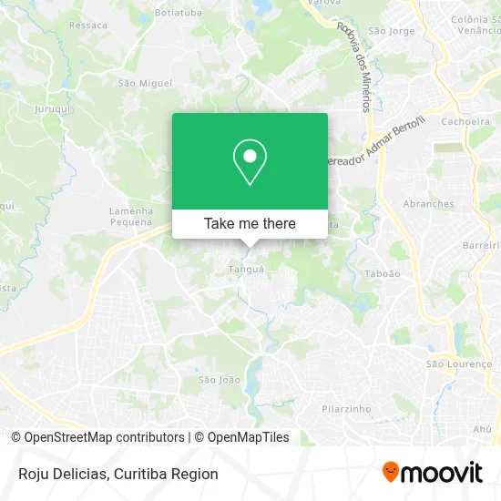
See Roju Delicias, Almirante Tamandaré, on the map
Public Transit to Roju Delicias in Almirante Tamandaré
Wondering how to get to Roju Delicias in Almirante Tamandaré? Moovit helps you find the best way to get to Roju Delicias with step-by-step directions from the nearest public transit station.
Moovit provides free maps and live directions to help you navigate through your city. View schedules, routes, timetables, and find out how long does it take to get to Roju Delicias in real time.
Looking for the nearest stop or station to Roju Delicias? Check out this list of stops closest to your destination: Rua Das Laranjeiras; Rua José Tomás.
Bus: 924 SANTA FELICIDADE / SANTA CÂNDIDA, A77 TANGUÁ / GUADALUPE, A22 TANGUÁ / TAMANDARÉ, A80 TANGUÁ (VILA MARTA) / GUADALUPE, A78 VILA MARTA / PRAÇA 19.
Want to see if there’s another route that gets you there at an earlier time? Moovit helps you find alternative routes or times. Get directions from and directions to Roju Delicias easily from the Moovit App or Website.
We make riding to Roju Delicias easy, which is why over 1.5 million users, including users in Almirante Tamandaré, trust Moovit as the best app for public transit. You don’t need to download an individual bus app or train app, Moovit is your all-in-one transit app that helps you find the best bus time or train time available.
For information on prices of bus, costs and ride fares to Roju Delicias, please check the Moovit app.
Use the app to navigate to popular places including to the airport, hospital, stadium, grocery store, mall, coffee shop, school, college, and university.
Roju Delicias Address: Rua Professor Alberto Krause, 2275 Tanguá Almirante Tamandaré-PR 83508-500 street in Almirante Tamandaré
- Serralheria Ferreira,
- Tabacaria Tangua,
- Valdemar P Silva,
- Marinoni Comercio de Gas,
- Hot Dog,
- Infomax, O Máximo Em Tecnologia,
- Jhafy Distribuidora,
- Natupharma - Farmácia de Manipulação,
- Congregação das Testemunhas de Jesus no Brasil,
- Comunidade Testemunhas de Jesus,
- Distribuidora and Mercearia Schmidt Ltda,
- Correios,
- Rua Professor Alberto Krause 2114,
- Tangua Serviços Administrativos,
- Rua Frei Caneca,
- Igreja Cristã Atos II,
- Unidade de Saúde Tanguá,
- Bar10e20,
- Sas Distribuidora de Produtos Para Açougue,
- Lr Assistência
Places Near Roju Delicias (Almirante Tamandaré)
- Rua General Mário Tourinho, Campina Do Siqueira,
- Campo Largo, Campo,
- Hospital Universitário Evangélico de Curitiba, Bigorrilho,
- Jockey Plaza Shopping Center, Tarumã,
- Shopping Estação, Rebouças,
- Jardim Botânico de Curitiba PR, Centro,
- Hospital de Clínicas (HC - UFPR), Centro,
- Hospital Da Cruz Vermelha, Batel,
- Hospital Angelina Caron, Campina Grande Do Sul,
- Rua Martim Afonso 558, Mercês,
- Pontifícia Universidade Católica do Paraná (PUCPR), Prado Velho,
- Park Shopping Barigüi, Mossunguê,
- Parque Barigui, Mercês,
- Hospital do Rocio, Campo,
- Hhhhh, Fazendinha,
- Arena Da Baixada - Curitiba,
- Hospital Madalena Sofia, Bairro Alto,
- Hospital Nossa Senhora Das Graças, Mercês,
- Shopping Palladium, Portão,
- Hospital Erasto Gaertner, Jardim Das Américas
How to get to popular places in Curitiba Region with public transit
Get around Almirante Tamandaré by public transit!
Traveling around Almirante Tamandaré has never been so easy. See step by step directions as you travel to any attraction, street or major public transit station. View bus and train schedules, arrival times, service alerts and detailed routes on a map, so you know exactly how to get to anywhere in Almirante Tamandaré.
When traveling to any destination around Almirante Tamandaré use Moovit's Live Directions with Get Off Notifications to know exactly where and how far to walk, how long to wait for your line, and how many stops are left. Moovit will alert you when it's time to get off — no need to constantly re-check whether yours is the next stop.
Wondering how to use public transit in Almirante Tamandaré or how to pay for public transit in Almirante Tamandaré? Moovit public transit app can help you navigate your way with public transit easily, and at minimum cost. It includes public transit fees, ticket prices, and costs. Looking for a map of Almirante Tamandaré public transit lines? Moovit public transit app shows all public transit maps in Almirante Tamandaré with all Bus and Cable Car routes and stops on an interactive map.
Curitiba Region has 2 transit type(s), including: Bus and Cable Car, operated by several transit agencies, including Sistema Integrado de Mobilidade (URBS), Sistema Integrado de Mobilidade (AMEP), URBS (Cartões bancários e Dinheiro), URBS (Cartões bancários / Cartão URBS), AMEP (Cartões bancários / Cartão MetroCard), AMEP (Cartões bancários / Cartão MetroCard / Dinheiro), Viação Colombo (Dinheiro), TRIAR (Cartão TRIAR / Dinheiro), Empresa Curitiba Cerro Azul (Dinheiro), Expresso Nossa Senhora da Penha (Dinheiro), Empresa Campo Alto Tijucas (Dinheiro), Auto Viação São José (Cartão VEM / Dinheiro), BRT S/A (Cartão VEM / Dinheiro), TransPiedade (Cartão Cidadão / Dinheiro) and Oceânica Sul (Cartão Transporte / Dinheiro)