Directions to Rolando Esportes (Uberaba) with public transportation
The following transit lines have routes that pass near Rolando Esportes
How to get to Rolando Esportes by bus?
Click on the bus route to see step by step directions with maps, line arrival times and updated time schedules.
From Gerar, Centro
39 minFrom Avenida Monteiro Tourinho 1506, Atuba
53 minFrom Rua Paulo Gorski, Mossunguê
54 minFrom Rua Flávio Dallegrave, Boa Vista
55 minFrom Rua João Chede, Cic
67 minFrom São Francisco, São Francisco
45 minFrom Rua Desembargador Hugo Simas, Vista Alegre
57 minFrom COREN-PR, Centro
40 minFrom Ginásio do Tarumã, Tarumã
47 minFrom Curitiba, Centro
41 min
Bus stops near Rolando Esportes in Uberaba
Bus lines to Rolando Esportes in Uberaba
- 471 VILA SÃO PAULO, Praça Rui Barbosa → Vila São Paulo,VIEW
- 188 MAD. PILARZINHO / UBERABA, Praça Rui Barbosa ↺ Uberaba (Circular),VIEW
- 338 CENTENÁRIO / HAUER, Terminal Hauer → Terminal Centenário,VIEW
- 472 UBERABA, Praça Rui Barbosa → Uberaba,VIEW
- X14 REFORÇO HAUER, Marumbi → Terminal Hauer,VIEW
- 516 CANAL BELÉM / SALGADO FILHO, Terminal Hauer ↻ Canal Belém (Circular),VIEW
- E01 URANO / GUADALUPE, Terminal Guadalupe → Terminal Afonso Pena,VIEW
- E67 BRAGA / CURITIBA (VIA OURO FINO), Terminal Guadalupe ↺ Braga / Ouro Fino (Circular),VIEW
- E68 QUISSISSANA / GUADALUPE, Quississana → Terminal Guadalupe,VIEW
- E99 SÃO JOSÉ / GUADALUPE (VIA T. CENTRAL), Praça Pedro Moro → Terminal Guadalupe,VIEW
- 468 JARDIM CENTAURO, Jardim Centauro → Praça Rui Barbosa,VIEW
- 474 JARDIM ITIBERÊ, Jardim Itiberê → Praça Rui Barbosa,VIEW
What are the closest stations to Rolando Esportes?
The closest stations to Rolando Esportes are:
- Rua Clóvis Beviláqua Sobrinho, 631-699 is 213 meters away, 3 min walk.
- Av. Senador Salgado Filho, 3860 is 436 meters away, 6 min walk.
- Av. Senador Salgado Filho, 3857 is 457 meters away, 7 min walk.
- R. Francisco Timóteo De Simas, 440 is 537 meters away, 8 min walk.
- Av. Comendador Franco, 5066 is 679 meters away, 9 min walk.
Which bus lines stop near Rolando Esportes?
These bus lines stop near Rolando Esportes: 338 CENTENÁRIO / HAUER, 468 JARDIM CENTAURO, 471 VILA SÃO PAULO, 472 UBERABA, E01 URANO / GUADALUPE, E68 QUISSISSANA / GUADALUPE.
What’s the nearest bus station to Rolando Esportes in Uberaba?
The nearest bus station to Rolando Esportes in Uberaba is Rua Clóvis Beviláqua Sobrinho, 631-699. It’s a 3 min walk away.
What time is the first bus to Rolando Esportes in Uberaba?
The 188 MAD. PILARZINHO / UBERABA is the first bus that goes to Rolando Esportes in Uberaba. It stops nearby at 3:12 AM.
What time is the last bus to Rolando Esportes in Uberaba?
The 188 MAD. PILARZINHO / UBERABA is the last bus that goes to Rolando Esportes in Uberaba. It stops nearby at 2:36 AM.
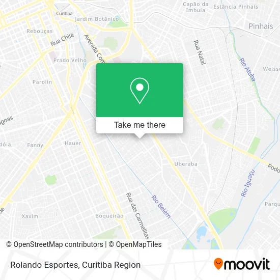
See Rolando Esportes, Uberaba, on the map
Public Transit to Rolando Esportes in Uberaba
Wondering how to get to Rolando Esportes in Uberaba? Moovit helps you find the best way to get to Rolando Esportes with step-by-step directions from the nearest public transit station.
Moovit provides free maps and live directions to help you navigate through your city. View schedules, routes, timetables, and find out how long does it take to get to Rolando Esportes in real time.
Looking for the nearest stop or station to Rolando Esportes? Check out this list of stops closest to your destination: Rua Clóvis Beviláqua Sobrinho; Av. Senador Salgado Filho; Av. Senador Salgado Filho; R. Francisco Timóteo De Simas; Av. Comendador Franco.
Bus: 338 CENTENÁRIO / HAUER, 468 JARDIM CENTAURO, 471 VILA SÃO PAULO, 472 UBERABA, E01 URANO / GUADALUPE, E68 QUISSISSANA / GUADALUPE, 188 MAD. PILARZINHO / UBERABA, X14 REFORÇO HAUER, 516 CANAL BELÉM / SALGADO FILHO, E67 BRAGA / CURITIBA (VIA OURO FINO), E99 SÃO JOSÉ / GUADALUPE (VIA T. CENTRAL).
Want to see if there’s another route that gets you there at an earlier time? Moovit helps you find alternative routes or times. Get directions from and directions to Rolando Esportes easily from the Moovit App or Website.
We make riding to Rolando Esportes easy, which is why over 1.5 million users, including users in Uberaba, trust Moovit as the best app for public transit. You don’t need to download an individual bus app or train app, Moovit is your all-in-one transit app that helps you find the best bus time or train time available.
For information on prices of bus, costs and ride fares to Rolando Esportes, please check the Moovit app.
Use the app to navigate to popular places including to the airport, hospital, stadium, grocery store, mall, coffee shop, school, college, and university.
Rolando Esportes Address: Rua Coronel José Carvalho de Oliveira, 713 Uberaba Curitiba-PR 81570-160 street in Uberaba
- Condomínio Vila Real,
- Magnaldo Comercio Varejista De Artigos Do Vestuario,
- Cacazu Eatec Equipamentos Eletronicos,
- Map - Moldes de Alta Performance,
- Darp,
- Central Animal Banho e Tosa,
- Parma Casa de Massas,
- Associacao Pio Lanteri,
- congregação Cristã no Brasil (Vila São Paulo),
- Igreja São Paulo Apóstolo,
- Rua Padre Júlio Saavedra 170,
- Zokacom Teleinformatica,
- Rua Padre Júlio Saavedra,
- Colégio Estadual Pio Lanteri,
- Sapataria Aquarius,
- Rua Mário Mendes de Lara 72,
- Condominio Residencial Agata,
- Escola Nova Era,
- Aquarela salão de festa infantil,
- Soma Representacoes
Places Near Rolando Esportes (Uberaba)
- Park Shopping Barigüi, Mossunguê,
- Hospital de Clínicas (HC - UFPR), Centro,
- Jardim Botânico de Curitiba PR, Centro,
- Hospital Madalena Sofia, Bairro Alto,
- Hospital Angelina Caron, Campina Grande Do Sul,
- Shopping Palladium, Portão,
- Hhhhh, Fazendinha,
- Jockey Plaza Shopping Center, Tarumã,
- Campo Largo, Campo,
- Rua General Mário Tourinho, Campina Do Siqueira,
- Parque Barigui, Mercês,
- Pontifícia Universidade Católica do Paraná (PUCPR), Prado Velho,
- Hospital Nossa Senhora Das Graças, Mercês,
- Hospital Universitário Evangélico de Curitiba, Bigorrilho,
- Arena Da Baixada - Curitiba,
- Shopping Estação, Rebouças,
- Hospital Da Cruz Vermelha, Batel,
- Rua Martim Afonso 558, Mercês,
- Hospital Erasto Gaertner, Jardim Das Américas,
- Hospital do Rocio, Campo
How to get to popular places in Curitiba Region with public transit
Get around Uberaba by public transit!
Traveling around Uberaba has never been so easy. See step by step directions as you travel to any attraction, street or major public transit station. View bus and train schedules, arrival times, service alerts and detailed routes on a map, so you know exactly how to get to anywhere in Uberaba.
When traveling to any destination around Uberaba use Moovit's Live Directions with Get Off Notifications to know exactly where and how far to walk, how long to wait for your line, and how many stops are left. Moovit will alert you when it's time to get off — no need to constantly re-check whether yours is the next stop.
Wondering how to use public transit in Uberaba or how to pay for public transit in Uberaba? Moovit public transit app can help you navigate your way with public transit easily, and at minimum cost. It includes public transit fees, ticket prices, and costs. Looking for a map of Uberaba public transit lines? Moovit public transit app shows all public transit maps in Uberaba with all Bus and Cable Car routes and stops on an interactive map.
Curitiba Region has 2 transit type(s), including: Bus and Cable Car, operated by several transit agencies, including Sistema Integrado de Mobilidade (URBS), Sistema Integrado de Mobilidade (AMEP), URBS (Cartões bancários e Dinheiro), URBS (Cartões bancários / Cartão URBS), AMEP (Cartões bancários / Cartão MetroCard), AMEP (Cartões bancários / Cartão MetroCard / Dinheiro), Viação Colombo (Dinheiro), TRIAR (Cartão TRIAR / Dinheiro), Empresa Curitiba Cerro Azul (Dinheiro), Expresso Nossa Senhora da Penha (Dinheiro), Empresa Campo Alto Tijucas (Dinheiro), Auto Viação São José (Cartão VEM / Dinheiro), BRT S/A (Cartão VEM / Dinheiro), TransPiedade (Cartão Cidadão / Dinheiro) and Oceânica Sul (Cartão Transporte / Dinheiro)