Directions to Roll-A-Way Disposal (Boston) with public transportation
The following transit lines have routes that pass near Roll-A-Way Disposal
 Bus: 1, 20.
- Train: PROVIDENCE/STOUGHTON.
How to get to Roll-A-Way Disposal by bus?
Click on the bus route to see step by step directions with maps, line arrival times and updated time schedules.
How to get to Roll-A-Way Disposal by train?
Click on the train route to see step by step directions with maps, line arrival times and updated time schedules.
Bus stops near Roll-A-Way Disposal in Boston
Train station near Roll-A-Way Disposal in Boston
- T.F. Green Airport, 54 min walk,VIEW
Bus lines to Roll-A-Way Disposal in Boston
What are the closest stations to Roll-A-Way Disposal?
The closest stations to Roll-A-Way Disposal are:
- 901 Post is 234 yards away, 4 min walk.
- Elmwood Before Fifth is 302 yards away, 4 min walk.
- T.F. Green Airport is 4548 yards away, 54 min walk.
Which bus lines stop near Roll-A-Way Disposal?
These bus lines stop near Roll-A-Way Disposal: 1, 20.
Which train line stops near Roll-A-Way Disposal?
PROVIDENCE/STOUGHTON (#839 | Wickford Junction)
What’s the nearest bus station to Roll-A-Way Disposal in Boston?
The nearest bus stations to Roll-A-Way Disposal in Boston are 901 Post and Elmwood Before Fifth. The closest one is a 4 min walk away.
What time is the first train to Roll-A-Way Disposal in Boston?
The PROVIDENCE/STOUGHTON is the first train that goes to Roll-A-Way Disposal in Boston. It stops nearby at 6:00 AM.
What time is the last train to Roll-A-Way Disposal in Boston?
The PROVIDENCE/STOUGHTON is the last train that goes to Roll-A-Way Disposal in Boston. It stops nearby at 7:56 PM.
What time is the first bus to Roll-A-Way Disposal in Boston?
The 20 is the first bus that goes to Roll-A-Way Disposal in Boston. It stops nearby at 5:49 AM.
What time is the last bus to Roll-A-Way Disposal in Boston?
The 20 is the last bus that goes to Roll-A-Way Disposal in Boston. It stops nearby at 12:46 AM.
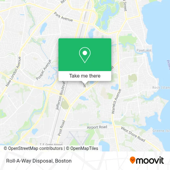
See Roll-A-Way Disposal, Boston, on the map
Public Transit to Roll-A-Way Disposal in Boston
Wondering how to get to Roll-A-Way Disposal in Boston? Moovit helps you find the best way to get to Roll-A-Way Disposal with step-by-step directions from the nearest public transit station.
Moovit provides free maps and live directions to help you navigate through your city. View schedules, routes, timetables, and find out how long does it take to get to Roll-A-Way Disposal in real time.
Looking for the nearest stop or station to Roll-A-Way Disposal? Check out this list of stops closest to your destination: 901 Post; Elmwood Before Fifth; T.F. Green Airport.
Bus: 1, 20.Train: PROVIDENCE/STOUGHTON.
Want to see if there’s another route that gets you there at an earlier time? Moovit helps you find alternative routes or times. Get directions from and directions to Roll-A-Way Disposal easily from the Moovit App or Website.
We make riding to Roll-A-Way Disposal easy, which is why over 1.7 million users, including users in Boston, trust Moovit as the best app for public transit. You don’t need to download an individual bus app or train app, Moovit is your all-in-one transit app that helps you find the best bus time or train time available.
For information on prices of bus and train, costs and ride fares to Roll-A-Way Disposal, please check the Moovit app.
Use the app to navigate to popular places including to the airport, hospital, stadium, grocery store, mall, coffee shop, school, college, and university.
Roll-A-Way Disposal Address: 2077 Elmwood Ave street in Boston
- Millenium Landscape,
- Hassle Free Collision,
- Ecoatm,
- Warwick Auto Glass Sunroof Replacement Auto Glass,
- Josiah Locks Re Keyed Locksmith,
- Presenting Hersheys Ice Cream of Warwick,
- Intercity Paper Company,
- Ronzio Pizza & Subs,
- Coinstar Kiosk,
- Ryan Andrews, Psychiatric Nurse Practitioner,
- Nicole Smith, LCMHC,
- Katherine Pescosolido, LMHC,
- #NBHNC,
- AVIS,
- Redeemed Christian Church - Grace Tabernacle,
- Norwood School,
- E Pro Computer Solutions,
- Jmbuild,
- Insurance Store,
- Sunny & Shears/ United Ink Tattoos
Places Near Roll-A-Way Disposal (Boston)
- Boston Medical Center, Boston,
- Seaport District, Boston,
- Wang Theater, Boston,
- House Of Blues, Boston,
- Faneuil Hall, Boston,
- Boston Convention & Exhibition Center, Boston,
- Boston Common, Boston,
- Isabella Stewart Gardner Museum, Boston,
- Museum Of Science, Boston,
- Boston Children's Hospital, Boston,
- Quincy Market, Boston,
- Leader Bank Pavilion (Leader Bank Pavillion), Boston,
- North End, Boston,
- Wilbur Theatre, Boston,
- Castle Island, Boston,
- Massachusetts General Hospital, Boston,
- Mgm Music Hall, Boston,
- Cheers, Boston,
- Td Garden, Boston,
- Prudential Center, Boston
How to get to popular places in Boston with public transit
Get around Boston by public transit!
Traveling around Boston has never been so easy. See step by step directions as you travel to any attraction, street or major public transit station. View bus and train schedules, arrival times, service alerts and detailed routes on a map, so you know exactly how to get to anywhere in Boston.
When traveling to any destination around Boston use Moovit's Live Directions with Get Off Notifications to know exactly where and how far to walk, how long to wait for your line, and how many stops are left. Moovit will alert you when it's time to get off — no need to constantly re-check whether yours is the next stop.
Wondering how to use public transit in Boston or how to pay for public transit in Boston? Moovit public transit app can help you navigate your way with public transit easily, and at minimum cost. It includes public transit fees, ticket prices, and costs. Looking for a map of Boston public transit lines? Moovit public transit app shows all public transit maps in Boston with all Bus, Train, Subway and Ferry routes and stops on an interactive map.
Boston has 4 transit type(s), including: Bus, Train, Subway and Ferry, operated by several transit agencies, including MBTA, Southeastern Regional Transit Authority, MetroWest Regional Transit Authority, Rhode Island Public Transit Authority, WRTA, Lowell Regional Transit Authority, Merrimack Valley Transit, Montachusett Regional Transit Authority, Cape Cod Regional Transit Authority, Brockton Area Transit Authority, Martha's Vineyard Transit Authority, the WAVE - Nantucket Regional Transit Authority, GATRA, Cape Ann Transportation Authority and Massport