Directions to Rollo Corporation (Framingham) with public transportation
The following transit lines have routes that pass near Rollo Corporation
 Bus: 07, 07C, 09, 10, 04N.
- Train: FRAMINGHAM/WORCESTER, LAKE SHORE LIMITED.
How to get to Rollo Corporation by bus?
Click on the bus route to see step by step directions with maps, line arrival times and updated time schedules.
From Staples Corporate HQ, Framingham
38 minFrom Hopkinton, MA, Hopkinton
59 minFrom Boston Scientific, Marlborough
82 minFrom Babson College, Wellesley
75 minFrom Marlborough, MA, Marlborough
84 minFrom I-95 / Route 128 & Route 16 Interchange (Exit 21), Newton
80 minFrom Boston Marriott Newton, Newton
106 minFrom Wellesley, MA, Wellesley
78 min
How to get to Rollo Corporation by train?
Click on the train route to see step by step directions with maps, line arrival times and updated time schedules.
Train stations near Rollo Corporation in Framingham
Bus stops near Rollo Corporation in Framingham
Bus lines to Rollo Corporation in Framingham
What are the closest stations to Rollo Corporation?
The closest stations to Rollo Corporation are:
- West Natick is 693 yards away, 9 min walk.
- Concord St/ Anzio Rd is 1332 yards away, 16 min walk.
- Arsenal Rd is 1375 yards away, 17 min walk.
- Normandy Rd is 1460 yards away, 18 min walk.
- Framingham Amtrak is 3252 yards away, 39 min walk.
Which bus lines stop near Rollo Corporation?
These bus lines stop near Rollo Corporation: 07, 07C, 09, 10.
Which train line stops near Rollo Corporation?
FRAMINGHAM/WORCESTER (#521 | Worcester)
What’s the nearest train station to Rollo Corporation in Framingham?
The nearest train station to Rollo Corporation in Framingham is West Natick. It’s a 9 min walk away.
What time is the first train to Rollo Corporation in Framingham?
The FRAMINGHAM/WORCESTER is the first train that goes to Rollo Corporation in Framingham. It stops nearby at 4:54 AM.
What time is the last train to Rollo Corporation in Framingham?
The LAKE SHORE LIMITED is the last train that goes to Rollo Corporation in Framingham. It stops nearby at 8:00 PM.
What time is the first bus to Rollo Corporation in Framingham?
The 03 is the first bus that goes to Rollo Corporation in Framingham. It stops nearby at 6:36 AM.
What time is the last bus to Rollo Corporation in Framingham?
The 04N is the last bus that goes to Rollo Corporation in Framingham. It stops nearby at 10:39 PM.
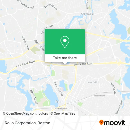
See Rollo Corporation, Framingham, on the map
Public Transit to Rollo Corporation in Framingham
Wondering how to get to Rollo Corporation in Framingham? Moovit helps you find the best way to get to Rollo Corporation with step-by-step directions from the nearest public transit station.
Moovit provides free maps and live directions to help you navigate through your city. View schedules, routes, timetables, and find out how long does it take to get to Rollo Corporation in real time.
Looking for the nearest stop or station to Rollo Corporation? Check out this list of stops closest to your destination: West Natick; Concord St/ Anzio Rd; Arsenal Rd; Normandy Rd; Framingham Amtrak.
Bus: 07, 07C, 09, 10, 04N, 02, 03.Train: FRAMINGHAM/WORCESTER, LAKE SHORE LIMITED.
Want to see if there’s another route that gets you there at an earlier time? Moovit helps you find alternative routes or times. Get directions from and directions to Rollo Corporation easily from the Moovit App or Website.
We make riding to Rollo Corporation easy, which is why over 1.7 million users, including users in Framingham, trust Moovit as the best app for public transit. You don’t need to download an individual bus app or train app, Moovit is your all-in-one transit app that helps you find the best bus time or train time available.
For information on prices of bus and train, costs and ride fares to Rollo Corporation, please check the Moovit app.
Use the app to navigate to popular places including to the airport, hospital, stadium, grocery store, mall, coffee shop, school, college, and university.
Rollo Corporation Address: 501 Worcester Rd street in Framingham
- Mass Nutrition Center - Framingham,
- Rise Above Smoke Shop,
- Vin Goute,
- Street Kitchen Express,
- Locksmith Express,
- Tile Installers,
- Chiropractic Health & Performance Center,
- Metrowest Firewood,
- Metrowest Acura,
- 508 Sealcoating,
- Colorado Prime,
- Acadia Behavioral Health Associates,
- Project Technologies Group,
- Advanced Chiropractic Center,
- Swain Health Group,
- Pamela Kim,MD, Rpvi - Center for Vein Restoration,
- Architectural Design,
- BQS Moving,
- Wayside Academy,
- Oaks Rd Realty Trust
Places Near Rollo Corporation (Framingham)
- Boston Medical Center, Boston,
- North End, Boston,
- Seaport District, Boston,
- House Of Blues, Boston,
- Cheers, Boston,
- Castle Island, Boston,
- Wang Theater, Boston,
- Isabella Stewart Gardner Museum, Boston,
- Quincy Market, Boston,
- Wilbur Theatre, Boston,
- Massachusetts General Hospital, Boston,
- Td Garden, Boston,
- Boston Children's Hospital, Boston,
- Leader Bank Pavilion (Leader Bank Pavillion), Boston,
- Faneuil Hall, Boston,
- Museum Of Science, Boston,
- Boston Convention & Exhibition Center, Boston,
- Boston Common, Boston,
- Prudential Center, Boston,
- Mgm Music Hall, Boston
How to get to popular places in Boston with public transit
Get around Framingham by public transit!
Traveling around Framingham has never been so easy. See step by step directions as you travel to any attraction, street or major public transit station. View bus and train schedules, arrival times, service alerts and detailed routes on a map, so you know exactly how to get to anywhere in Framingham.
When traveling to any destination around Framingham use Moovit's Live Directions with Get Off Notifications to know exactly where and how far to walk, how long to wait for your line, and how many stops are left. Moovit will alert you when it's time to get off — no need to constantly re-check whether yours is the next stop.
Wondering how to use public transit in Framingham or how to pay for public transit in Framingham? Moovit public transit app can help you navigate your way with public transit easily, and at minimum cost. It includes public transit fees, ticket prices, and costs. Looking for a map of Framingham public transit lines? Moovit public transit app shows all public transit maps in Framingham with all Bus, Train, Subway and Ferry routes and stops on an interactive map.
Boston has 4 transit type(s), including: Bus, Train, Subway and Ferry, operated by several transit agencies, including MBTA, Southeastern Regional Transit Authority, MetroWest Regional Transit Authority, Rhode Island Public Transit Authority, WRTA, Lowell Regional Transit Authority, Merrimack Valley Transit, Montachusett Regional Transit Authority, Cape Cod Regional Transit Authority, Brockton Area Transit Authority, Martha's Vineyard Transit Authority, the WAVE - Nantucket Regional Transit Authority, GATRA, Cape Ann Transportation Authority and Massport