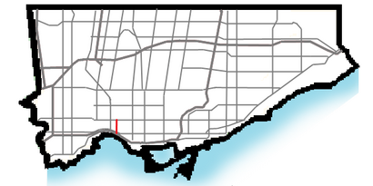
See Roncesvalles Avenue, Toronto, on the map
Directions to Roncesvalles Avenue (Toronto) with public transportation
The following transit lines have routes that pass near Roncesvalles Avenue
 Bus:
Bus: - Train:
- Subway:
- Streetcar:
How to get to Roncesvalles Avenue by bus?
Click on the bus route to see step by step directions with maps, line arrival times and updated time schedules.
How to get to Roncesvalles Avenue by train?
Click on the train route to see step by step directions with maps, line arrival times and updated time schedules.
How to get to Roncesvalles Avenue by subway?
Click on the subway route to see step by step directions with maps, line arrival times and updated time schedules.
Streetcar stations near Roncesvalles Avenue in Toronto
- Roncesvalles Ave at Howard Park Ave,1 min walk,
- Roncesvalles Ave at Howard Park Ave South Side,2 min walk,
- Roncesvalles Ave at Boustead Ave South Side,3 min walk,
Bus stations near Roncesvalles Avenue in Toronto
- Bloor St West at Dundas St West,8 min walk,
- Dundas West Station,9 min walk,
- Edna Ave at Dundas St West,9 min walk,
- Parkside Dr at Howard Park Ave,9 min walk,
Bus lines to Roncesvalles Avenue in Toronto
- 300A,3450 Danforth Ave,
- 300B,Kennedy Station - Platform B,
- 300S,Danforth Ave at Pape Ave,
- 168,Edna Ave at Dundas St West,
- 402,Toronto Rehab - Bickle Centre at 130 Dunn Ave,
- 40,Dundas West Station,
- 40A,Kipling Station,
- 40B,St Clair Ave West at Jane St East Side,
- 306,Edna Ave at Dundas St West,
- 340,Gunns Loop at St Clair Ave West,
- 80,Keele Station,
What are the closest stations to Roncesvalles Avenue?
The closest stations to Roncesvalles Avenue are:
- Roncesvalles Ave at Howard Park Ave is 53 meters away, 1 min walk.
- Roncesvalles Ave at Howard Park Ave South Side is 83 meters away, 2 min walk.
- Roncesvalles Ave at Boustead Ave South Side is 193 meters away, 3 min walk.
- Bloor St West at Dundas St West is 550 meters away, 8 min walk.
- Dundas West Station is 639 meters away, 9 min walk.
- Edna Ave at Dundas St West is 673 meters away, 9 min walk.
- Parkside Dr at Howard Park Ave is 673 meters away, 9 min walk.
Which bus lines stop near Roncesvalles Avenue?
These bus lines stop near Roncesvalles Avenue: 40, 41, 506, 80.
Which train line stops near Roncesvalles Avenue?
UP
Which subway line stops near Roncesvalles Avenue?
2
Which Streetcar line stops near Roncesvalles Avenue?
504
What’s the nearest Streetcar station to Roncesvalles Avenue in Toronto?
The nearest Streetcar station to Roncesvalles Avenue in Toronto is Roncesvalles Ave at Howard Park Ave. It’s a 1 min walk away.
What’s the nearest bus stop to Roncesvalles Avenue in Toronto?
The nearest bus stop to Roncesvalles Avenue in Toronto is Bloor St West at Dundas St West. It’s a 8 min walk away.
See Roncesvalles Avenue, Toronto, on the map
Public Transit to Roncesvalles Avenue in Toronto
Wondering how to get to Roncesvalles Avenue in Toronto, Canada? Moovit helps you find the best way to get to Roncesvalles Avenue with step-by-step directions from the nearest public transit station.
Moovit provides free maps and live directions to help you navigate through your city. View schedules, routes, timetables, and find out how long does it take to get to Roncesvalles Avenue in real time.
Looking for the nearest stop or station to Roncesvalles Avenue? Check out this list of stops closest to your destination: Roncesvalles Ave at Howard Park Ave; Roncesvalles Ave at Howard Park Ave South Side; Roncesvalles Ave at Boustead Ave South Side; Bloor St West at Dundas St West; Dundas West Station; Edna Ave at Dundas St West; Parkside Dr at Howard Park Ave.
Bus:Train:Subway:Streetcar:
Want to see if there’s another route that gets you there at an earlier time? Moovit helps you find alternative routes or times. Get directions from and directions to Roncesvalles Avenue easily from the Moovit App or Website.
We make riding to Roncesvalles Avenue easy, which is why over 1.5 million users, including users in Toronto, trust Moovit as the best app for public transit. You don’t need to download an individual bus app or train app, Moovit is your all-in-one transit app that helps you find the best bus time or train time available.
For information on prices of bus, subway, train and Streetcar, costs and ride fares to Roncesvalles Avenue, please check the Moovit app.
Use the app to navigate to popular places including to the airport, hospital, stadium, grocery store, mall, coffee shop, school, college, and university.
Roncesvalles Avenue Address: Howard Park Avenue street in Toronto
Attractions near Roncesvalles Avenue
Moretti,Roncesvalles Hair Salon,Belo Fashions,Maggie's Farm,Revue Cinema,lp lp's,Scout,Scout,Howard Park Avenue,Avalon Dentistry,Doll Factory by Damzels,Sweet Thrills,Evolve,Tuk Tuk Canteen,Prints Charming,Himalayan Collections,Mother Of All,Likely General,Westminster Chapel at High Park,HelgaHow to get to popular attractions in Toronto with public transit
Mcmaster University, Hamilton,Costco Wholesale, Hamilton,Jack Astor's Bar & Grill, Toronto,IKEA, Burlington,Vaughan Mills, Vaughan,Dixie Outlet Mall, Mississauga,Toronto Eaton Centre, Toronto,Lawrence Subway Station, Toronto,Burlington Bay James N. Allan Skyway, Hamilton,Terminal 1 - Toronto Pearson Int'L Airport, Mississauga,Square One Bus Terminal, Mississauga,Oliver & Bonacini Café Grill, Yonge and Front, Toronto,Toronto Pearson International Airport (Yyz), Mississauga,The Rivoli, Toronto,Fresh On Spadina, Toronto,Starbucks, Toronto,Wayne Gretzky's Toronto, Toronto,St Joseph's Healthcare (Charlton Campus), Hamilton,Pacific Mall, Markham,Phoenix Restaurant 金鳳餐廳, MarkhamGet around Toronto by public transit!
Traveling around Toronto has never been so easy. See step by step directions as you travel to any attraction, street or major public transit station. View bus and train schedules, arrival times, service alerts and detailed routes on a map, so you know exactly how to get to anywhere in Toronto.
When traveling to any destination around Toronto use Moovit's Live Directions with Get Off Notifications to know exactly where and how far to walk, how long to wait for your line, and how many stops are left. Moovit will alert you when it's time to get off — no need to constantly re-check whether yours is the next stop.
Wondering how to use public transit in Toronto or how to pay for public transit in Toronto? Moovit public transit app can help you navigate your way with public transit easily, and at minimum cost. It includes public transit fees, ticket prices, and costs. Looking for a map of Toronto public transit lines? Moovit public transit app shows all public transit maps in Toronto with all bus, subway, train or Streetcar routes and stops on an interactive map.
Toronto has 4 transit type(s), including: bus, subway, train or Streetcar, operated by several transit agencies, including TTC, TTC Streetcar, Toronto Subway, GO Transit Bus, GO Transit, Amtrak, York Region Transit, Grand River Transit, Guelph Transit, grt, Hamilton Street Railway, MiWay, Brampton Transit, Burlington Transit and Oakville Transit