Directions to Root For Us (Newton) with public transportation
The following transit lines have routes that pass near Root For Us
 Bus: 52, 59, 60, GREEN LINE D SHUTTLE, GREEN LINE D SHUTTLE.
- Subway: GREEN LINE D.
How to get to Root For Us by bus?
Click on the bus route to see step by step directions with maps, line arrival times and updated time schedules.
From Landmark Center, Boston
73 minFrom The Westin Waltham Boston, Waltham
91 minFrom The Castle, Boston
65 minFrom James P. Kelleher Rose Garden, Boston
74 minFrom Kenmore Square, Boston
68 minFrom Mass General Waltham, Waltham
91 minFrom Harvard University, Cambridge
59 minFrom West Roxbury VA Medical Center, Boston
44 minFrom Guitar Center, Boston
70 minFrom Danehy Park, Cambridge
71 min
How to get to Root For Us by subway?
Click on the subway route to see step by step directions with maps, line arrival times and updated time schedules.
Bus stops near Root For Us in Newton
Subway station near Root For Us in Newton
- Eliot, 21 min walk,VIEW
Bus lines to Root For Us in Newton
- 59, Needham Junction Via Needham St,VIEW
- GREEN LINE D SHUTTLE, Riverside - Newton Highlands,VIEW
- GREEN LINE D SHUTTLE, Riverside - Kenmore via Saint Mary's Street,VIEW
- GREEN LINE D SHUTTLE, Riverside - Brookline Hills,VIEW
- GREEN LINE D SHUTTLE, Riverside - Fenway,VIEW
- GREEN LINE D SHUTTLE, Riverside - Kenmore (Shuttle),VIEW
- GREEN LINE D SHUTTLE, Riverside - Brookline Village,VIEW
- GREEN LINE D SHUTTLE, Riverside - Copley (Shuttle),VIEW
- GREEN LINE D SHUTTLE, Riverside - Reservoir,VIEW
- GREEN LINE D SHUTTLE, Riverside - Kenmore,VIEW
What are the closest stations to Root For Us?
The closest stations to Root For Us are:
- Winchester St @ Centre St is 358 yards away, 5 min walk.
- Lincoln St @ Woodward St is 1015 yards away, 12 min walk.
- Eliot is 1750 yards away, 21 min walk.
Which bus lines stop near Root For Us?
These bus lines stop near Root For Us: 52, 59, 60.
Which subway line stops near Root For Us?
GREEN LINE D (Riverside)
What’s the nearest subway station to Root For Us in Newton?
The nearest subway station to Root For Us in Newton is Eliot. It’s a 21 min walk away.
What’s the nearest bus station to Root For Us in Newton?
The nearest bus station to Root For Us in Newton is Winchester St @ Centre St. It’s a 5 min walk away.
What time is the first subway to Root For Us in Newton?
The GREEN LINE D is the first subway that goes to Root For Us in Newton. It stops nearby at 4:46 AM.
What time is the last subway to Root For Us in Newton?
The GREEN LINE D is the last subway that goes to Root For Us in Newton. It stops nearby at 2:46 AM.
What time is the first bus to Root For Us in Newton?
The 59 is the first bus that goes to Root For Us in Newton. It stops nearby at 6:19 AM.
What time is the last bus to Root For Us in Newton?
The 59 is the last bus that goes to Root For Us in Newton. It stops nearby at 8:06 PM.
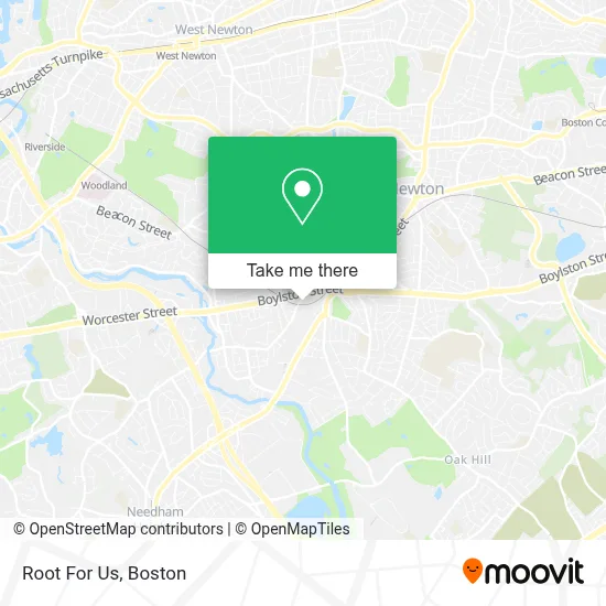
See Root For Us, Newton, on the map
Public Transit to Root For Us in Newton
Wondering how to get to Root For Us in Newton? Moovit helps you find the best way to get to Root For Us with step-by-step directions from the nearest public transit station.
Moovit provides free maps and live directions to help you navigate through your city. View schedules, routes, timetables, and find out how long does it take to get to Root For Us in real time.
Looking for the nearest stop or station to Root For Us? Check out this list of stops closest to your destination: Winchester St @ Centre St; Lincoln St @ Woodward St; Eliot.
Bus: 52, 59, 60, GREEN LINE D SHUTTLE, GREEN LINE D SHUTTLE, GREEN LINE D SHUTTLE, GREEN LINE D SHUTTLE, GREEN LINE D SHUTTLE.Subway: GREEN LINE D.
Want to see if there’s another route that gets you there at an earlier time? Moovit helps you find alternative routes or times. Get directions from and directions to Root For Us easily from the Moovit App or Website.
We make riding to Root For Us easy, which is why over 1.7 million users, including users in Newton, trust Moovit as the best app for public transit. You don’t need to download an individual bus app or train app, Moovit is your all-in-one transit app that helps you find the best bus time or train time available.
For information on prices of bus and subway, costs and ride fares to Root For Us, please check the Moovit app.
Use the app to navigate to popular places including to the airport, hospital, stadium, grocery store, mall, coffee shop, school, college, and university.
Root For Us Address: 26 Elliot St street in Newton
- ATM CVS,
- Spanish Immersion Montessori School,
- TBQ Junk Removal Newton,
- Upper Falls Greenway,
- bp,
- Muscle,
- DUNKIN',
- Builders FirstSource,
- Olympia Marble & Granite Company,
- Pest Assassins,
- Kindernest Montessori,
- Town Fair Tire,
- TFT Newton Ma,
- Mavis Discount Tire,
- Third Space Kitchen,
- Martin Zinke Consulting,
- VCA,
- Creative Playthings,
- Mass General Brigham Urgent Care - Newton,
- Skillful Heating & Cooling Repair
Places Near Root For Us (Newton)
- Seaport District, Boston,
- Quincy Market, Boston,
- Isabella Stewart Gardner Museum, Boston,
- Cheers, Boston,
- Boston Medical Center, Boston,
- Castle Island, Boston,
- Wilbur Theatre, Boston,
- Faneuil Hall, Boston,
- Boston Children's Hospital, Boston,
- Mgm Music Hall, Boston,
- Museum Of Science, Boston,
- Leader Bank Pavilion (Leader Bank Pavillion), Boston,
- Prudential Center, Boston,
- Massachusetts General Hospital, Boston,
- Boston Convention & Exhibition Center, Boston,
- Wang Theater, Boston,
- North End, Boston,
- House Of Blues, Boston,
- Td Garden, Boston,
- Boston Common, Boston
How to get to popular places in Boston with public transit
Get around Newton by public transit!
Traveling around Newton has never been so easy. See step by step directions as you travel to any attraction, street or major public transit station. View bus and train schedules, arrival times, service alerts and detailed routes on a map, so you know exactly how to get to anywhere in Newton.
When traveling to any destination around Newton use Moovit's Live Directions with Get Off Notifications to know exactly where and how far to walk, how long to wait for your line, and how many stops are left. Moovit will alert you when it's time to get off — no need to constantly re-check whether yours is the next stop.
Wondering how to use public transit in Newton or how to pay for public transit in Newton? Moovit public transit app can help you navigate your way with public transit easily, and at minimum cost. It includes public transit fees, ticket prices, and costs. Looking for a map of Newton public transit lines? Moovit public transit app shows all public transit maps in Newton with all Bus, Train, Subway and Ferry routes and stops on an interactive map.
Boston has 4 transit type(s), including: Bus, Train, Subway and Ferry, operated by several transit agencies, including MBTA, Southeastern Regional Transit Authority, MetroWest Regional Transit Authority, Rhode Island Public Transit Authority, WRTA, Lowell Regional Transit Authority, Merrimack Valley Transit, Montachusett Regional Transit Authority, Cape Cod Regional Transit Authority, Brockton Area Transit Authority, Martha's Vineyard Transit Authority, the WAVE - Nantucket Regional Transit Authority, GATRA, Cape Ann Transportation Authority and Massport