Directions to Roots Of Strength (Somerville) with public transportation
The following transit lines have routes that pass near Roots Of Strength
 Bus: 109, 85, 89, 90, 91.
- Subway: GREEN LINE E, ORANGE LINE, GREEN LINE D, GREEN LINE B, GREEN LINE C.
How to get to Roots Of Strength by bus?
Click on the bus route to see step by step directions with maps, line arrival times and updated time schedules.
From Myers + Chang (Myers & Chang), Boston
65 minFrom Dorchester District Court, Boston
89 minFrom Heartbreak Hill, Newton
72 minFrom Sonia, Boston
46 minFrom The Mall At Chestnut Hill, Newton
81 minFrom Jamaica Pond, Boston
69 minFrom Beth Israel Deaconess Medical Center (Shapiro Garage), Boston
41 minFrom Newton, MA, Newton
72 minFrom Spaulding Rehab, Boston
90 minFrom Northeastern University, Boston
55 min
How to get to Roots Of Strength by subway?
Click on the subway route to see step by step directions with maps, line arrival times and updated time schedules.
From Myers + Chang (Myers & Chang), Boston
40 minFrom Dorchester District Court, Boston
69 minFrom Heartbreak Hill, Newton
83 minFrom Sonia, Boston
83 minFrom The Mall At Chestnut Hill, Newton
91 minFrom Jamaica Pond, Boston
58 minFrom Beth Israel Deaconess Medical Center (Shapiro Garage), Boston
61 minFrom Newton, MA, Newton
82 minFrom Spaulding Rehab, Boston
71 minFrom Northeastern University, Boston
49 min
Bus stops near Roots Of Strength in Somerville
Subway stations near Roots Of Strength in Somerville
Bus lines to Roots Of Strength in Somerville
What are the closest stations to Roots Of Strength?
The closest stations to Roots Of Strength are:
- Pearl St @ Mcgrath Hwy is 142 yards away, 2 min walk.
- Union Square is 341 yards away, 5 min walk.
- Cross St @ Ellsworth St is 367 yards away, 5 min walk.
- Medford St @ Highland Ave is 500 yards away, 6 min walk.
- East Somerville Station is 738 yards away, 9 min walk.
- Broadway @ Cross St is 931 yards away, 12 min walk.
- Sullivan Square is 1825 yards away, 22 min walk.
Which bus lines stop near Roots Of Strength?
These bus lines stop near Roots Of Strength: 109, 85, 89, 90, 91.
Which subway lines stop near Roots Of Strength?
These subway lines stop near Roots Of Strength: GREEN LINE E, ORANGE LINE.
What’s the nearest subway station to Roots Of Strength in Somerville?
The nearest subway station to Roots Of Strength in Somerville is Union Square. It’s a 5 min walk away.
What’s the nearest bus station to Roots Of Strength in Somerville?
The nearest bus station to Roots Of Strength in Somerville is Pearl St @ Mcgrath Hwy. It’s a 2 min walk away.
What time is the first subway to Roots Of Strength in Somerville?
The GREEN LINE E is the first subway that goes to Roots Of Strength in Somerville. It stops nearby at 4:49 AM.
What time is the last subway to Roots Of Strength in Somerville?
The GREEN LINE E is the last subway that goes to Roots Of Strength in Somerville. It stops nearby at 2:36 AM.
What time is the first bus to Roots Of Strength in Somerville?
The 89/93 is the first bus that goes to Roots Of Strength in Somerville. It stops nearby at 4:42 AM.
What time is the last bus to Roots Of Strength in Somerville?
The 89 is the last bus that goes to Roots Of Strength in Somerville. It stops nearby at 1:48 AM.
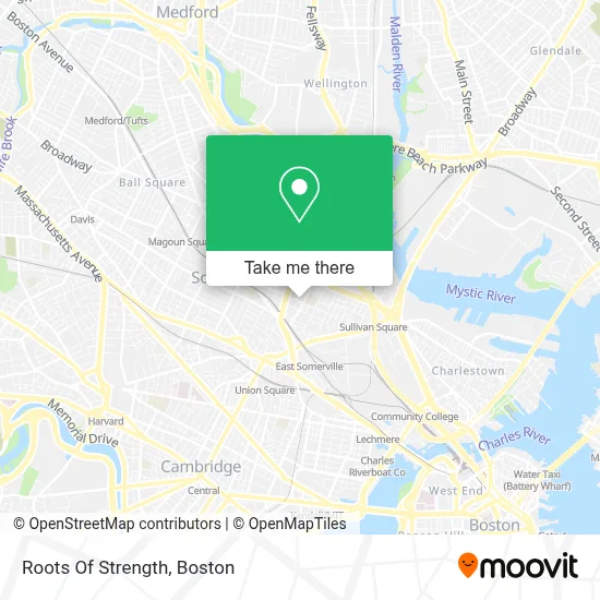
See Roots Of Strength, Somerville, on the map
Public Transit to Roots Of Strength in Somerville
Wondering how to get to Roots Of Strength in Somerville? Moovit helps you find the best way to get to Roots Of Strength with step-by-step directions from the nearest public transit station.
Moovit provides free maps and live directions to help you navigate through your city. View schedules, routes, timetables, and find out how long does it take to get to Roots Of Strength in real time.
Looking for the nearest stop or station to Roots Of Strength? Check out this list of stops closest to your destination: Pearl St @ Mcgrath Hwy; Union Square; Cross St @ Ellsworth St; Medford St @ Highland Ave; East Somerville Station; Broadway @ Cross St; Sullivan Square.
Bus: 109, 85, 89, 90, 91, 80, 88.Subway: GREEN LINE E, ORANGE LINE, GREEN LINE D, GREEN LINE B, GREEN LINE C.
Want to see if there’s another route that gets you there at an earlier time? Moovit helps you find alternative routes or times. Get directions from and directions to Roots Of Strength easily from the Moovit App or Website.
We make riding to Roots Of Strength easy, which is why over 1.7 million users, including users in Somerville, trust Moovit as the best app for public transit. You don’t need to download an individual bus app or train app, Moovit is your all-in-one transit app that helps you find the best bus time or train time available.
For information on prices of bus and subway, costs and ride fares to Roots Of Strength, please check the Moovit app.
Use the app to navigate to popular places including to the airport, hospital, stadium, grocery store, mall, coffee shop, school, college, and university.
Location: Somerville, Boston
- Boston Worship,
- Jaxon Golf,
- MBTA Bus Stop Cross St at Pearl Street,
- East Somerville Community School (Somerville Special Ed Dept),
- E Somerville Community,
- The Abandoned Parking Lot Where Asha's Decrepit Car Is,
- Bento Snow Removal Service,
- One Visual Mind,
- Winter Hill Pest Control,
- Deanna Cremin Playground,
- East Somerville,
- USPS Collection Box - Blue Box,
- Marlon's Barbers,
- Michette,
- DHL,
- Cristo and Margarets Meat Market,
- Jasper 1 24 Hour Somerville Emergency Locksmith,
- Prospect Hill Academy,
- Lock and Lockout Service,
- Broadway Residence
Places Near Roots Of Strength (Somerville)
- Wang Theater, Boston,
- Boston Children's Hospital, Boston,
- Seaport District, Boston,
- Faneuil Hall, Boston,
- Cheers, Boston,
- Massachusetts General Hospital, Boston,
- Td Garden, Boston,
- Boston Common, Boston,
- Museum Of Science, Boston,
- Isabella Stewart Gardner Museum, Boston,
- North End, Boston,
- Mgm Music Hall, Boston,
- Wilbur Theatre, Boston,
- House Of Blues, Boston,
- Boston Convention & Exhibition Center, Boston,
- Boston Medical Center, Boston,
- Castle Island, Boston,
- Quincy Market, Boston,
- Prudential Center, Boston,
- Leader Bank Pavilion (Leader Bank Pavillion), Boston
How to get to popular places in Boston with public transit
Get around Somerville by public transit!
Traveling around Somerville has never been so easy. See step by step directions as you travel to any attraction, street or major public transit station. View bus and train schedules, arrival times, service alerts and detailed routes on a map, so you know exactly how to get to anywhere in Somerville.
When traveling to any destination around Somerville use Moovit's Live Directions with Get Off Notifications to know exactly where and how far to walk, how long to wait for your line, and how many stops are left. Moovit will alert you when it's time to get off — no need to constantly re-check whether yours is the next stop.
Wondering how to use public transit in Somerville or how to pay for public transit in Somerville? Moovit public transit app can help you navigate your way with public transit easily, and at minimum cost. It includes public transit fees, ticket prices, and costs. Looking for a map of Somerville public transit lines? Moovit public transit app shows all public transit maps in Somerville with all Bus, Train, Subway and Ferry routes and stops on an interactive map.
Boston has 4 transit type(s), including: Bus, Train, Subway and Ferry, operated by several transit agencies, including MBTA, Southeastern Regional Transit Authority, MetroWest Regional Transit Authority, Rhode Island Public Transit Authority, WRTA, Lowell Regional Transit Authority, Merrimack Valley Transit, Montachusett Regional Transit Authority, Cape Cod Regional Transit Authority, Brockton Area Transit Authority, Martha's Vineyard Transit Authority, the WAVE - Nantucket Regional Transit Authority, GATRA, Cape Ann Transportation Authority and Massport