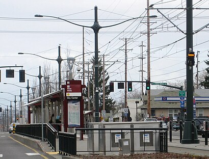
Directions to Rosa Parks MAX Station (Portland) with public transportation
The following transit lines have routes that pass near Rosa Parks MAX Station
How to get to Rosa Parks MAX Station by bus?
Click on the bus route to see step by step directions with maps, line arrival times and updated time schedules.
Light Rail stations near Rosa Parks MAX Station in Portland
- N Killingsworth St,11 min walk,
Bus stations near Rosa Parks MAX Station in Portland
- N Albina & Killingsworth (North),18 min walk,
Bus lines to Rosa Parks MAX Station in Portland
- 4,SW Jefferson & 5th (West),
What are the closest stations to Rosa Parks MAX Station?
The closest stations to Rosa Parks MAX Station are:
- N Killingsworth St is 878 yards away, 11 min walk.
- N Albina & Killingsworth (North) is 1425 yards away, 18 min walk.
Which bus lines stop near Rosa Parks MAX Station?
These bus lines stop near Rosa Parks MAX Station: 44, 72.
Which light rail line stops near Rosa Parks MAX Station?
MAX YELLOW LINE
What’s the nearest light rail station to Rosa Parks MAX Station in Portland?
The nearest light rail station to Rosa Parks MAX Station in Portland is N Killingsworth St. It’s a 11 min walk away.
See Rosa Parks MAX Station, Portland, on the map
Public Transit to Rosa Parks MAX Station in Portland
Wondering how to get to Rosa Parks MAX Station in Portland, United States? Moovit helps you find the best way to get to Rosa Parks MAX Station with step-by-step directions from the nearest public transit station.
Moovit provides free maps and live directions to help you navigate through your city. View schedules, routes, timetables, and find out how long does it take to get to Rosa Parks MAX Station in real time.
Looking for the nearest stop or station to Rosa Parks MAX Station? Check out this list of stops closest to your destination: N Killingsworth St; N Albina & Killingsworth (North).
Bus:44724Light Rail:MAX YELLOW LINE
Want to see if there’s another route that gets you there at an earlier time? Moovit helps you find alternative routes or times. Get directions from and directions to Rosa Parks MAX Station easily from the Moovit App or Website.
We make riding to Rosa Parks MAX Station easy, which is why over 1.5 million users, including users in Portland, trust Moovit as the best app for public transit. You don’t need to download an individual bus app or train app, Moovit is your all-in-one transit app that helps you find the best bus time or train time available.
For information on prices of bus and light rail, costs and ride fares to Rosa Parks MAX Station, please check the Moovit app.
Use the app to navigate to popular places including to the airport, hospital, stadium, grocery store, mall, coffee shop, school, college, and university.
Location: Portland, Portland, OR
Attractions near Rosa Parks MAX Station
N Rosa Parks Way & Interstate,TriMet Rosa Parks MAX Station,Rosa Parks,Max-Rosa Parks-SB,Northwest Regional Secure Transport,Portland Mercury Distribution Box,6525 N Maryland Ave,Kincaid Custom Surface,Peninsula Park Substation,On Site Appliance Repair,Blackbird Pizza,1600 N Holman St,Auto Locksmith,Ockley Green Middle School,Satchel,N Minnesota Ave,Little Imprints,N Dekum St,1825 N Cramer St,I-5 North Columbia Blvd (Exit 306)How to get to popular attractions in Portland with public transit
Hazel Dell, Hazel Dell,TriMet Tualatin Park & Ride, Tualatin,Belluschi Building, Portland,Washington Square Mall, Tigard,Cully Neighborhood, Portland,Hyatt Place Portland Airport / Cascade Station, Portland,Downtown Portland, Portland,Portland Japanese Garden, Portland,McMenamins East Vancouver Pub, Vancouver,Alphabet District, Portland,Clark College, Vancouver,WinCo Foods, Gresham,Sunset Highway US 26W, Portland,Bröder Cafe, Portland,TriMet Rockwood / E 188th Ave MAX Station, Gresham,Bob's Red Mill Whole Grain Store, Milwaukie,TriMet Lents Town Center / Foster Rd MAX Station, Portland,Kells Irish Restaurant & Pub, Portland,Skidmore Bluffs, Portland,TriMet Washington / SE 12th Ave MAX Station, HillsboroGet around Portland by public transit!
Traveling around Portland has never been so easy. See step by step directions as you travel to any attraction, street or major public transit station. View bus and train schedules, arrival times, service alerts and detailed routes on a map, so you know exactly how to get to anywhere in Portland.
When traveling to any destination around Portland use Moovit's Live Directions with Get Off Notifications to know exactly where and how far to walk, how long to wait for your line, and how many stops are left. Moovit will alert you when it's time to get off — no need to constantly re-check whether yours is the next stop.
Wondering how to use public transit in Portland or how to pay for public transit in Portland? Moovit public transit app can help you navigate your way with public transit easily, and at minimum cost. It includes public transit fees, ticket prices, and costs. Looking for a map of Portland public transit lines? Moovit public transit app shows all public transit maps in Portland with all bus or light rail routes and stops on an interactive map.
Portland has 2 transit type(s), including: bus or light rail, operated by several transit agencies, including Mount Adams Transportation Service, RiverCities Transit, TriMet , TriMet , TriMet, Portland Streetcar, Portland Aerial Tram, C-TRAN, Multnomah County Job Connector Shuttles, Washington Park Shuttle, SMART, Canby Area Transit, South Clackamas Transportation District, The Wave and Lincoln County Transit