Directions to Rose (Beverly) with public transportation
The following transit lines have routes that pass near Rose
 Bus: 451, CITY OF BEVERLY SHUTTLE.
- Train: NEWBURYPORT/ROCKPORT.
How to get to Rose by bus?
Click on the bus route to see step by step directions with maps, line arrival times and updated time schedules.
How to get to Rose by train?
Click on the train route to see step by step directions with maps, line arrival times and updated time schedules.
Bus stops near Rose in Beverly
Train station near Rose in Beverly
- North Beverly, 25 min walk,VIEW
Bus lines to Rose in Beverly
What are the closest stations to Rose?
The closest stations to Rose are:
- Henry's Food Mart is 362 yards away, 5 min walk.
- Dodge St @ Cabot St is 423 yards away, 5 min walk.
- North Beverly is 2108 yards away, 25 min walk.
Which bus lines stop near Rose?
These bus lines stop near Rose: 451, CITY OF BEVERLY SHUTTLE.
Which train line stops near Rose?
NEWBURYPORT/ROCKPORT (#27 | Rockport)
What’s the nearest train station to Rose in Beverly?
The nearest train station to Rose in Beverly is North Beverly. It’s a 25 min walk away.
What’s the nearest bus station to Rose in Beverly?
The nearest bus stations to Rose in Beverly are Henry's Food Mart and Dodge St @ Cabot St. The closest one is a 5 min walk away.
What time is the first train to Rose in Beverly?
The NEWBURYPORT/ROCKPORT is the first train that goes to Rose in Beverly. It stops nearby at 5:11 AM.
What time is the last train to Rose in Beverly?
The NEWBURYPORT/ROCKPORT is the last train that goes to Rose in Beverly. It stops nearby at 12:36 AM.
What time is the first bus to Rose in Beverly?
The 451 is the first bus that goes to Rose in Beverly. It stops nearby at 6:43 AM.
What time is the last bus to Rose in Beverly?
The 451 is the last bus that goes to Rose in Beverly. It stops nearby at 7:15 PM.
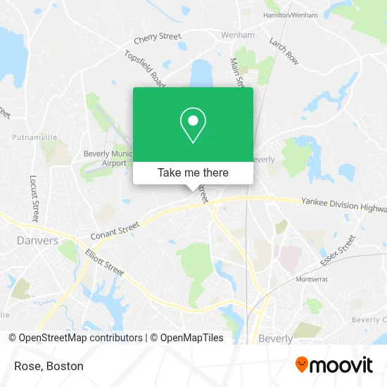
See Rose, Beverly, on the map
Public Transit to Rose in Beverly
Wondering how to get to Rose in Beverly? Moovit helps you find the best way to get to Rose with step-by-step directions from the nearest public transit station.
Moovit provides free maps and live directions to help you navigate through your city. View schedules, routes, timetables, and find out how long does it take to get to Rose in real time.
Looking for the nearest stop or station to Rose? Check out this list of stops closest to your destination: Henry's Food Mart; Dodge St @ Cabot St; North Beverly.
Bus: 451, CITY OF BEVERLY SHUTTLE.Train: NEWBURYPORT/ROCKPORT.
Want to see if there’s another route that gets you there at an earlier time? Moovit helps you find alternative routes or times. Get directions from and directions to Rose easily from the Moovit App or Website.
We make riding to Rose easy, which is why over 1.7 million users, including users in Beverly, trust Moovit as the best app for public transit. You don’t need to download an individual bus app or train app, Moovit is your all-in-one transit app that helps you find the best bus time or train time available.
For information on prices of bus and train, costs and ride fares to Rose, please check the Moovit app.
Use the app to navigate to popular places including to the airport, hospital, stadium, grocery store, mall, coffee shop, school, college, and university.
Rose Address: 61 Conant St street in Beverly
- The United Church of Christ,
- Family Promise North Shore Boston,
- North Shore Christian School,
- Rev Wendy Linares,
- North Shore Christian Academy Beacon Campus,
- Boulay Rick Painting,
- Brew's,
- The House of Boats,
- Washingtons Naval Base I,
- Josh's Landscaping,
- The Pug Pit,
- Wckd Real Estate Media,
- Buck Hau Inc,
- David Brown, the Gentleman Realtor North Of Boston,
- Peter Hallisey Realtor,
- Exxon,
- Chamber Your Inner Beauty,
- The Boston Realty Group,
- Sallys,
- Atm Cvs
Places Near Rose (Beverly)
- Castle Island, Boston,
- Faneuil Hall, Boston,
- Boston Common, Boston,
- Cheers, Boston,
- Boston Convention & Exhibition Center, Boston,
- House Of Blues, Boston,
- Boston Children's Hospital, Boston,
- Wilbur Theatre, Boston,
- Massachusetts General Hospital, Boston,
- Leader Bank Pavilion (Leader Bank Pavillion), Boston,
- Boston Medical Center, Boston,
- Quincy Market, Boston,
- Isabella Stewart Gardner Museum, Boston,
- Prudential Center, Boston,
- Td Garden, Boston,
- North End, Boston,
- Seaport District, Boston,
- Wang Theater, Boston,
- Museum Of Science, Boston,
- Mgm Music Hall, Boston
How to get to popular places in Boston with public transit
Get around Beverly by public transit!
Traveling around Beverly has never been so easy. See step by step directions as you travel to any attraction, street or major public transit station. View bus and train schedules, arrival times, service alerts and detailed routes on a map, so you know exactly how to get to anywhere in Beverly.
When traveling to any destination around Beverly use Moovit's Live Directions with Get Off Notifications to know exactly where and how far to walk, how long to wait for your line, and how many stops are left. Moovit will alert you when it's time to get off — no need to constantly re-check whether yours is the next stop.
Wondering how to use public transit in Beverly or how to pay for public transit in Beverly? Moovit public transit app can help you navigate your way with public transit easily, and at minimum cost. It includes public transit fees, ticket prices, and costs. Looking for a map of Beverly public transit lines? Moovit public transit app shows all public transit maps in Beverly with all Bus, Train, Subway and Ferry routes and stops on an interactive map.
Boston has 4 transit type(s), including: Bus, Train, Subway and Ferry, operated by several transit agencies, including MBTA, Southeastern Regional Transit Authority, MetroWest Regional Transit Authority, Rhode Island Public Transit Authority, WRTA, Lowell Regional Transit Authority, Merrimack Valley Transit, Montachusett Regional Transit Authority, Cape Cod Regional Transit Authority, Brockton Area Transit Authority, Martha's Vineyard Transit Authority, the WAVE - Nantucket Regional Transit Authority, GATRA, Cape Ann Transportation Authority and Massport