How to get to Rosedale Middle School by bus?
Click on the bus route to see step by step directions with maps, line arrival times and updated time schedules.
Bus stops near Rosedale Middle School in Kansas City
Light Rail stations near Rosedale Middle School in Kansas City
- Westport(39th & Main St), 20 min walk,VIEW
Bus lines to Rosedale Middle School in Kansas City
What are the closest stations to Rosedale Middle School?
The closest stations to Rosedale Middle School are:
- On Rainbow at SW Blvd Southbound is 715 yards away, 9 min walk.
- On 39th at Rainbow Westbound is 875 yards away, 11 min walk.
- On 39th at Ku Med Center Eastbound is 1154 yards away, 14 min walk.
- 39th & Rainbow is 1236 yards away, 15 min walk.
- Westport(39th & Main St) is 1679 yards away, 20 min walk.
Which bus lines stop near Rosedale Middle School?
These bus lines stop near Rosedale Middle School: 107, 11, 39, 47.
What’s the nearest light rail station to Rosedale Middle School in Kansas City?
The nearest light rail station to Rosedale Middle School in Kansas City is Westport(39th & Main St). It’s a 20 min walk away.
What’s the nearest bus station to Rosedale Middle School in Kansas City?
The nearest bus station to Rosedale Middle School in Kansas City is On Rainbow at SW Blvd Southbound. It’s a 9 min walk away.
What time is the first light rail to Rosedale Middle School in Kansas City?
The STCR is the first light rail that goes to Rosedale Middle School in Kansas City. It stops nearby at 5:17 AM.
What time is the last light rail to Rosedale Middle School in Kansas City?
The STCR is the last light rail that goes to Rosedale Middle School in Kansas City. It stops nearby at 12:18 AM.
What time is the first bus to Rosedale Middle School in Kansas City?
The 39 is the first bus that goes to Rosedale Middle School in Kansas City. It stops nearby at 5:07 AM.
What time is the last bus to Rosedale Middle School in Kansas City?
The 47 is the last bus that goes to Rosedale Middle School in Kansas City. It stops nearby at 2:22 AM.
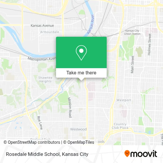
See Rosedale Middle School, Kansas City, on the map
Public Transit to Rosedale Middle School in Kansas City
Wondering how to get to Rosedale Middle School in Kansas City? Moovit helps you find the best way to get to Rosedale Middle School with step-by-step directions from the nearest public transit station.
Moovit provides free maps and live directions to help you navigate through your city. View schedules, routes, timetables, and find out how long does it take to get to Rosedale Middle School in real time.
Looking for the nearest stop or station to Rosedale Middle School? Check out this list of stops closest to your destination: On Rainbow at SW Blvd Southbound; On 39th at Rainbow Westbound; On 39th at Ku Med Center Eastbound; 39th & Rainbow; Westport(39th & Main St).
Bus: 107, 11, 39, 47, 403.
Want to see if there’s another route that gets you there at an earlier time? Moovit helps you find alternative routes or times. Get directions from and directions to Rosedale Middle School easily from the Moovit App or Website.
We make riding to Rosedale Middle School easy, which is why over 1.5 million users, including users in Kansas City, trust Moovit as the best app for public transit. You don’t need to download an individual bus app or train app, Moovit is your all-in-one transit app that helps you find the best bus time or train time available.
For information on prices of bus, costs and ride fares to Rosedale Middle School, please check the Moovit app.
Use the app to navigate to popular places including to the airport, hospital, stadium, grocery store, mall, coffee shop, school, college, and university.
Rosedale Middle School Address: 3600 Springfield St street in Kansas City
- KU Medical Center Support Services,
- Hemenway Life Sciences Innovation Center - KU Med,
- 39th And Rainbow,
- Hoglund Brain Imaging Center @ The University Of Kansas Medical Center,
- Child Development Unit,
- Sutherland Institute @ Ku Med,
- Ku Medical Center,
- Hallmark,
- University Of Kansas Hospital Emergency Room,
- KUMC Bell Hospital,
- KUMED Boley Conference Room,
- The University of Kansas Hospital,
- Medical Surgical ICU (Unit 61),
- KU Methadone Clinic,
- Medical Office Building (@KUMC),
- University of Kansas Hospital Center for Transplantation,
- Up-Bnsf Rosedale Yard (Abandoned),
- Isha Sisters Hair Braiding (African Hair Braiding),
- Power Equiment Sales (Power Equipment Sales Company),
- The Brannon Brothel
Places Near Rosedale Middle School (Kansas City)
- Country Club Plaza,
- Stans Glory Hole,
- Liberty, MO, Liberty,
- Worlds of Fun,
- Ku Medical Center, Kansas City,
- Arrowhead Stadium,
- Legends Outlets Kansas City, Kansas City,
- Harrah's Casino, North Kansas City,
- T-Mobile Center,
- Grandview, MO, Grandview,
- St. Luke's Hospital - Medical Plaza I,
- Kansas City International Airport (MCI) (Kansas City International Airport),
- Truman Medical Center,
- GEHA Field at Arrowhead Stadium,
- Amazon Fulfilment Center-MKC6, Kansas City,
- The Glory Hole,
- Kansas City Zoo,
- Walmart Supercenter,
- Kauffman Stadium,
- Walmart, Kansas City
How to get to popular places in Kansas City with public transit
Get around Kansas City by public transit!
Traveling around Kansas City has never been so easy. See step by step directions as you travel to any attraction, street or major public transit station. View bus and train schedules, arrival times, service alerts and detailed routes on a map, so you know exactly how to get to anywhere in Kansas City.
When traveling to any destination around Kansas City use Moovit's Live Directions with Get Off Notifications to know exactly where and how far to walk, how long to wait for your line, and how many stops are left. Moovit will alert you when it's time to get off — no need to constantly re-check whether yours is the next stop.
Wondering how to use public transit in Kansas City or how to pay for public transit in Kansas City? Moovit public transit app can help you navigate your way with public transit easily, and at minimum cost. It includes public transit fees, ticket prices, and costs. Looking for a map of Kansas City public transit lines? Moovit public transit app shows all public transit maps in Kansas City with all Bus, Train and Light Rail routes and stops on an interactive map.
Kansas City has 3 transit type(s), including: Bus, Train and Light Rail, operated by several transit agencies, including Kansas City Area Transportation Authority, Lawrence Transit, Topeka Metro, RideKC Johnson County, Amtrak, Greyhound-us and FlixBus-us