Directions to Roslindale Florist (Boston) with public transportation
The following transit lines have routes that pass near Roslindale Florist
 Bus: 34, 50.
- Train: NEEDHAM, FAIRMOUNT LINE SHUTTLE, FAIRMOUNT, FRANKLIN/FOXBORO, PROVIDENCE/STOUGHTON.
- Subway: ORANGE LINE.
How to get to Roslindale Florist by bus?
Click on the bus route to see step by step directions with maps, line arrival times and updated time schedules.
From Shubert Theatre, Boston
58 minFrom Courtyard Marriott Lobby, Boston
62 minFrom Saltie Girl, Boston
69 minFrom Boch Center, Boston
63 minFrom Brighton, Boston
64 minFrom Sonia, Boston
68 minFrom Old Town Trolley Tours of Boston, Boston
51 minFrom Bistro du Midi, Boston
51 minFrom Royale, Boston
58 minFrom Earls Kitchen + Bar, Boston
48 min
How to get to Roslindale Florist by train?
Click on the train route to see step by step directions with maps, line arrival times and updated time schedules.
From Shubert Theatre, Boston
51 minFrom Courtyard Marriott Lobby, Boston
52 minFrom Saltie Girl, Boston
75 minFrom Boch Center, Boston
51 minFrom Sonia, Boston
83 minFrom Old Town Trolley Tours of Boston, Boston
48 minFrom Bistro du Midi, Boston
48 minFrom Royale, Boston
49 minFrom Earls Kitchen + Bar, Boston
47 min
How to get to Roslindale Florist by subway?
Click on the subway route to see step by step directions with maps, line arrival times and updated time schedules.
Bus stop near Roslindale Florist in Boston
- Metropolitan Ave @ Highfield Rd, 4 min walk,VIEW
Train stations near Roslindale Florist in Boston
Bus lines to Roslindale Florist in Boston
- 50, Forest Hills,VIEW
What are the closest stations to Roslindale Florist?
The closest stations to Roslindale Florist are:
- Metropolitan Ave @ Highfield Rd is 258 yards away, 4 min walk.
- Bellevue is 1102 yards away, 13 min walk.
- Fairmount is 1864 yards away, 22 min walk.
Which bus lines stop near Roslindale Florist?
These bus lines stop near Roslindale Florist: 34, 50.
Which train line stops near Roslindale Florist?
NEEDHAM (#625 | Needham Heights)
Which subway line stops near Roslindale Florist?
ORANGE LINE (Forest Hills)
What’s the nearest train station to Roslindale Florist in Boston?
The nearest train station to Roslindale Florist in Boston is Bellevue. It’s a 13 min walk away.
What’s the nearest bus station to Roslindale Florist in Boston?
The nearest bus station to Roslindale Florist in Boston is Metropolitan Ave @ Highfield Rd. It’s a 4 min walk away.
What time is the first train to Roslindale Florist in Boston?
The FAIRMOUNT is the first train that goes to Roslindale Florist in Boston. It stops nearby at 4:33 AM.
What time is the last train to Roslindale Florist in Boston?
The PROVIDENCE/STOUGHTON is the last train that goes to Roslindale Florist in Boston. It stops nearby at 12:22 AM.
What time is the first bus to Roslindale Florist in Boston?
The 50 is the first bus that goes to Roslindale Florist in Boston. It stops nearby at 6:04 AM.
What time is the last bus to Roslindale Florist in Boston?
The 50 is the last bus that goes to Roslindale Florist in Boston. It stops nearby at 10:32 PM.
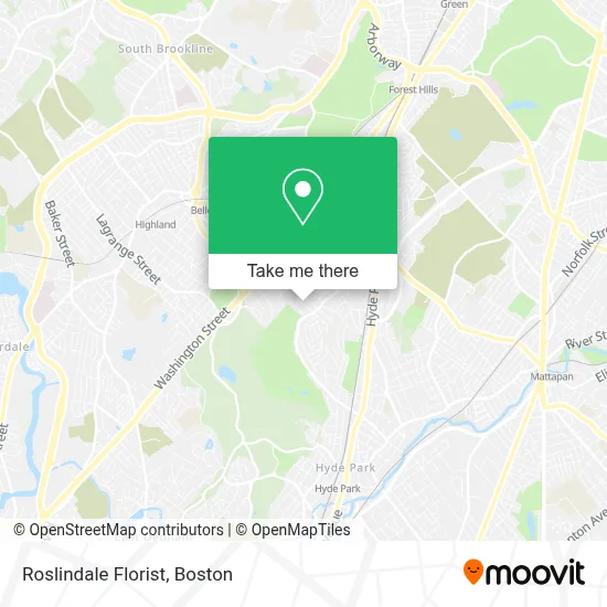
See Roslindale Florist, Boston, on the map
Public Transit to Roslindale Florist in Boston
Wondering how to get to Roslindale Florist in Boston? Moovit helps you find the best way to get to Roslindale Florist with step-by-step directions from the nearest public transit station.
Moovit provides free maps and live directions to help you navigate through your city. View schedules, routes, timetables, and find out how long does it take to get to Roslindale Florist in real time.
Looking for the nearest stop or station to Roslindale Florist? Check out this list of stops closest to your destination: Metropolitan Ave @ Highfield Rd; Bellevue; Fairmount.
Bus: 34, 50.Train: NEEDHAM, FAIRMOUNT LINE SHUTTLE, FAIRMOUNT, FRANKLIN/FOXBORO, PROVIDENCE/STOUGHTON.Subway: ORANGE LINE.
Want to see if there’s another route that gets you there at an earlier time? Moovit helps you find alternative routes or times. Get directions from and directions to Roslindale Florist easily from the Moovit App or Website.
We make riding to Roslindale Florist easy, which is why over 1.7 million users, including users in Boston, trust Moovit as the best app for public transit. You don’t need to download an individual bus app or train app, Moovit is your all-in-one transit app that helps you find the best bus time or train time available.
For information on prices of bus, subway and train, costs and ride fares to Roslindale Florist, please check the Moovit app.
Use the app to navigate to popular places including to the airport, hospital, stadium, grocery store, mall, coffee shop, school, college, and university.
Roslindale Florist Address: 545 Beech St street in Boston
- Best Selling Flowers,
- Brian G Donovan Construction C,
- Fullbodycast,
- Free Your Mind Publishing,
- Evo9x,
- Family Matters,
- RMV,
- RVZ Candles,
- Stony Brook Reservation,
- Odimas International DJ /Club Gears,
- The Partnership Marriage Book,
- Blue Ledge Co-OP Apartments,
- Stony Brook Commons,
- Washington S Building 4572,
- O'Connell, KK Security,
- MoneyGram,
- Accident Chiropractors,
- DUNKIN',
- Xfinity,
- Metropolitan Hill / Beach Street, Massachusetts
Places Near Roslindale Florist (Boston)
- Isabella Stewart Gardner Museum, Boston,
- Museum Of Science, Boston,
- Cheers, Boston,
- Castle Island, Boston,
- Mgm Music Hall, Boston,
- Wilbur Theatre, Boston,
- Boston Common, Boston,
- Quincy Market, Boston,
- North End, Boston,
- Massachusetts General Hospital, Boston,
- Prudential Center, Boston,
- Faneuil Hall, Boston,
- Boston Convention & Exhibition Center, Boston,
- House Of Blues, Boston,
- Leader Bank Pavilion (Leader Bank Pavillion), Boston,
- Td Garden, Boston,
- Boston Medical Center, Boston,
- Boston Children's Hospital, Boston,
- Wang Theater, Boston,
- Seaport District, Boston
How to get to popular places in Boston with public transit
Get around Boston by public transit!
Traveling around Boston has never been so easy. See step by step directions as you travel to any attraction, street or major public transit station. View bus and train schedules, arrival times, service alerts and detailed routes on a map, so you know exactly how to get to anywhere in Boston.
When traveling to any destination around Boston use Moovit's Live Directions with Get Off Notifications to know exactly where and how far to walk, how long to wait for your line, and how many stops are left. Moovit will alert you when it's time to get off — no need to constantly re-check whether yours is the next stop.
Wondering how to use public transit in Boston or how to pay for public transit in Boston? Moovit public transit app can help you navigate your way with public transit easily, and at minimum cost. It includes public transit fees, ticket prices, and costs. Looking for a map of Boston public transit lines? Moovit public transit app shows all public transit maps in Boston with all Bus, Train, Subway and Ferry routes and stops on an interactive map.
Boston has 4 transit type(s), including: Bus, Train, Subway and Ferry, operated by several transit agencies, including MBTA, Southeastern Regional Transit Authority, MetroWest Regional Transit Authority, Rhode Island Public Transit Authority, WRTA, Lowell Regional Transit Authority, Merrimack Valley Transit, Montachusett Regional Transit Authority, Cape Cod Regional Transit Authority, Brockton Area Transit Authority, Martha's Vineyard Transit Authority, the WAVE - Nantucket Regional Transit Authority, GATRA, Cape Ann Transportation Authority and Massport