Directions to Ross & Toner PC (Boston) with public transportation
The following transit lines have routes that pass near Ross & Toner PC
 Bus: 35, 36, 37, NEEDHAM LINE SHUTTLE, NEEDHAM LINE SHUTTLE.
- Train: NEEDHAM, FRANKLIN/FOXBORO, ORANGE LINE, PROVIDENCE/STOUGHTON.
- Subway: ORANGE LINE.
How to get to Ross & Toner PC by bus?
Click on the bus route to see step by step directions with maps, line arrival times and updated time schedules.
From Chinatown Station MBTA, Boston
56 minFrom Harvard Stadium, Boston
73 minFrom MBTA-Chinatown, Boston
56 minFrom Boston Bowl - Dorchester, Boston
62 minFrom New England Conservatory of Music, Boston
45 minFrom AMC Theatres-Boston Common 19, Boston
54 minFrom Studio Allston, Boston
71 minFrom Kendall Square, Cambridge
83 minFrom The Ritz-Carlton, Boston, Boston
55 minFrom Boston Park Plaza, Boston
50 min
How to get to Ross & Toner PC by train?
Click on the train route to see step by step directions with maps, line arrival times and updated time schedules.
From Chinatown Station MBTA, Boston
32 minFrom Harvard Stadium, Boston
104 minFrom MBTA-Chinatown, Boston
32 minFrom New England Conservatory of Music, Boston
22 minFrom AMC Theatres-Boston Common 19, Boston
35 minFrom Studio Allston, Boston
93 minFrom The Ritz-Carlton, Boston, Boston
34 minFrom Boston Park Plaza, Boston
24 min
How to get to Ross & Toner PC by subway?
Click on the subway route to see step by step directions with maps, line arrival times and updated time schedules.
From Chinatown Station MBTA, Boston
62 minFrom Harvard Stadium, Boston
93 minFrom MBTA-Chinatown, Boston
62 minFrom New England Conservatory of Music, Boston
61 minFrom AMC Theatres-Boston Common 19, Boston
65 minFrom Kendall Square, Cambridge
81 minFrom The Ritz-Carlton, Boston, Boston
65 minFrom Boston Park Plaza, Boston
66 min
Bus stops near Ross & Toner PC in Boston
Train stations near Ross & Toner PC in Boston
Bus lines to Ross & Toner PC in Boston
What are the closest stations to Ross & Toner PC?
The closest stations to Ross & Toner PC are:
- Belgrade Ave @ Mccraw St is 45 yards away, 1 min walk.
- Bellevue is 80 yards away, 2 min walk.
- Belgrade Ave @ West Roxbury Pkwy is 213 yards away, 3 min walk.
- West Roxbury is 1476 yards away, 18 min walk.
- Forest Hills is 2473 yards away, 30 min walk.
Which bus lines stop near Ross & Toner PC?
These bus lines stop near Ross & Toner PC: 35, 36, 37.
Which train line stops near Ross & Toner PC?
NEEDHAM (#625 | Needham Heights)
Which subway line stops near Ross & Toner PC?
ORANGE LINE (Forest Hills)
What’s the nearest train station to Ross & Toner PC in Boston?
The nearest train station to Ross & Toner PC in Boston is West Roxbury. It’s a 18 min walk away.
What’s the nearest bus station to Ross & Toner PC in Boston?
The nearest bus station to Ross & Toner PC in Boston is Belgrade Ave @ Mccraw St. It’s a 1 min walk away.
What time is the first subway to Ross & Toner PC in Boston?
The ORANGE LINE is the first subway that goes to Ross & Toner PC in Boston. It stops nearby at 5:15 AM.
What time is the last subway to Ross & Toner PC in Boston?
The ORANGE LINE is the last subway that goes to Ross & Toner PC in Boston. It stops nearby at 1:02 AM.
What time is the first train to Ross & Toner PC in Boston?
The NEEDHAM is the first train that goes to Ross & Toner PC in Boston. It stops nearby at 5:21 AM.
What time is the last train to Ross & Toner PC in Boston?
The NEEDHAM is the last train that goes to Ross & Toner PC in Boston. It stops nearby at 12:23 AM.
What time is the first bus to Ross & Toner PC in Boston?
The 36 is the first bus that goes to Ross & Toner PC in Boston. It stops nearby at 4:38 AM.
What time is the last bus to Ross & Toner PC in Boston?
The 36 is the last bus that goes to Ross & Toner PC in Boston. It stops nearby at 1:36 AM.
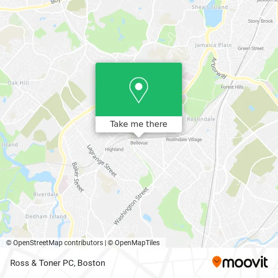
See Ross & Toner PC, Boston, on the map
Public Transit to Ross & Toner PC in Boston
Wondering how to get to Ross & Toner PC in Boston? Moovit helps you find the best way to get to Ross & Toner PC with step-by-step directions from the nearest public transit station.
Moovit provides free maps and live directions to help you navigate through your city. View schedules, routes, timetables, and find out how long does it take to get to Ross & Toner PC in real time.
Looking for the nearest stop or station to Ross & Toner PC? Check out this list of stops closest to your destination: Belgrade Ave @ Mccraw St; Bellevue; Belgrade Ave @ West Roxbury Pkwy; West Roxbury; Forest Hills.
Bus: 35, 36, 37, NEEDHAM LINE SHUTTLE, NEEDHAM LINE SHUTTLE, 38.Train: NEEDHAM, FRANKLIN/FOXBORO, ORANGE LINE, PROVIDENCE/STOUGHTON.Subway: ORANGE LINE.
Want to see if there’s another route that gets you there at an earlier time? Moovit helps you find alternative routes or times. Get directions from and directions to Ross & Toner PC easily from the Moovit App or Website.
We make riding to Ross & Toner PC easy, which is why over 1.5 million users, including users in Boston, trust Moovit as the best app for public transit. You don’t need to download an individual bus app or train app, Moovit is your all-in-one transit app that helps you find the best bus time or train time available.
For information on prices of bus, subway and train, costs and ride fares to Ross & Toner PC, please check the Moovit app.
Use the app to navigate to popular places including to the airport, hospital, stadium, grocery store, mall, coffee shop, school, college, and university.
Ross & Toner PC Address: 343 Belgrade Ave Roslindale, MA 02131 street in Boston
- MBTA Bellevue Commuter Rail,
- Banh Mi Oi (Banh Mi Ngon),
- Claude's Jewelry,
- Roche Bros.,
- Punta Cana Beer and Wi,
- Fallon Field (Fallon Field, Roslindale),
- Arbri Cafe,
- Fallon Field,
- Paul John Kilgarriff Attorney;Enrolled AG,
- Bellevue Hill, Massachusetts,
- West Roxbury,
- Boston Ale House,
- Hercules Stump Grinding,
- Roslindale,
- Qualter General Contractor,
- Joyce Kilmer Upper School,
- Boston Public Schools,
- Triple Crown Services,
- Parkway Community Ymca,
- MLB Construction
Places Near Ross & Toner PC (Boston)
- Boston Common, Boston,
- Quincy Market, Boston,
- Castle Island, Boston,
- Wang Theater, Boston,
- Massachusetts General Hospital, Boston,
- Mgm Music Hall, Boston,
- Leader Bank Pavilion (Leader Bank Pavillion), Boston,
- Isabella Stewart Gardner Museum, Boston,
- Museum Of Science, Boston,
- Faneuil Hall, Boston,
- Boston Children's Hospital, Boston,
- Boston Convention & Exhibition Center, Boston,
- House Of Blues, Boston,
- Seaport District, Boston,
- Td Garden, Boston,
- Cheers, Boston,
- Prudential Center, Boston,
- North End, Boston,
- Boston Medical Center, Boston,
- Wilbur Theatre, Boston
How to get to popular places in Boston with public transit
Get around Boston by public transit!
Traveling around Boston has never been so easy. See step by step directions as you travel to any attraction, street or major public transit station. View bus and train schedules, arrival times, service alerts and detailed routes on a map, so you know exactly how to get to anywhere in Boston.
When traveling to any destination around Boston use Moovit's Live Directions with Get Off Notifications to know exactly where and how far to walk, how long to wait for your line, and how many stops are left. Moovit will alert you when it's time to get off — no need to constantly re-check whether yours is the next stop.
Wondering how to use public transit in Boston or how to pay for public transit in Boston? Moovit public transit app can help you navigate your way with public transit easily, and at minimum cost. It includes public transit fees, ticket prices, and costs. Looking for a map of Boston public transit lines? Moovit public transit app shows all public transit maps in Boston with all Bus, Train, Subway and Ferry routes and stops on an interactive map.
Boston has 4 transit type(s), including: Bus, Train, Subway and Ferry, operated by several transit agencies, including MBTA, Southeastern Regional Transit Authority, MetroWest Regional Transit Authority, Rhode Island Public Transit Authority, WRTA, Lowell Regional Transit Authority, Merrimack Valley Transit, Montachusett Regional Transit Authority, Cape Cod Regional Transit Authority, Brockton Area Transit Authority, Martha's Vineyard Transit Authority, the WAVE - Nantucket Regional Transit Authority, GATRA, Cape Ann Transportation Authority and Massport