How to get to Rothsnasenhütte by bus?
Click on the bus route to see step by step directions with maps, line arrival times and updated time schedules.
From Thingstätte, Handschuhsheim
63 minFrom SAP Campus, Walldorf
71 minFrom Luxor Filmpalast, Bahnstadt
56 minFrom SAP Walldorf P18, Walldorf
78 minFrom SAP Headquarters, Walldorf
76 minFrom Agaplesion Bethanien Krankenhaus Heidelberg, Südstadt
57 minFrom GRN-Klinik Schwetzingen, Schwetzingen
78 minFrom Neuenheimer Feld, Neuenheim
56 minFrom Marie-Baum-Schule Heidelberg, Wieblingen
56 min
How to get to Rothsnasenhütte by train?
Click on the train route to see step by step directions with maps, line arrival times and updated time schedules.
Bus stops near Rothsnasenhütte in Verwaltungsverband Neckargemünd
Train station near Rothsnasenhütte in Verwaltungsverband Neckargemünd
- Neckargemünd, Bahnhof, 17 min walk,VIEW
Bus lines to Rothsnasenhütte in Verwaltungsverband Neckargemünd
- 736, Kleingemünd, Felsenberg,VIEW
- 746, Neckargemünd, Ghs,VIEW
- 752, Mückenloch, Friedhof,VIEW
- 753, Kleingemünd, P.-Schnellbach-S.,VIEW
- 755, Waldhilsbach, Eulenscheich,VIEW
- RNV 35, Heidelberg, Bismarckplatz,VIEW
- 735, Hilsenhain, Dell,VIEW
- 8913, Kleingemünd, Abzw. B 37,VIEW
- 754, Moosbrunn,VIEW
- 7940, Neckargemünd, Bahnhof,VIEW
- 8911, Waldhilsbach, Eulenscheich - Neckargemünd, Bahnhof,VIEW
- RE 2, Osterburken, Bahnhof - Heidelberg, Hauptbahnhof,VIEW
- RE 5, Eppingen Gleis 22 - Neckargemünd, Bahnhof,VIEW
- RE 10A, Mannheim, Hauptbahnhof - Heilbronn Hauptbahnhof Gleis 5,VIEW
- RE 10B, Mannheim, Hauptbahnhof - Heilbronn Hauptbahnhof Gleis 5,VIEW
- S1, Mosbach, Bahnhof - Osterburken, Bahnhof,VIEW
- S1, Bruchsal - Heidelberg, Hauptbahnhof,VIEW
- S2, Karlsruhe Hauptbahnhof - Kaiserslautern, Hbf,VIEW
- S2, Mosbach, Bahnhof - Kaiserslautern, Hbf,VIEW
- S3, Osterburken, Bahnhof - Mannheim, Hauptbahnhof,VIEW
What are the closest stations to Rothsnasenhütte?
The closest stations to Rothsnasenhütte are:
- Neckargemünd, Ghs is 232 meters away, 4 min walk.
- Neckargemünd, Schützenhausbr. is 293 meters away, 4 min walk.
- Kleingemünd, Ort is 459 meters away, 6 min walk.
- Neckargemünd, Hanfmarkt is 821 meters away, 11 min walk.
- Neckargemünd, Bahnhof is 1138 meters away, 15 min walk.
Which train lines stop near Rothsnasenhütte?
These train lines stop near Rothsnasenhütte: RE10A, RE10B, S7, S8.
Which light rail line stops near Rothsnasenhütte?
S2 (Mosbach, Bahnhof)
Which bus lines stop near Rothsnasenhütte?
These bus lines stop near Rothsnasenhütte: 35, 735.
What’s the nearest train station to Rothsnasenhütte in Verwaltungsverband Neckargemünd?
The nearest train station to Rothsnasenhütte in Verwaltungsverband Neckargemünd is Neckargemünd, Bahnhof. It’s a 17 min walk away.
What’s the nearest bus station to Rothsnasenhütte in Verwaltungsverband Neckargemünd?
The nearest bus stations to Rothsnasenhütte in Verwaltungsverband Neckargemünd are Neckargemünd, Ghs and Neckargemünd, Schützenhausbr.. The closest one is a 4 min walk away.
What time is the first light rail to Rothsnasenhütte in Verwaltungsverband Neckargemünd?
The S1 is the first light rail that goes to Rothsnasenhütte in Verwaltungsverband Neckargemünd. It stops nearby at 4:56 AM.
What time is the last light rail to Rothsnasenhütte in Verwaltungsverband Neckargemünd?
The S5 is the last light rail that goes to Rothsnasenhütte in Verwaltungsverband Neckargemünd. It stops nearby at 12:59 AM.
What time is the first train to Rothsnasenhütte in Verwaltungsverband Neckargemünd?
The S7 is the first train that goes to Rothsnasenhütte in Verwaltungsverband Neckargemünd. It stops nearby at 5:10 AM.
What time is the last train to Rothsnasenhütte in Verwaltungsverband Neckargemünd?
The S7 is the last train that goes to Rothsnasenhütte in Verwaltungsverband Neckargemünd. It stops nearby at 12:59 AM.
What time is the first bus to Rothsnasenhütte in Verwaltungsverband Neckargemünd?
The RNV 35 is the first bus that goes to Rothsnasenhütte in Verwaltungsverband Neckargemünd. It stops nearby at 4:45 AM.
What time is the last bus to Rothsnasenhütte in Verwaltungsverband Neckargemünd?
The 7940 is the last bus that goes to Rothsnasenhütte in Verwaltungsverband Neckargemünd. It stops nearby at 12:47 AM.
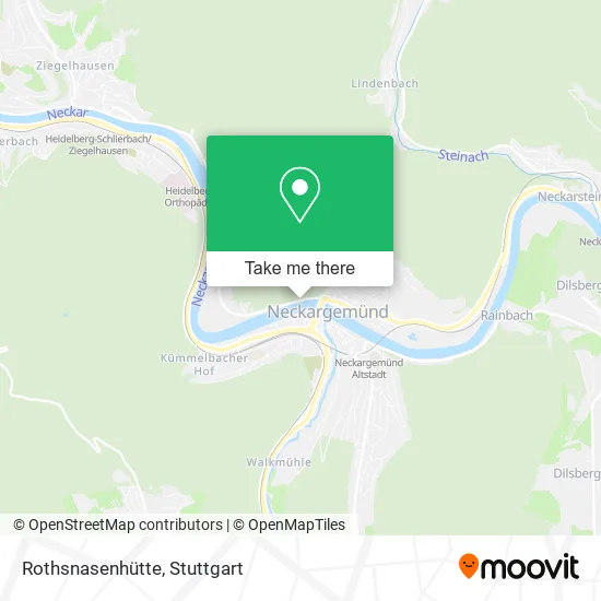
See Rothsnasenhütte, Verwaltungsverband Neckargemünd, on the map
Public Transit to Rothsnasenhütte in Verwaltungsverband Neckargemünd
Wondering how to get to Rothsnasenhütte in Verwaltungsverband Neckargemünd? Moovit helps you find the best way to get to Rothsnasenhütte with step-by-step directions from the nearest public transit station.
Moovit provides free maps and live directions to help you navigate through your city. View schedules, routes, timetables, and find out how long does it take to get to Rothsnasenhütte in real time.
Looking for the nearest stop or station to Rothsnasenhütte? Check out this list of stops closest to your destination: Neckargemünd; Neckargemünd; Kleingemünd; Neckargemünd; Neckargemünd.
Train: RE10A, RE10B, S7, S8, RE2, S3, RE7.Light Rail: S2.Bus: 35, 735, 736, 746, 752, 753, 755, RNV 35, 8913, 754, 7940, 8911, RE 2, RE 5, RE 10A, RE 10B.
Want to see if there’s another route that gets you there at an earlier time? Moovit helps you find alternative routes or times. Get directions from and directions to Rothsnasenhütte easily from the Moovit App or Website.
We make riding to Rothsnasenhütte easy, which is why over 1.5 million users, including users in Verwaltungsverband Neckargemünd, trust Moovit as the best app for public transit. You don’t need to download an individual bus app or train app, Moovit is your all-in-one transit app that helps you find the best bus time or train time available.
For information on prices of bus, train and light rail, costs and ride fares to Rothsnasenhütte, please check the Moovit app.
Use the app to navigate to popular places including to the airport, hospital, stadium, grocery store, mall, coffee shop, school, college, and university.
Rothsnasenhütte Address: Ziegelhäuser Straße 69151 Neckargemünd street in Verwaltungsverband Neckargemünd
- Kleingemünd,
- Dlrg-Gruppe Neckargemünd,
- Falltorstraße/Brücke,
- Campig an der Friedensbrücke,
- Neuapostolische Kirche Süddeutschland K.D.Ö.R,
- Kanuverleih Neckargemünd,
- Camping Neckargemuend,
- Campinplatz Neckargmue,
- Flatsebatser,
- Sportanglerverein Neckargemünd,
- Allianz Versicherung Steven Punt Hauptvertretung,
- Friedensbrücke,
- Neckargemünd/Kleingemünd,
- Martin-Luther-Haus,
- M. Vermittlungsgesellschaft für Finanzanlagen und Versicherungen,
- Heinz Steck,
- M. Vermittlungsgesellschaft,
- An Der Friedensbrücke,
- Claudia Mory,
- Dr. Claudia Mory
Places Near Rothsnasenhütte (Verwaltungsverband Neckargemünd)
- Marmorsaal Im Weissenburgpark, Stuttgart-Süd,
- Hanns-Martin-Schleyer-Halle, Bad Cannstatt,
- SI-Centrum, Möhringen,
- Wilhelma (U-Bahn Wilhelma), Bad Cannstatt,
- Gleis 101/102 (tief), Stuttgart-Mitte,
- Gasometer Pforzheim, Pforzheim,
- Porsche-Arena, Bad Cannstatt,
- Hauptbahnhof Stuttgart, Stuttgart-Mitte,
- Im Wizemann (Halle), Bad Cannstatt,
- Mettingen Eros-Center Puff Laufhaus, Esslingen Am Neckar,
- Mercedes-Benz Museum (Mercedes Museum Stuttgart), Bad Cannstatt,
- Porsche Museum, Zuffenhausen,
- Waldfriedhof, Degerloch,
- Mercedes-Benz Museum, Bad Cannstatt,
- Schleyerhalle, Bad Cannstatt,
- Geilhaus Haus 33a, Reutlingen-Betzingen,
- Klinikum Stuttgart - Katharinenhospital, Stuttgart-Mitte,
- Hanns-Martin-Schleyer-Halle (Stuttgart Hans-Martin-Schleyerhalle), Bad Cannstatt,
- FlixBus Haltestelle, Stuttgart,
- Pariser Platz Stuttgart, Stuttgart-Mitte
How to get to popular places in Stuttgart with public transit
Get around Verwaltungsverband Neckargemünd by public transit!
Traveling around Verwaltungsverband Neckargemünd has never been so easy. See step by step directions as you travel to any attraction, street or major public transit station. View bus and train schedules, arrival times, service alerts and detailed routes on a map, so you know exactly how to get to anywhere in Verwaltungsverband Neckargemünd.
When traveling to any destination around Verwaltungsverband Neckargemünd use Moovit's Live Directions with Get Off Notifications to know exactly where and how far to walk, how long to wait for your line, and how many stops are left. Moovit will alert you when it's time to get off — no need to constantly re-check whether yours is the next stop.
Wondering how to use public transit in Verwaltungsverband Neckargemünd or how to pay for public transit in Verwaltungsverband Neckargemünd? Moovit public transit app can help you navigate your way with public transit easily, and at minimum cost. It includes public transit fees, ticket prices, and costs. Looking for a map of Verwaltungsverband Neckargemünd public transit lines? Moovit public transit app shows all public transit maps in Verwaltungsverband Neckargemünd with all Bus, Train, Subway, Light Rail, Ferry, S-Bahn and Funicular routes and stops on an interactive map.
Stuttgart has 7 transit type(s), including: Bus, Train, Subway, Light Rail, Ferry, S-Bahn and Funicular, operated by several transit agencies, including SSB - Stadtbahn, SSB, SSB - Seilbahn / Zacke, S-Bahn Stuttgart, Rhein-Neckar-Verkehr GmbH (rnv), Karlsruher Verkehrsverbund, DB AG, DB Regiobus BW, Arverio Baden-Württemberg GmbH, DB RegioNetz Verkehrs GmbH Westfrankenbahn, DB Regio AG Baden-Württemberg, Südwestdeutsche Verkehrs-AG, DB Regio AG Mitte Region Hessen, DB and Bodensee-Oberschwaben-Bahn