Directions to Roue de Paris with public transportation
The following transit lines have routes that pass near Roue de Paris
How to get to Roue de Paris by bus?
Click on the bus route to see step by step directions with maps, line arrival times and updated time schedules.
How to get to Roue de Paris by train?
Click on the train route to see step by step directions with maps, line arrival times and updated time schedules.
How to get to Roue de Paris by metro?
Click on the metro route to see step by step directions with maps, line arrival times and updated time schedules.
Metro stations near Roue de Paris
- Concorde, 3 min walk,
- Madeleine, 7 min walk,
Rer stations near Roue de Paris
- Musee D Orsay, 10 min walk,
What are the closest stations to Roue de Paris?
The closest stations to Roue de Paris are:
- Concorde is 183 meters away, 3 min walk.
- Madeleine is 509 meters away, 7 min walk.
- Musee D Orsay is 772 meters away, 10 min walk.
Which train lines stop near Roue de Paris?
These train lines stop near Roue de Paris: J, L, N.
Which metro lines stop near Roue de Paris?
These metro lines stop near Roue de Paris: 1, 12, 13, 8.
Which bus lines stop near Roue de Paris?
These bus lines stop near Roue de Paris: 20, 42, 72, 73, 94.
What’s the nearest metro station to Roue de Paris?
The nearest metro station to Roue de Paris is Concorde. It’s a 3 min walk away.
What’s the nearest RER station to Roue de Paris?
The nearest RER station to Roue de Paris is Musee D Orsay. It’s a 10 min walk away.
See Roue de Paris on the map
Public Transportation to Roue de Paris
Wondering how to get to Roue de Paris, France? Moovit helps you find the best way to get to Roue de Paris with step-by-step directions from the nearest public transit station.
Moovit provides free maps and live directions to help you navigate through your city. View schedules, routes, timetables, and find out how long does it take to get to Roue de Paris in real time.
Looking for the nearest stop or station to Roue de Paris? Check out this list of stops closest to your destination: Concorde; Madeleine; Musee D Orsay.
Train: J, L, N.RER: C.Metro: 1, 12, 13, 8, 14.Bus: 20, 42, 72, 73, 94.
Want to see if there’s another route that gets you there at an earlier time? Moovit helps you find alternative routes or times. Get directions from and directions to Roue de Paris easily from the Moovit App or Website.
We make riding to Roue de Paris easy, which is why over 1.5 million users, including users in Paris, trust Moovit as the best app for public transit. You don’t need to download an individual bus app or train app, Moovit is your all-in-one transit app that helps you find the best bus time or train time available.
For information on prices of metro, bus, train, RER and light rail, costs and ride fares to Roue de Paris, please check the Moovit app.
Use the app to navigate to popular places including to the airport, hospital, stadium, grocery store, mall, coffee shop, school, college, and university.
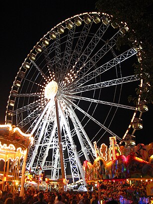
Roue de Paris Address: Place de la Concorde street in Paris
Attractions near Roue de Paris
Grande Roue de Paris,Carousel De Place De La Concorde,Arrêt Concorde - Quai des Tuileries [72],Entrée Concorde,Toilettes Des Tuileries,Strasbourg,11 Rue Saint-Florentin,Concorde plaza,Trg sloge,Praça da Concórdia,Fontaine des Fleuves,Obélisque de Louxor,Obélisque de Louxor,Place de la Concorde,Le Baiser,Place de la Concorde,Marseille,Musée de l'Orangerie,Fontaine Des Mers,Entrée Poterne de L'OrangerieHow to get to popular attractions in Paris with public transit
Agence Delasource, Boulogne-Billancourt,Pullman Roissy CDG, Roissy-En-France,Court Philippe Chatrier, Paris,Novedia, Boulogne-Billancourt,PagesJaunes, Sevres,Parc Des Buttes-Chaumont, Paris,Parc Des Princes A To F, Paris,Hôpital Cochin, Paris,Stade de France A To J, Saint-Denis,Alcatel Lucent France, Velizy-Villacoublay,Parc Monceau, Paris,Starbucks, Versailles,Roissy Charles de Gaulle, Roissy-En-France,Bercy Village, Paris,Cergy, Cergy,Aeroport Charles de Gaulle, Le Mesnil-Amelot,Poissy, Poissy,Edenred, Malakoff,Saint-Cloud, Saint-Cloud,Musée D'Orsay, ParisGet around Paris by public transit!
Traveling around Paris has never been so easy. See step by step directions as you travel to any attraction, street or major public transit station. View bus and train schedules, arrival times, service alerts and detailed routes on a map, so you know exactly how to get to anywhere in Paris.
When traveling to any destination around Paris use Moovit's Live Directions with Get Off Notifications to know exactly where and how far to walk, how long to wait for your line, and how many stops are left. Moovit will alert you when it's time to get off — no need to constantly re-check whether yours is the next stop.
Wondering how to use public transit in Paris or how to pay for public transit in Paris? Moovit public transit app can help you navigate your way with public transit easily, and at minimum cost. It includes public transit fees, ticket prices, and costs. Looking for a map of Paris public transit lines? Moovit public transit app shows all public transit maps in Paris with all Bus, Train, Metro, Light Rail, RER and Funicular routes and stops on an interactive map.
Paris has 6 transit type(s), including: Bus, Train, Metro, Light Rail, RER and Funicular, operated by several transit agencies, including RATP, RER, RER Bus de remplacement, Train, Train Bus de remplacement, Tramway Bus de remplacement, TER, Tramway, ADP, Noctilien, Magical Shuttle, Apolo 7, Argenteuil - Boucles de Seine, Autobus du Fort, Autocars Dominique