How to get to Routing Nutrition by bus?
Click on the bus route to see step by step directions with maps, line arrival times and updated time schedules.
From Apple Cinemas, Cambridge
106 minFrom Andrew Square, Boston
57 minFrom the mall at rockingham park mall, Boston
80 minFrom Brighton District Court, Boston
73 minFrom Belmont, MA, Belmont
95 minFrom Boston City Hall, Boston
64 minFrom Watertown Mall, Watertown Town
92 minFrom 7F Everett Street, Revere
41 min
How to get to Routing Nutrition by subway?
Click on the subway route to see step by step directions with maps, line arrival times and updated time schedules.
Bus stops near Routing Nutrition in Boston
Subway station near Routing Nutrition in Boston
- Maverick, 15 min walk,VIEW
Ferry station near Routing Nutrition in Boston
- Lewis Mall Wharf, 21 min walk,VIEW
Bus lines to Routing Nutrition in Boston
- 22, Conrac Rental Car Center, Drop Off - Conrac Rental Car Center, Pick Up,VIEW
- 33, Conrac Rental Car Center, Drop Off - Conrac Rental Car Center, Pick Up,VIEW
- 41, LOC1,VIEW
- 44, Blue Line - MBTA - Blue Line - MBTA,VIEW
- 55, Conrac Rental Car Center, Drop Off - Conrac Rental Car Center, Pick Up,VIEW
- 66, Water Transportation Dock - Water Transportation Dock,VIEW
- 88, Economy Parking - Economy Parking,VIEW
- 221, 221,VIEW
- 331, 331,VIEW
- 551, 551,VIEW
- 552, 552,VIEW
- BLUE LINE SHUTTLE, Orient Heights (Local Shuttle),VIEW
- 120, Orient Heights Via Jeffries Point & Waldemar,VIEW
- 114, Maverick,VIEW
- 116, Haymarket Via Maverick,VIEW
- 121, Eagle Square,VIEW
- BLUE LINE SHUTTLE, Government Center Via Maverick (Shuttle),VIEW
- BLUE LINE SHUTTLE, Airport Via Maverick (Shuttle),VIEW
What are the closest stations to Routing Nutrition?
The closest stations to Routing Nutrition are:
- Blue Line - Mbta is 175 yards away, 3 min walk.
- Airport is 432 yards away, 6 min walk.
- Bennington St @ Brooks St is 509 yards away, 7 min walk.
- Meridian St @ Saratoga St is 512 yards away, 7 min walk.
- Maverick is 571 yards away, 7 min walk.
- Lewis Mall Wharf is 1699 yards away, 21 min walk.
Which bus lines stop near Routing Nutrition?
These bus lines stop near Routing Nutrition: 104, 116, SL3.
Which subway line stops near Routing Nutrition?
BLUE LINE (Wonderland)
What’s the nearest subway station to Routing Nutrition in Boston?
The nearest subway station to Routing Nutrition in Boston is Maverick. It’s a 15 min walk away.
What’s the nearest bus station to Routing Nutrition in Boston?
The nearest bus station to Routing Nutrition in Boston is Blue Line - Mbta. It’s a 3 min walk away.
What’s the nearest ferry station to Routing Nutrition in Boston?
The nearest ferry station to Routing Nutrition in Boston is Lewis Mall Wharf. It’s a 21 min walk away.
What time is the first subway to Routing Nutrition in Boston?
The BLUE LINE is the first subway that goes to Routing Nutrition in Boston. It stops nearby at 5:10 AM.
What time is the last subway to Routing Nutrition in Boston?
The BLUE LINE is the last subway that goes to Routing Nutrition in Boston. It stops nearby at 2:01 AM.
What time is the first bus to Routing Nutrition in Boston?
The 44 is the first bus that goes to Routing Nutrition in Boston. It stops nearby at 3:00 AM.
What time is the last bus to Routing Nutrition in Boston?
The 552 is the last bus that goes to Routing Nutrition in Boston. It stops nearby at 3:08 AM.
What time is the first ferry to Routing Nutrition in Boston?
The EAST is the first ferry that goes to Routing Nutrition in Boston. It stops nearby at 5:55 AM.
What time is the last ferry to Routing Nutrition in Boston?
The EAST BOSTON FERRY is the last ferry that goes to Routing Nutrition in Boston. It stops nearby at 7:55 PM.
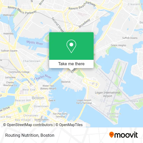
See Routing Nutrition, Boston, on the map
Public Transit to Routing Nutrition in Boston
Wondering how to get to Routing Nutrition in Boston? Moovit helps you find the best way to get to Routing Nutrition with step-by-step directions from the nearest public transit station.
Moovit provides free maps and live directions to help you navigate through your city. View schedules, routes, timetables, and find out how long does it take to get to Routing Nutrition in real time.
Looking for the nearest stop or station to Routing Nutrition? Check out this list of stops closest to your destination: Blue Line - Mbta; Airport; Bennington St @ Brooks St; Meridian St @ Saratoga St; Maverick; Lewis Mall Wharf.
Bus: 104, 116, SL3, 22, 33, 41, 44, 55, BLUE LINE SHUTTLE, 120, 114, 121.Subway: BLUE LINE.Ferry: EAST BOSTON FERRY, EAST.
Want to see if there’s another route that gets you there at an earlier time? Moovit helps you find alternative routes or times. Get directions from and directions to Routing Nutrition easily from the Moovit App or Website.
We make riding to Routing Nutrition easy, which is why over 1.7 million users, including users in Boston, trust Moovit as the best app for public transit. You don’t need to download an individual bus app or train app, Moovit is your all-in-one transit app that helps you find the best bus time or train time available.
For information on prices of subway, bus and ferry, costs and ride fares to Routing Nutrition, please check the Moovit app.
Use the app to navigate to popular places including to the airport, hospital, stadium, grocery store, mall, coffee shop, school, college, and university.
Routing Nutrition Address: 114 Chelsea St street in Boston
- Santarpio's Pizza,
- Santarpios,
- Melendez Electric,
- Reserve Now,
- Pazza on Porter,
- Jack's Abbey Beer Garden,
- USS Constitution,
- Minas Hair Salon,
- 156 W Newton Street,
- East Boston Neighborhood Health Center (Lemont, Laura E, MD - Boston Health Net),
- YMCA,
- East Boston Ymca,
- moakley federal court house,
- Lucy's Beauty Salon,
- Central Square,
- El Rey,
- Copacabana Beauty Salon,
- Tele Paisa,
- Rockland Trust Bank,
- RS Auto Mechanic
Places Near Routing Nutrition (Boston)
- Wang Theater, Boston,
- Td Garden, Boston,
- Quincy Market, Boston,
- Prudential Center, Boston,
- Cheers, Boston,
- North End, Boston,
- Boston Common, Boston,
- Faneuil Hall, Boston,
- Boston Children's Hospital, Boston,
- Isabella Stewart Gardner Museum, Boston,
- Leader Bank Pavilion (Leader Bank Pavillion), Boston,
- Boston Convention & Exhibition Center, Boston,
- Boston Medical Center, Boston,
- Massachusetts General Hospital, Boston,
- Wilbur Theatre, Boston,
- Mgm Music Hall, Boston,
- Castle Island, Boston,
- Museum Of Science, Boston,
- House Of Blues, Boston,
- Seaport District, Boston
How to get to popular places in Boston with public transit
Get around Boston by public transit!
Traveling around Boston has never been so easy. See step by step directions as you travel to any attraction, street or major public transit station. View bus and train schedules, arrival times, service alerts and detailed routes on a map, so you know exactly how to get to anywhere in Boston.
When traveling to any destination around Boston use Moovit's Live Directions with Get Off Notifications to know exactly where and how far to walk, how long to wait for your line, and how many stops are left. Moovit will alert you when it's time to get off — no need to constantly re-check whether yours is the next stop.
Wondering how to use public transit in Boston or how to pay for public transit in Boston? Moovit public transit app can help you navigate your way with public transit easily, and at minimum cost. It includes public transit fees, ticket prices, and costs. Looking for a map of Boston public transit lines? Moovit public transit app shows all public transit maps in Boston with all Bus, Train, Subway and Ferry routes and stops on an interactive map.
Boston has 4 transit type(s), including: Bus, Train, Subway and Ferry, operated by several transit agencies, including MBTA, Southeastern Regional Transit Authority, MetroWest Regional Transit Authority, Rhode Island Public Transit Authority, WRTA, Lowell Regional Transit Authority, Merrimack Valley Transit, Montachusett Regional Transit Authority, Cape Cod Regional Transit Authority, Brockton Area Transit Authority, Martha's Vineyard Transit Authority, the WAVE - Nantucket Regional Transit Authority, GATRA, Cape Ann Transportation Authority and Massport