Directions to Rox Diner - Newton with public transportation
The following transit lines have routes that pass near Rox Diner - Newton
 Bus: 52, 59, 60, GREEN LINE D SHUTTLE, GREEN LINE D SHUTTLE.
- Train: FRAMINGHAM/WORCESTER.
- Subway: GREEN LINE D.
How to get to Rox Diner - Newton by bus?
Click on the bus route to see step by step directions with maps, line arrival times and updated time schedules.
From Roxbury
93 minFrom YMCA of Greater Boston
62 minFrom Takeda Pharmaceuticals
58 minFrom New England Conservatory of Music
63 minFrom Museum Of Fine Arts MBTA Station
64 minFrom Scullers Jazz Club
55 minFrom Massachusetts Institute of Technology (MIT)
68 minFrom Brigham and Women's Hospital
68 minFrom Mgm Music Hall
64 minFrom Warren St
50 min
How to get to Rox Diner - Newton by train?
Click on the train route to see step by step directions with maps, line arrival times and updated time schedules.
How to get to Rox Diner - Newton by subway?
Click on the subway route to see step by step directions with maps, line arrival times and updated time schedules.
From Roxbury
62 minFrom YMCA of Greater Boston
47 minFrom Takeda Pharmaceuticals
61 minFrom New England Conservatory of Music
49 minFrom Museum Of Fine Arts MBTA Station
49 minFrom Scullers Jazz Club
76 minFrom Massachusetts Institute of Technology (MIT)
54 minFrom Brigham and Women's Hospital
38 minFrom Mgm Music Hall
40 minFrom Warren St
41 min
Bus stops near Rox Diner - Newton
Subway station near Rox Diner - Newton
- Eliot, 13 min walk,VIEW
Bus lines to Rox Diner - Newton
- 59, Watertown Square via Needham St - Needham Junction via Needham St,VIEW
- GREEN LINE D SHUTTLE, Newton Highlands - Brookline Hills,VIEW
- GREEN LINE D SHUTTLE, Newton Highlands - Kenmore,VIEW
- GREEN LINE D SHUTTLE, Riverside - Brookline Hills,VIEW
- GREEN LINE D SHUTTLE, Newton Highlands - Fenway,VIEW
- GREEN LINE D SHUTTLE, Newton Highlands - Kenmore via Saint Mary's Street,VIEW
- NEEDHAM LINE SHUTTLE, Newton Highlands - Forest Hills,VIEW
- GREEN LINE D SHUTTLE, Riverside - Newton Highlands,VIEW
- GREEN LINE D SHUTTLE, Riverside - Brookline Village,VIEW
- GREEN LINE D SHUTTLE, Riverside - Copley (Shuttle),VIEW
- GREEN LINE D SHUTTLE, Riverside - Reservoir,VIEW
- GREEN LINE D SHUTTLE, Riverside - Kenmore,VIEW
- GREEN LINE D SHUTTLE, Riverside - Fenway,VIEW
- GREEN LINE D SHUTTLE, Riverside - Kenmore via Saint Mary's Street,VIEW
- GREEN LINE D SHUTTLE, Riverside - Kenmore (Shuttle),VIEW
- GREEN LINE D SHUTTLE, Reservoir (Shuttle),VIEW
What are the closest stations to Rox Diner - Newton?
The closest stations to Rox Diner - Newton are:
- Newton Highlands is 315 yards away, 4 min walk.
- Newton Highlands - Walnut St @ Lincoln St is 574 yards away, 8 min walk.
- Newton Highlands - Walnut St @ Floral St is 617 yards away, 8 min walk.
- Eliot is 1062 yards away, 13 min walk.
Which bus lines stop near Rox Diner - Newton?
These bus lines stop near Rox Diner - Newton: 52, 59, 60.
Which train line stops near Rox Diner - Newton?
FRAMINGHAM/WORCESTER (#530 | South Station)
Which subway line stops near Rox Diner - Newton?
GREEN LINE D (Riverside)
What’s the nearest subway station to Rox Diner - Newton?
The nearest subway station to Rox Diner - Newton is Eliot. It’s a 13 min walk away.
What’s the nearest bus station to Rox Diner - Newton?
The nearest bus station to Rox Diner - Newton is Newton Highlands. It’s a 4 min walk away.
What time is the first subway to Rox Diner - Newton?
The GREEN LINE D is the first subway that goes to Rox Diner - Newton. It stops nearby at 4:46 AM.
What time is the last subway to Rox Diner - Newton?
The GREEN LINE D is the last subway that goes to Rox Diner - Newton. It stops nearby at 2:46 AM.
What time is the first bus to Rox Diner - Newton?
The 59 is the first bus that goes to Rox Diner - Newton. It stops nearby at 6:17 AM.
What time is the last bus to Rox Diner - Newton?
The 59 is the last bus that goes to Rox Diner - Newton. It stops nearby at 8:08 PM.
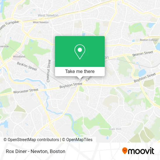
See Rox Diner - Newton on the map
Public Transportation to Rox Diner - Newton
Wondering how to get to Rox Diner - Newton? Moovit helps you find the best way to get to Rox Diner - Newton with step-by-step directions from the nearest public transit station.
Moovit provides free maps and live directions to help you navigate through your city. View schedules, routes, timetables, and find out how long does it take to get to Rox Diner - Newton in real time.
Looking for the nearest stop or station to Rox Diner - Newton? Check out this list of stops closest to your destination: Newton Highlands; Newton Highlands - Walnut St @ Lincoln St; Newton Highlands - Walnut St @ Floral St; Eliot.
Bus: 52, 59, 60, GREEN LINE D SHUTTLE, GREEN LINE D SHUTTLE, GREEN LINE D SHUTTLE, GREEN LINE D SHUTTLE, GREEN LINE D SHUTTLE, GREEN LINE D SHUTTLE, GREEN LINE D SHUTTLE, GREEN LINE D SHUTTLE, GREEN LINE D SHUTTLE, GREEN LINE D SHUTTLE.Train: FRAMINGHAM/WORCESTER.Subway: GREEN LINE D.
Want to see if there’s another route that gets you there at an earlier time? Moovit helps you find alternative routes or times. Get directions from and directions to Rox Diner - Newton easily from the Moovit App or Website.
We make riding to Rox Diner - Newton easy, which is why over 1.7 million users, including users in Newton, trust Moovit as the best app for public transit. You don’t need to download an individual bus app or train app, Moovit is your all-in-one transit app that helps you find the best bus time or train time available.
For information on prices of subway, bus and train, costs and ride fares to Rox Diner - Newton, please check the Moovit app.
Use the app to navigate to popular places including to the airport, hospital, stadium, grocery store, mall, coffee shop, school, college, and university.
Rox Diner - Newton Address: 4 Hartford St street in Newton
- Yuan Liang MD: Liang Yuan MD,
- Rox Diner,
- Barbara Psy Daley D,
- Covet + Lou,
- Dr. Rae Huang, Od,
- Dish Network,
- Eastern Ballroom Alliance,
- Asir Samrout - Commonwealth Standard Realty,
- Senior Helpers of Boston,
- Michelle L Imber PHD Abpp,
- Boston Chiropractic & Sports Therapy,
- Law Office of,
- New Repertory Theatre,
- Alex Santiago, Realtor,
- Griffin Law,
- Real Estate in Massachusetts,
- Joie de Vie,
- USPS Collection Box - Blue Box,
- Bamel Jonathan DMD,
- John O'Hara Square and Officer English Garden
Places Near Rox Diner - Newton
- Leader Bank Pavilion (Leader Bank Pavillion), Boston,
- Isabella Stewart Gardner Museum, Boston,
- Prudential Center, Boston,
- Boston Common, Boston,
- Faneuil Hall, Boston,
- Boston Medical Center, Boston,
- Wang Theater, Boston,
- Mgm Music Hall, Boston,
- House Of Blues, Boston,
- Boston Children's Hospital, Boston,
- North End, Boston,
- Quincy Market, Boston,
- Td Garden, Boston,
- Wilbur Theatre, Boston,
- Cheers, Boston,
- Seaport District, Boston,
- Museum Of Science, Boston,
- Boston Convention & Exhibition Center, Boston,
- Massachusetts General Hospital, Boston,
- Castle Island, Boston
How to get to popular places in Boston with public transit
Get around Newton by public transit!
Traveling around Newton has never been so easy. See step by step directions as you travel to any attraction, street or major public transit station. View bus and train schedules, arrival times, service alerts and detailed routes on a map, so you know exactly how to get to anywhere in Newton.
When traveling to any destination around Newton use Moovit's Live Directions with Get Off Notifications to know exactly where and how far to walk, how long to wait for your line, and how many stops are left. Moovit will alert you when it's time to get off — no need to constantly re-check whether yours is the next stop.
Wondering how to use public transit in Newton or how to pay for public transit in Newton? Moovit public transit app can help you navigate your way with public transit easily, and at minimum cost. It includes public transit fees, ticket prices, and costs. Looking for a map of Newton public transit lines? Moovit public transit app shows all public transit maps in Newton with all Bus, Train, Subway and Ferry routes and stops on an interactive map.
Boston has 4 transit type(s), including: Bus, Train, Subway and Ferry, operated by several transit agencies, including MBTA, Southeastern Regional Transit Authority, MetroWest Regional Transit Authority, Rhode Island Public Transit Authority, WRTA, Lowell Regional Transit Authority, Merrimack Valley Transit, Montachusett Regional Transit Authority, Cape Cod Regional Transit Authority, Brockton Area Transit Authority, Martha's Vineyard Transit Authority, the WAVE - Nantucket Regional Transit Authority, GATRA, Cape Ann Transportation Authority and Massport