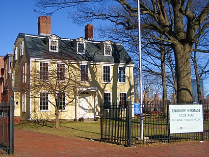
See Roxbury Heritage State Park, Boston, on the map
Directions to Roxbury Heritage State Park (Boston) with public transportation
The following transit lines have routes that pass near Roxbury Heritage State Park
 Bus:
Bus: - Train:
- Subway:
How to get to Roxbury Heritage State Park by bus?
Click on the bus route to see step by step directions with maps, line arrival times and updated time schedules.
How to get to Roxbury Heritage State Park by train?
Click on the train route to see step by step directions with maps, line arrival times and updated time schedules.
How to get to Roxbury Heritage State Park by subway?
Click on the subway route to see step by step directions with maps, line arrival times and updated time schedules.
Bus stations near Roxbury Heritage State Park in Boston
- Malcolm X Blvd @ O'Bryant Hs,2 min walk,
Bus lines to Roxbury Heritage State Park in Boston
- 15,Ruggles - Fields Corner,
- 23,Ruggles - Ashmont,
- 28,Ruggles - Mattapan,
- 44,Ruggles - Jackson Square,
- 45,Ruggles - Franklin Park,
- 66,Nubian via Allston - Harvard via Allston,
What are the closest stations to Roxbury Heritage State Park?
The closest stations to Roxbury Heritage State Park are:
- Malcolm X Blvd @ O'Bryant Hs is 105 yards away, 2 min walk.
Which bus lines stop near Roxbury Heritage State Park?
These bus lines stop near Roxbury Heritage State Park: 23, 66, SL4.
Which train lines stop near Roxbury Heritage State Park?
These train lines stop near Roxbury Heritage State Park: FRANKLIN LINE, PROVIDENCE/STOUGHTON LINE.
Which subway line stops near Roxbury Heritage State Park?
ORANGE LINE
What’s the nearest bus stop to Roxbury Heritage State Park in Boston?
The nearest bus stop to Roxbury Heritage State Park in Boston is Malcolm X Blvd @ O'Bryant Hs. It’s a 2 min walk away.
See Roxbury Heritage State Park, Boston, on the map
Public Transit to Roxbury Heritage State Park in Boston
Wondering how to get to Roxbury Heritage State Park in Boston, United States? Moovit helps you find the best way to get to Roxbury Heritage State Park with step-by-step directions from the nearest public transit station.
Moovit provides free maps and live directions to help you navigate through your city. View schedules, routes, timetables, and find out how long does it take to get to Roxbury Heritage State Park in real time.
Looking for the nearest stop or station to Roxbury Heritage State Park? Check out this list of stops closest to your destination: Malcolm X Blvd @ O'Bryant Hs.
Bus:Train:Subway:
Want to see if there’s another route that gets you there at an earlier time? Moovit helps you find alternative routes or times. Get directions from and directions to Roxbury Heritage State Park easily from the Moovit App or Website.
We make riding to Roxbury Heritage State Park easy, which is why over 1.5 million users, including users in Boston, trust Moovit as the best app for public transit. You don’t need to download an individual bus app or train app, Moovit is your all-in-one transit app that helps you find the best bus time or train time available.
For information on prices of bus, subway and train, costs and ride fares to Roxbury Heritage State Park, please check the Moovit app.
Use the app to navigate to popular places including to the airport, hospital, stadium, grocery store, mall, coffee shop, school, college, and university.
Location: Boston
Attractions near Roxbury Heritage State Park
Vinfen,Unitarian Universalist Urban Ministry,First Church Of Roxbury,Nubia Center,Malcolm X Blvd @ O'Bryant HS,38 Dudley Street,Reengagement Center at Boston Public Schools,John D. O' Bryant School Of Mathematics And Science,O'Bryant High School,Roxbury Post Office (Historical),Pickering Palace Of Likes,Boston Adult Academy,Madison Park High,Holy Temple Church,Mississippis Restaurant,Madison Park Village Community Garden,BCYF - Recreation Center at Madison Park,205 Roxbury Timilty School,John Eliot Sq,Madison Park High SchoolHow to get to popular attractions in Boston with public transit
Samuel Adams Brewery, Boston,Boston Sail Loft, Boston,Apple Providence Place,Ruggles Station, Boston,Hopkinton, MA, Hopkinton,Massachusetts, Medford,FiRE + iCE Boston, Boston,Cranston, RI,Providence Train Station (PVD) - MBTA & Amtrak,Bridgewater, MA, Bridgewater,Night Shift Brewing, Inc., Everett,Harry's Bar and Grill, Boston,La Famiglia Giorgio's, Boston,Cityside Restaurant & Bar, Boston,Charlestown, Boston,Flour Bakery & Cafe, Boston,The Capital Grille, Boston,Starbucks,Walmart Supercenter, Worcester,Kings Dining & Entertainment - Boston Back Bay, BostonGet around Boston by public transit!
Traveling around Boston has never been so easy. See step by step directions as you travel to any attraction, street or major public transit station. View bus and train schedules, arrival times, service alerts and detailed routes on a map, so you know exactly how to get to anywhere in Boston.
When traveling to any destination around Boston use Moovit's Live Directions with Get Off Notifications to know exactly where and how far to walk, how long to wait for your line, and how many stops are left. Moovit will alert you when it's time to get off — no need to constantly re-check whether yours is the next stop.
Wondering how to use public transit in Boston or how to pay for public transit in Boston? Moovit public transit app can help you navigate your way with public transit easily, and at minimum cost. It includes public transit fees, ticket prices, and costs. Looking for a map of Boston public transit lines? Moovit public transit app shows all public transit maps in Boston with all bus, subway or train routes and stops on an interactive map.
Boston has 3 transit type(s), including: bus, subway or train, operated by several transit agencies, including MBTA, MBTA, MBTA, Southeastern Regional Transit Authority, MetroWest Regional Transit Authority, Rhode Island Public Transit Authority, WRTA, Lowell Regional Transit Authority, Merrimack Valley Transit, Montachusett Regional Transit Authority, Cape Cod Regional Transit Authority, Brockton Area Transit Authority, Cape Cod Regional Transit Authority, Martha's Vineyard Transit Authority and the WAVE - Nantucket Regional Transit Authority