Directions to Roxbury Memory Trail (Boston) with public transportation
The following transit lines have routes that pass near Roxbury Memory Trail
 Bus: 16, 19, 23, 28, 45.
- Train: FAIRMOUNT, FRANKLIN/FOXBORO, PROVIDENCE/STOUGHTON, FAIRMOUNT LINE SHUTTLE.
- Subway: ORANGE LINE, RED LINE.
How to get to Roxbury Memory Trail by bus?
Click on the bus route to see step by step directions with maps, line arrival times and updated time schedules.
From Studio Allston, Boston
74 minFrom Bow Market, Somerville
80 minFrom Danehy Park, Cambridge
85 minFrom TownePlace Suites Boston Logan Airport/Chelsea, Chelsea
76 minFrom Massport Bus 77 Chelsea Employee Parking, Chelsea
76 minFrom Hampton Inn Boston Logan Airport Chelsea, Chelsea
89 minFrom Porter Square, Cambridge
85 minFrom Yotel, Boston
55 minFrom Dedham District Court, Dedham
57 minFrom Micro Center (Micro Elecronics), Cambridge
53 min
How to get to Roxbury Memory Trail by train?
Click on the train route to see step by step directions with maps, line arrival times and updated time schedules.
How to get to Roxbury Memory Trail by subway?
Click on the subway route to see step by step directions with maps, line arrival times and updated time schedules.
From Bow Market, Somerville
73 minFrom Danehy Park, Cambridge
77 minFrom TownePlace Suites Boston Logan Airport/Chelsea, Chelsea
72 minFrom Massport Bus 77 Chelsea Employee Parking, Chelsea
72 minFrom Porter Square, Cambridge
60 minFrom Yotel, Boston
57 minFrom Micro Center (Micro Elecronics), Cambridge
72 min
Bus stops near Roxbury Memory Trail in Boston
Train stations near Roxbury Memory Trail in Boston
Bus lines to Roxbury Memory Trail in Boston
What are the closest stations to Roxbury Memory Trail?
The closest stations to Roxbury Memory Trail are:
- Washington St @ Blue Hill Ave is 96 yards away, 2 min walk.
- Four Corners/Geneva is 98 yards away, 2 min walk.
- Blue Hill Ave @ Castlegate Rd is 136 yards away, 2 min walk.
- Blue Hill Ave @ Wayne St is 183 yards away, 3 min walk.
- Talbot Avenue is 1351 yards away, 16 min walk.
Which bus lines stop near Roxbury Memory Trail?
These bus lines stop near Roxbury Memory Trail: 16, 19, 23, 28, 45.
Which train line stops near Roxbury Memory Trail?
FAIRMOUNT (#1619 | Fairmount)
Which subway lines stop near Roxbury Memory Trail?
These subway lines stop near Roxbury Memory Trail: ORANGE LINE, RED LINE.
What’s the nearest train station to Roxbury Memory Trail in Boston?
The nearest train station to Roxbury Memory Trail in Boston is Four Corners/Geneva. It’s a 2 min walk away.
What’s the nearest bus station to Roxbury Memory Trail in Boston?
The nearest bus stations to Roxbury Memory Trail in Boston are Washington St @ Blue Hill Ave and Blue Hill Ave @ Castlegate Rd. The closest one is a 2 min walk away.
What time is the first train to Roxbury Memory Trail in Boston?
The FAIRMOUNT is the first train that goes to Roxbury Memory Trail in Boston. It stops nearby at 4:41 AM.
What time is the last train to Roxbury Memory Trail in Boston?
The FAIRMOUNT is the last train that goes to Roxbury Memory Trail in Boston. It stops nearby at 12:03 AM.
What time is the first bus to Roxbury Memory Trail in Boston?
The 28 is the first bus that goes to Roxbury Memory Trail in Boston. It stops nearby at 3:16 AM.
What time is the last bus to Roxbury Memory Trail in Boston?
The 23 is the last bus that goes to Roxbury Memory Trail in Boston. It stops nearby at 2:35 AM.
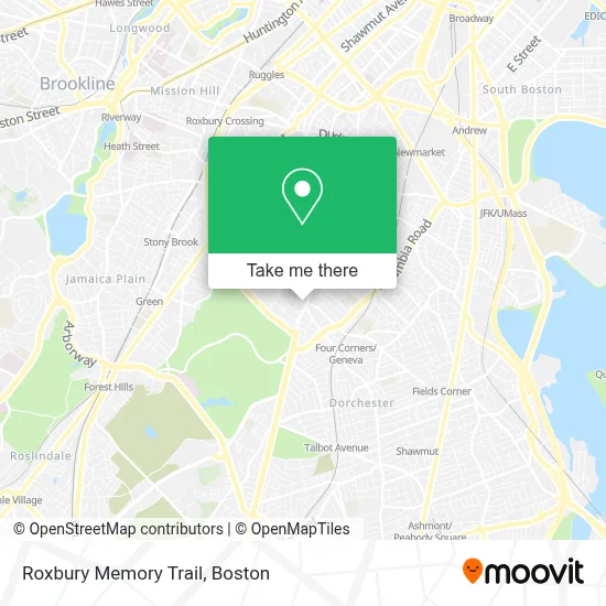
See Roxbury Memory Trail, Boston, on the map
Public Transit to Roxbury Memory Trail in Boston
Wondering how to get to Roxbury Memory Trail in Boston? Moovit helps you find the best way to get to Roxbury Memory Trail with step-by-step directions from the nearest public transit station.
Moovit provides free maps and live directions to help you navigate through your city. View schedules, routes, timetables, and find out how long does it take to get to Roxbury Memory Trail in real time.
Looking for the nearest stop or station to Roxbury Memory Trail? Check out this list of stops closest to your destination: Washington St @ Blue Hill Ave; Four Corners/Geneva; Blue Hill Ave @ Castlegate Rd; Blue Hill Ave @ Wayne St; Talbot Avenue.
Bus: 16, 19, 23, 28, 45, 14, 10, 22.Train: FAIRMOUNT, FRANKLIN/FOXBORO, PROVIDENCE/STOUGHTON, FAIRMOUNT LINE SHUTTLE.Subway: ORANGE LINE, RED LINE.
Want to see if there’s another route that gets you there at an earlier time? Moovit helps you find alternative routes or times. Get directions from and directions to Roxbury Memory Trail easily from the Moovit App or Website.
We make riding to Roxbury Memory Trail easy, which is why over 1.7 million users, including users in Boston, trust Moovit as the best app for public transit. You don’t need to download an individual bus app or train app, Moovit is your all-in-one transit app that helps you find the best bus time or train time available.
For information on prices of bus, subway and train, costs and ride fares to Roxbury Memory Trail, please check the Moovit app.
Use the app to navigate to popular places including to the airport, hospital, stadium, grocery store, mall, coffee shop, school, college, and university.
Roxbury Memory Trail Address: 7 Cheney St street in Boston
- Walaikum's Burger,
- Ramzo African Market,
- Blue Hill Ave & Georgia St,
- Redbox,
- St Katharine Drexel,
- Brothers Supermarket (Brother's Supermarket),
- Boston Public Library Grove Hall Branch,
- Sunny Hill Garden Suites,
- Jeremiah E Burke High School,
- Bulldog Towing Service,
- Dorchester,
- Lilyp African Hair Braiding,
- Abcd,
- United House Of Prayer,
- Charles Street Ame Church (The Historic Charles Street African Methodist Episcopal Church),
- Redefining Lighting,
- Commercial Property Management Company in Massachusetts,
- Yawkey Center,
- Law Office of Susan T Aguiar (Law Offices of Susan T. Aguiar),
- Figueroa Mini Market
Places Near Roxbury Memory Trail (Boston)
- House Of Blues, Boston,
- Prudential Center, Boston,
- Boston Convention & Exhibition Center, Boston,
- Wang Theater, Boston,
- Seaport District, Boston,
- Td Garden, Boston,
- Leader Bank Pavilion (Leader Bank Pavillion), Boston,
- Museum Of Science, Boston,
- North End, Boston,
- Castle Island, Boston,
- Boston Medical Center, Boston,
- Boston Children's Hospital, Boston,
- Boston Common, Boston,
- Quincy Market, Boston,
- Massachusetts General Hospital, Boston,
- Faneuil Hall, Boston,
- Wilbur Theatre, Boston,
- Cheers, Boston,
- Isabella Stewart Gardner Museum, Boston,
- Mgm Music Hall, Boston
How to get to popular places in Boston with public transit
Get around Boston by public transit!
Traveling around Boston has never been so easy. See step by step directions as you travel to any attraction, street or major public transit station. View bus and train schedules, arrival times, service alerts and detailed routes on a map, so you know exactly how to get to anywhere in Boston.
When traveling to any destination around Boston use Moovit's Live Directions with Get Off Notifications to know exactly where and how far to walk, how long to wait for your line, and how many stops are left. Moovit will alert you when it's time to get off — no need to constantly re-check whether yours is the next stop.
Wondering how to use public transit in Boston or how to pay for public transit in Boston? Moovit public transit app can help you navigate your way with public transit easily, and at minimum cost. It includes public transit fees, ticket prices, and costs. Looking for a map of Boston public transit lines? Moovit public transit app shows all public transit maps in Boston with all Bus, Train, Subway and Ferry routes and stops on an interactive map.
Boston has 4 transit type(s), including: Bus, Train, Subway and Ferry, operated by several transit agencies, including MBTA, Southeastern Regional Transit Authority, MetroWest Regional Transit Authority, Rhode Island Public Transit Authority, WRTA, Lowell Regional Transit Authority, Merrimack Valley Transit, Montachusett Regional Transit Authority, Cape Cod Regional Transit Authority, Brockton Area Transit Authority, Martha's Vineyard Transit Authority, the WAVE - Nantucket Regional Transit Authority, GATRA, Cape Ann Transportation Authority and Massport