Directions to Roxbury Mosque (Boston) with public transportation
The following transit lines have routes that pass near Roxbury Mosque
 Bus: 15, 23, 28, 66, BB.
- Train: PROVIDENCE/STOUGHTON, FRANKLIN/FOXBORO, NEEDHAM.
- Subway: ORANGE LINE, GREEN LINE E.
How to get to Roxbury Mosque by bus?
Click on the bus route to see step by step directions with maps, line arrival times and updated time schedules.
From Bunker Hill Monument, Boston
57 minFrom Hampton Inn & Suites-Hampton Watertown Boston (Hampton Inn & Suites Watertown Boston), Watertown Town
58 minFrom MBTA Suffolk Downs Station, Boston
78 minFrom Academy Of the Pacific Rim Charter Public School, Boston
77 minFrom Hampton Inn Boston Logan Airport Chelsea, Chelsea
78 minFrom Costco, Everett
101 minFrom Suffolk Downs, Boston
75 minFrom Ramada Boston, Boston
56 minFrom Belle Isle Lobster & Seafood, Winthrop Town
96 minFrom Winthrop, Winthrop Town
127 min
How to get to Roxbury Mosque by train?
Click on the train route to see step by step directions with maps, line arrival times and updated time schedules.
How to get to Roxbury Mosque by subway?
Click on the subway route to see step by step directions with maps, line arrival times and updated time schedules.
Bus stops near Roxbury Mosque in Boston
Subway stations near Roxbury Mosque in Boston
Train station near Roxbury Mosque in Boston
- Ruggles, 6 min walk,VIEW
Bus lines to Roxbury Mosque in Boston
- 14, Heath St,VIEW
- 41, Jfk/Umass,VIEW
- 45, Ruggles,VIEW
- 66, Harvard Via Allston,VIEW
- 19, Gallivan Blvd,VIEW
- 22, Ruggles - Ashmont,VIEW
- ORANGE LINE SHUTTLE, Forest Hills - Back Bay (Shuttle),VIEW
- ORANGE LINE SHUTTLE, Forest Hills - Ruggles,VIEW
- ORANGE LINE SHUTTLE, Forest Hills - Copley,VIEW
- ORANGE LINE SHUTTLE, Forest Hills - Back Bay via Ruggles Busway (Shuttle),VIEW
- ORANGE LINE SHUTTLE, Jackson Square - Copley,VIEW
- ORANGE LINE SHUTTLE, Jackson Square - Back Bay,VIEW
- ORANGE LINE SHUTTLE, Forest Hills - Back Bay via Copley (Shuttle),VIEW
- 15, Ruggles - Fields Corner,VIEW
- 23, Ruggles - Ashmont,VIEW
- 28, Ruggles - Mattapan,VIEW
- 44, Ruggles - Jackson Square,VIEW
What are the closest stations to Roxbury Mosque?
The closest stations to Roxbury Mosque are:
- 205 Roxbury St is 183 yards away, 3 min walk.
- Tremont St @ Sewall St is 190 yards away, 3 min walk.
- Roxbury Crossing is 213 yards away, 3 min walk.
- Tremont St Opp Roxbury Crossing Sta is 241 yards away, 3 min walk.
- Tremont St @ Roxbury Crossing Station is 271 yards away, 4 min walk.
- Malcolm X Blvd @ Tremont St is 417 yards away, 5 min walk.
- Ruggles is 437 yards away, 6 min walk.
- Longwood Medical Area is 763 yards away, 10 min walk.
Which bus lines stop near Roxbury Mosque?
These bus lines stop near Roxbury Mosque: 15, 23, 28, 66, BB, SL5.
Which train line stops near Roxbury Mosque?
PROVIDENCE/STOUGHTON (#824 | South Station)
Which subway line stops near Roxbury Mosque?
ORANGE LINE (Forest Hills)
What’s the nearest subway station to Roxbury Mosque in Boston?
The nearest subway station to Roxbury Mosque in Boston is Roxbury Crossing. It’s a 3 min walk away.
What’s the nearest train station to Roxbury Mosque in Boston?
The nearest train station to Roxbury Mosque in Boston is Ruggles. It’s a 6 min walk away.
What’s the nearest bus station to Roxbury Mosque in Boston?
The nearest bus stations to Roxbury Mosque in Boston are 205 Roxbury St, Tremont St @ Sewall St and Tremont St Opp Roxbury Crossing Sta. The closest one is a 3 min walk away.
What time is the first subway to Roxbury Mosque in Boston?
The ORANGE LINE is the first subway that goes to Roxbury Mosque in Boston. It stops nearby at 5:22 AM.
What time is the last subway to Roxbury Mosque in Boston?
The GREEN LINE E is the last subway that goes to Roxbury Mosque in Boston. It stops nearby at 2:04 AM.
What time is the first train to Roxbury Mosque in Boston?
The PROVIDENCE/STOUGHTON is the first train that goes to Roxbury Mosque in Boston. It stops nearby at 4:28 AM.
What time is the last train to Roxbury Mosque in Boston?
The PROVIDENCE/STOUGHTON is the last train that goes to Roxbury Mosque in Boston. It stops nearby at 12:34 AM.
What time is the first bus to Roxbury Mosque in Boston?
The 66 is the first bus that goes to Roxbury Mosque in Boston. It stops nearby at 4:48 AM.
What time is the last bus to Roxbury Mosque in Boston?
The 28 is the last bus that goes to Roxbury Mosque in Boston. It stops nearby at 2:32 AM.
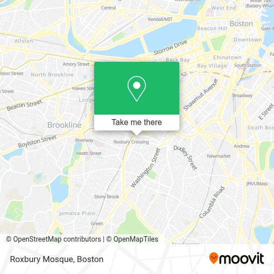
See Roxbury Mosque, Boston, on the map
Public Transit to Roxbury Mosque in Boston
Wondering how to get to Roxbury Mosque in Boston? Moovit helps you find the best way to get to Roxbury Mosque with step-by-step directions from the nearest public transit station.
Moovit provides free maps and live directions to help you navigate through your city. View schedules, routes, timetables, and find out how long does it take to get to Roxbury Mosque in real time.
Looking for the nearest stop or station to Roxbury Mosque? Check out this list of stops closest to your destination: 205 Roxbury St; Tremont St @ Sewall St; Roxbury Crossing; Tremont St Opp Roxbury Crossing Sta; Tremont St @ Roxbury Crossing Station; Malcolm X Blvd @ Tremont St; Ruggles; Longwood Medical Area.
Bus: 15, 23, 28, 66, BB, SL5, 14, 41, 45, 19.Train: PROVIDENCE/STOUGHTON, FRANKLIN/FOXBORO, NEEDHAM.Subway: ORANGE LINE, GREEN LINE E.
Want to see if there’s another route that gets you there at an earlier time? Moovit helps you find alternative routes or times. Get directions from and directions to Roxbury Mosque easily from the Moovit App or Website.
We make riding to Roxbury Mosque easy, which is why over 1.7 million users, including users in Boston, trust Moovit as the best app for public transit. You don’t need to download an individual bus app or train app, Moovit is your all-in-one transit app that helps you find the best bus time or train time available.
For information on prices of bus, subway and train, costs and ride fares to Roxbury Mosque, please check the Moovit app.
Use the app to navigate to popular places including to the airport, hospital, stadium, grocery store, mall, coffee shop, school, college, and university.
Location: Boston
- Boston Islamic Seminary,
- Madison Park H S Athletic Fields,
- Refugee & Immigrant Assistance Center,
- A1 Boston Concrete Foundations and Excavation Contractors,
- City of Boston,
- Boston Veg Food Fest (Taste of the Caribbean Food Festival),
- USPS Collection Box - Blue Box,
- Reggie Lewis Track & Athletic Center,
- Reggie Lewis Athletic Center,
- Gardner Street Apartments.,
- Roxbury Community College Mainstage Theater,
- MBTA Roxbury Crossing Station,
- Psi Omega Chapter of Alpha Kappa Alpha Sorority,
- Reggie Lewis Track,
- Dunkin Donuts,
- Reginald Lewis Athletic Center (Reggie Lewis Center),
- Roxbury Crossing,
- Local Locksmith Company,
- Amazon Counter-Health Mart Pharmacy,
- Roxbury Community College Bookstore
Places Near Roxbury Mosque (Boston)
- Wang Theater, Boston,
- Massachusetts General Hospital, Boston,
- Cheers, Boston,
- Td Garden, Boston,
- Boston Medical Center, Boston,
- Quincy Market, Boston,
- North End, Boston,
- Seaport District, Boston,
- Faneuil Hall, Boston,
- Isabella Stewart Gardner Museum, Boston,
- Boston Convention & Exhibition Center, Boston,
- Museum Of Science, Boston,
- Boston Common, Boston,
- Leader Bank Pavilion (Leader Bank Pavillion), Boston,
- Wilbur Theatre, Boston,
- Mgm Music Hall, Boston,
- Prudential Center, Boston,
- Castle Island, Boston,
- House Of Blues, Boston,
- Boston Children's Hospital, Boston
How to get to popular places in Boston with public transit
Get around Boston by public transit!
Traveling around Boston has never been so easy. See step by step directions as you travel to any attraction, street or major public transit station. View bus and train schedules, arrival times, service alerts and detailed routes on a map, so you know exactly how to get to anywhere in Boston.
When traveling to any destination around Boston use Moovit's Live Directions with Get Off Notifications to know exactly where and how far to walk, how long to wait for your line, and how many stops are left. Moovit will alert you when it's time to get off — no need to constantly re-check whether yours is the next stop.
Wondering how to use public transit in Boston or how to pay for public transit in Boston? Moovit public transit app can help you navigate your way with public transit easily, and at minimum cost. It includes public transit fees, ticket prices, and costs. Looking for a map of Boston public transit lines? Moovit public transit app shows all public transit maps in Boston with all Bus, Train, Subway and Ferry routes and stops on an interactive map.
Boston has 4 transit type(s), including: Bus, Train, Subway and Ferry, operated by several transit agencies, including MBTA, Southeastern Regional Transit Authority, MetroWest Regional Transit Authority, Rhode Island Public Transit Authority, WRTA, Lowell Regional Transit Authority, Merrimack Valley Transit, Montachusett Regional Transit Authority, Cape Cod Regional Transit Authority, Brockton Area Transit Authority, Martha's Vineyard Transit Authority, the WAVE - Nantucket Regional Transit Authority, GATRA, Cape Ann Transportation Authority and Massport