How to get to Roxy Beach - Realtor by bus?
Click on the bus route to see step by step directions with maps, line arrival times and updated time schedules.
From Oak Park Mall Venetian Carousel, Overland Park
65 minFrom Nall Ave / W 95th St, Overland Park
119 minFrom Tokyo Gratis, Overland Park
134 minFrom Court T. Kennedy, Attorney, Overland Park
142 minFrom Corning Clinical Laboratories, Overland Park
61 minFrom Arrowhead Liquors, Lenexa
75 minFrom Cils Elegancy at Oak Park Mall, Overland Park
134 min
Bus stop near Roxy Beach - Realtor in Leawood
- Prairie Fire, 16 min walk,VIEW
Bus lines to Roxy Beach - Realtor in Leawood
- B, Oak Park Mall,VIEW
What are the closest stations to Roxy Beach - Realtor?
The closest stations to Roxy Beach - Realtor are:
- Prairie Fire is 1280 yards away, 16 min walk.
Which bus lines stop near Roxy Beach - Realtor?
These bus lines stop near Roxy Beach - Realtor: 57, B.
What time is the first bus to Roxy Beach - Realtor in Leawood?
The B is the first bus that goes to Roxy Beach - Realtor in Leawood. It stops nearby at 10:44 AM.
What time is the last bus to Roxy Beach - Realtor in Leawood?
The B is the last bus that goes to Roxy Beach - Realtor in Leawood. It stops nearby at 9:44 PM.
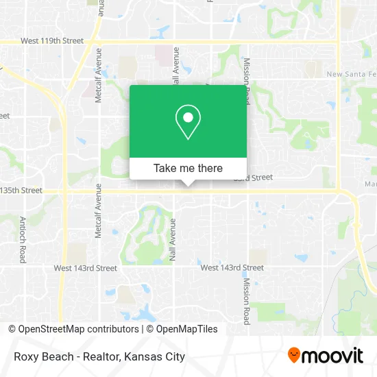
See Roxy Beach - Realtor, Leawood, on the map
Public Transit to Roxy Beach - Realtor in Leawood
Wondering how to get to Roxy Beach - Realtor in Leawood? Moovit helps you find the best way to get to Roxy Beach - Realtor with step-by-step directions from the nearest public transit station.
Moovit provides free maps and live directions to help you navigate through your city. View schedules, routes, timetables, and find out how long does it take to get to Roxy Beach - Realtor in real time.
Looking for the nearest stop or station to Roxy Beach - Realtor? Check out this list of stops closest to your destination: Prairie Fire.
Bus: 57, B.
Want to see if there’s another route that gets you there at an earlier time? Moovit helps you find alternative routes or times. Get directions from and directions to Roxy Beach - Realtor easily from the Moovit App or Website.
We make riding to Roxy Beach - Realtor easy, which is why over 1.5 million users, including users in Leawood, trust Moovit as the best app for public transit. You don’t need to download an individual bus app or train app, Moovit is your all-in-one transit app that helps you find the best bus time or train time available.
For information on prices of bus, costs and ride fares to Roxy Beach - Realtor, please check the Moovit app.
Use the app to navigate to popular places including to the airport, hospital, stadium, grocery store, mall, coffee shop, school, college, and university.
Location: Leawood, Kansas City
- Free Home Value Estimate,
- Big Brothers Big Sisters American Red Cross Dance Marathon and Public Administration Student Societ,
- Building 10,
- Center for Nutrition & Preventive Medicine (Center for Nutrition A),
- Willow Tree,
- Business Law Group,
- Servicing Businesses From Concept To $25mm in Enterprise Value,
- Use Vacation Giveaways,
- Geenens Psychiatry, P.A.,
- Law Office of Young, Jakobe & Kuhl,
- All Events Daily Specials,
- On W 135th St at Nall Ave Eastbound Nearside,
- Sano Orthopedics,
- Newport Grill,
- Pinstripes,
- Amc Dine-in Prairiefire 17,
- AMC Theatres (Amc Dine-in Prairiefire 17),
- Prairie Fire,
- Tyton Media,
- Made in Kansas City (Made in KC)
Places Near Roxy Beach - Realtor (Leawood)
- Kansas City Zoo,
- Liberty, MO, Liberty,
- Amazon Fulfilment Center-MKC6, Kansas City,
- T-Mobile Center,
- Worlds of Fun,
- Walmart Supercenter,
- Ku Medical Center, Kansas City,
- Stans Glory Hole,
- St. Luke's Hospital - Medical Plaza I,
- Kansas City International Airport (MCI) (Kansas City International Airport),
- Harrah's Casino, North Kansas City,
- GEHA Field at Arrowhead Stadium,
- Legends Outlets Kansas City, Kansas City,
- Walmart, Kansas City,
- Truman Medical Center,
- Kauffman Stadium,
- The Glory Hole,
- Grandview, MO, Grandview,
- Country Club Plaza,
- Arrowhead Stadium
How to get to popular places in Kansas City with public transit
Get around Leawood by public transit!
Traveling around Leawood has never been so easy. See step by step directions as you travel to any attraction, street or major public transit station. View bus and train schedules, arrival times, service alerts and detailed routes on a map, so you know exactly how to get to anywhere in Leawood.
When traveling to any destination around Leawood use Moovit's Live Directions with Get Off Notifications to know exactly where and how far to walk, how long to wait for your line, and how many stops are left. Moovit will alert you when it's time to get off — no need to constantly re-check whether yours is the next stop.
Wondering how to use public transit in Leawood or how to pay for public transit in Leawood? Moovit public transit app can help you navigate your way with public transit easily, and at minimum cost. It includes public transit fees, ticket prices, and costs. Looking for a map of Leawood public transit lines? Moovit public transit app shows all public transit maps in Leawood with all Bus, Train and Light Rail routes and stops on an interactive map.
Kansas City has 3 transit type(s), including: Bus, Train and Light Rail, operated by several transit agencies, including Kansas City Area Transportation Authority, Lawrence Transit, Topeka Metro, RideKC Johnson County, Amtrak, Greyhound-us and FlixBus-us